
 |
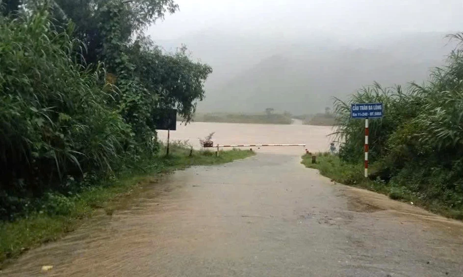
| Many traffic routes in the province were flooded due to the effects of storm No. 12 - Photo: Contributor |
Currently, floods on rivers are rising, especially Kien Giang river is rising rapidly. The whole province has 14 points and 6 inter-village roads flooded and cut off. Specifically, in the North of the province, there are 5 points, including: Kim Ngan commune, 3 points on the road from the commune People's Committee to Con Cung village, flooded about 60-70cm, culverts 25 and culverts 28 of National Highway 9B are flooded about 50cm; Hoan Lao commune, 2 points at Cay Mung spillway, Sen village flooded 0.3m and Lo Xo road in Ca village flooded 0.3m.
In the South of the province, there are 9 points and 6 inter-village roads flooded, including: Ba Long commune, 4 points at Ba Long spillway bridge, 1.1m flooded, Ta Lang bridge, 1.1m flooded, Tran bridge village 5, 0.8m flooded, Khe Vo bridge, 0.6m flooded; Dakrong commune, 1 point at Tran Ly Ton bridge, 1m flooded; Ben Quan commune, 3 points at Provincial Road 571, Ben Quan commune spillway bridges at Km5+200, Km8+700, Km9+650, flooded about 30-50cm; Khe Sanh commune, 1 point at La La spillway bridge (Provincial Road 587) flooded about 10-20cm; Nam Hai Lang commune, 6 roads along O Lau river in low-lying areas (Cang area) including villages: An Tho, Phu Kinh, Hoi Dien, My Chanh, Hung Nhon, Cau Nhi flooded 0.5-0.7m deep.
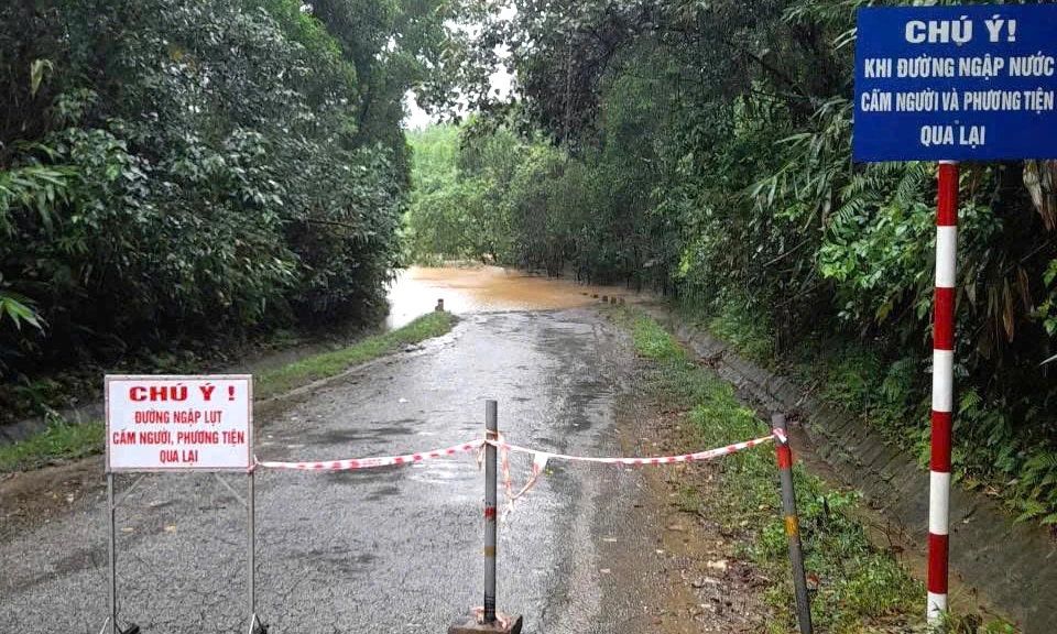 |
| At flooded areas, local authorities set up barriers and placed warning signs to prevent people from passing through, ensuring safety - Photo: Contributor |
To ensure the safety of reservoirs, dams and dykes before the flood season, localities and units have inspected, reviewed and assessed the current status of the works to detect and promptly fix, repair and restore any damage. Currently, the total capacity of the irrigation reservoir managed by the Irrigation Works Exploitation Company Limited is about 81.88% of the designed capacity.
The whole province currently has 8,704 vessels/23,243 workers anchored at storm shelters; there are still 16 vessels/117 workers operating at sea in Lam Dong . The vessels have received information about storm No. 12.
In Cua Viet commune alone, two fishing boats with 20CV and 40CV capacity sank.
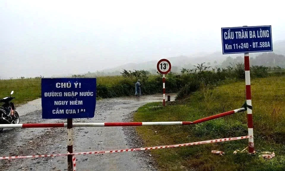 |
| A traffic route in Ba Long commune was flooded. Local authorities have set up barricades to prevent people and vehicles from passing through to ensure safety - Photo: Contributor |
Up to now, the whole province has had one house with its roof blown off in Vinh Linh commune. In addition, there are many landslides on traffic routes. Specifically, in Kim Ngan commune: Km 77+800 National Highway 9B has a landslide of about 1,000m3 of rock and soil, currently only motorbikes can pass.
Ben Quan Commune: Provincial Road 571 has a negative slope landslide at Km24+820 with dimensions of 30x7x4m.
Khe Sanh Commune: Provincial Road 587, section Km4-Km12, has many locations where the road surface has been eroded, creating deep ditches, making traffic difficult; landslides, slides, and broken road surfaces at 4 locations, including: Km5+200 (right of route) with dimensions of 8x4x2m, Km6+300 with dimensions of 10x3x3m, Km10+600 with dimensions of 10x3x3m and Km13+100 with dimensions of 7x3x2m.
Nam Dong Ha Ward: Sidewalk subsidence at Dang Dung-Nguyen Thuong Hien intersection, size 2x1.5x1m.
At flooded and isolated areas, local authorities have put up warning signs and warned people not to cross to ensure safety.
Nguyen Hoang
Source: https://baoquangtri.vn/thoi-su/202510/bao-so-12-gay-ngap-lut-chia-cat-nhieu-tuyen-duong-giao-thong-7fe27f4/
![[Photo] Prime Minister Pham Minh Chinh chairs meeting on railway projects](https://vphoto.vietnam.vn/thumb/1200x675/vietnam/resource/IMAGE/2025/10/23/1761206277171_dsc-9703-jpg.webp)


![[Photo] President Luong Cuong holds talks with South African President Matamela Cyril Ramaphosa](https://vphoto.vietnam.vn/thumb/1200x675/vietnam/resource/IMAGE/2025/10/23/1761221878741_ndo_br_1-8416-jpg.webp)
![[Photo] Prime Minister Pham Minh Chinh meets with South African President Matamela Cyril Ramaphosa](https://vphoto.vietnam.vn/thumb/1200x675/vietnam/resource/IMAGE/2025/10/23/1761226081024_dsc-9845-jpg.webp)


Comment (0)