

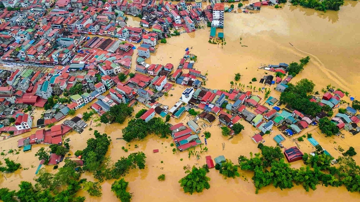
In Bo Ha commune, the working group recorded many areas being partially isolated due to the rising flood on the Thuong River, some roads were deeply flooded and impassable. Currently, 7 villages in the old Bo Ha commune are isolated, the Xuan Lan dike, about 1km long, has overflowed, the flood water is rising very quickly, and the dike construction cannot be carried out.
The commune has mobilized its forces to stand guard, support the people and maintain communication with the isolated areas. Notably, the new Dong Son bridge has been built but the old bridge has not been dismantled, causing obstruction of the flow and accumulation of waste after each rainy season.
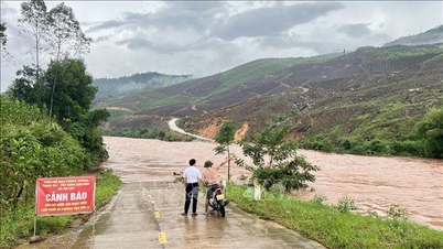
In Tien Luc commune, heavy rains caused many roads, residential areas and crop areas to be flooded and cut off. Meanwhile, My Thai commune not only had rice and crops flooded but also had serious landslides at the left Thuong dike (K2+600), posing a potential safety risk. The commune urgently mobilized forces, transported soil, and drove piles to reinforce the dike.
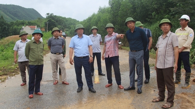
Directly inspecting the communes, Permanent Vice Chairman of Bac Ninh Provincial People's Committee Mai Son asked about the lives and production of people in flooded areas; at the same time, requested localities to put the task of ensuring people's safety first in preventing and fighting natural disasters.
Regarding Bo Ha commune, comrade Mai Son directed the locality to immediately set up warning signs and send forces to stand guard at deep flooded areas to prevent people from passing through; at the same time, coordinate the procedures to liquidate and dismantle the old Dong Son bridge to avoid the risk of insecurity during the rainy and stormy season. Regarding the landslide incident in My Thai commune, the locality needs to quickly overcome it.
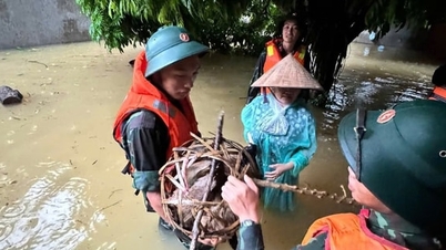
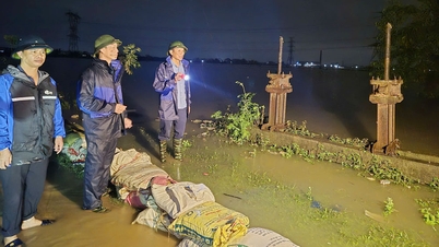
Standing Vice Chairman of the People's Committee of Mai Son province emphasized that the natural disaster is forecast to be complicated, floodwaters will continue to rise, so localities absolutely must not be subjective. It is necessary to review all flooded areas, arrange staff on duty, warn people not to go through dangerous areas; maintain contact with isolated areas at least once an hour. At the same time, proactively warn if flooding lasts long, prepare enough food and necessities to provide for people in isolated areas.
Mr. Mai Son requested that localities review and count the damage to report to superiors and have timely support plans. Areas at risk of landslides should be warned early so that people can proactively stay away and ensure safety.
Previously, according to the Bac Ninh Provincial Hydrometeorological Station, the water level of rivers in the province at 11:00 a.m. on October 7, on the Thuong River: at Cau Son the water level was 16.20m, 0.2m above alarm level III; at Phu Lang Thuong it was 5.56m, 0.26m above alarm level II. On the Luc Nam River, at Cam Dan it was 40.02m, 0.98m below alarm level I; at Chu it was 9.60m, 1.40m below alarm level I; at Luc Nam it was 5.13m, 0.17m below alarm level II. On the Cau River, at Phuc Loc Phuong it was 6.48m, 0.48m above alarm level I; at Dap Cau it was 4.9m, 0.4m below alarm level II. On the Duong River: at Ben Ho it was 5.09m, 1.71m below alarm level I.
Assessment of the possibility of flooding on rivers due to the influence of the south-southeast wind convergence from the east of the circulation of the low pressure area weakened by storm No. 11 and the western edge of the Subtropical high pressure, during the day and night of October 7 to October 8, places in the province will continue to have rain, moderate rain, some places will have heavy rain; from October 8, the rain trend will gradually decrease in area and amount. From October 7 to 9, rivers in the province will experience a flood, with a flood amplitude of 2 - 5m.
Warning in the context of the land being sufficiently hydrated, the water level of rivers being at a high level, under the impact of the rain caused by storm No. 11, it is necessary to proactively guard against major floods on rivers causing flooding in low-lying areas along rivers and urban streets, flash floods and landslides in the mountainous communes in the east of the province (Tay Yen Tu, Tuan Dao, Son Dong, Van Son, An Lac, Dai Son, Bien Son, Chu, Nghia Phuong, Luc Nam, Phuong Son) and the highlands of Yen The commune.
Source: https://baotintuc.vn/xa-hoi/ngap-lut-dien-rong-bac-ninh-khan-cap-chong-thien-tai-20251007154354587.htm


![[Photo] Closing of the 13th Conference of the 13th Party Central Committee](https://vphoto.vietnam.vn/thumb/1200x675/vietnam/resource/IMAGE/2025/10/08/1759893763535_ndo_br_a3-bnd-2504-jpg.webp)


Comment (0)