
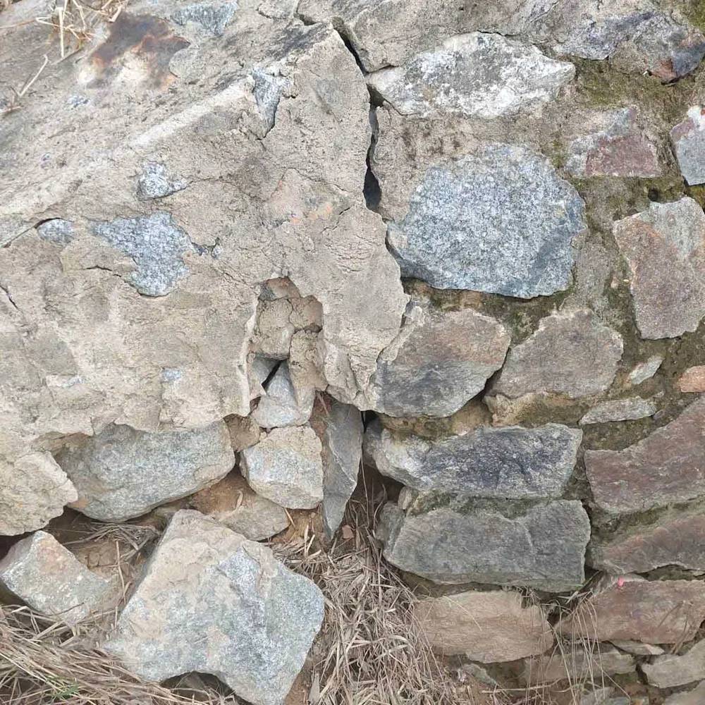
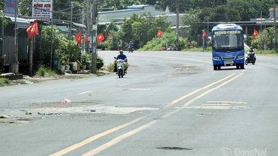
Nay Bridge project is located on the commune axis road connecting DH13 road (old district road) to Xuan Son and Ke Lat villages, Xuan Hoa lake and irrigation dam, with a length of about 45m, width of 4m; the bridge belongs to the HRDP Project and was built and put into use since August 2001.
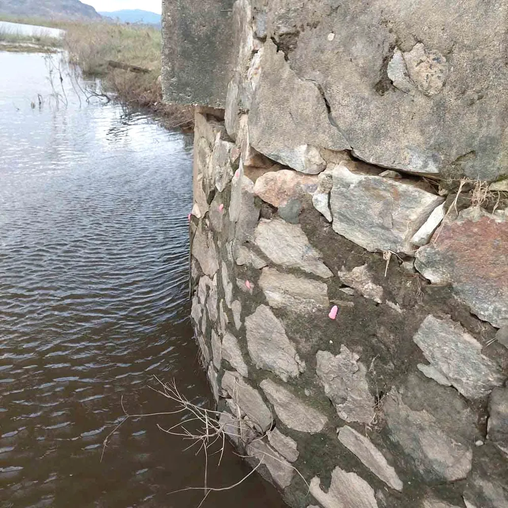
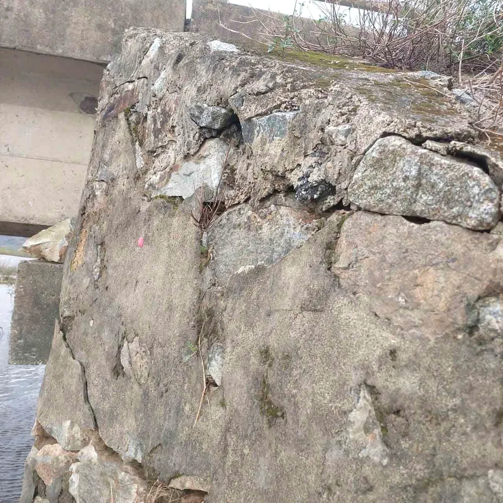
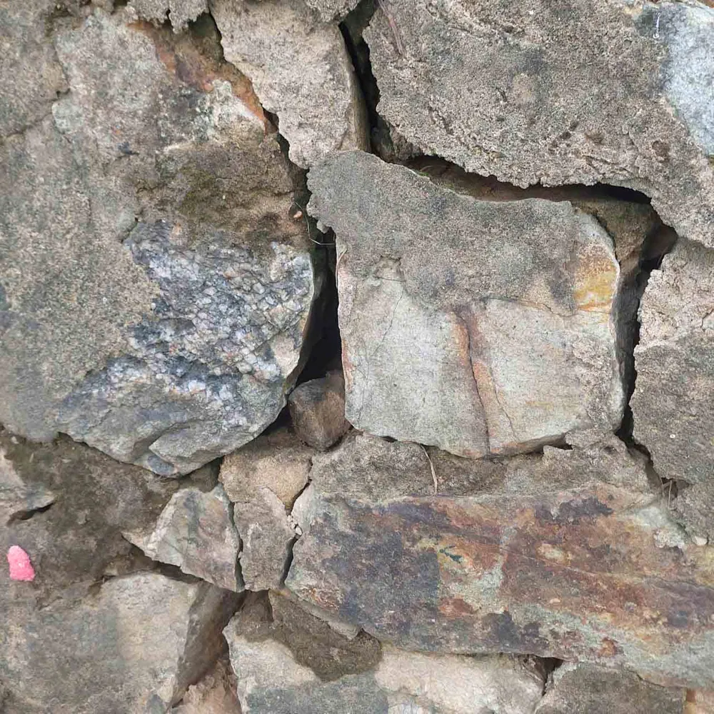
After a long period of use, due to the impact of natural disasters, especially the recent storms No. 5 and No. 10, the reinforced roof at the Nay bridge abutment in the West, built with rubble, has cracked and seriously eroded; during heavy rains or high tides, water overflows the bridgehead, eroding the abutment foot, and there is a risk of collapse and structural failure of the bridge if not promptly repaired.

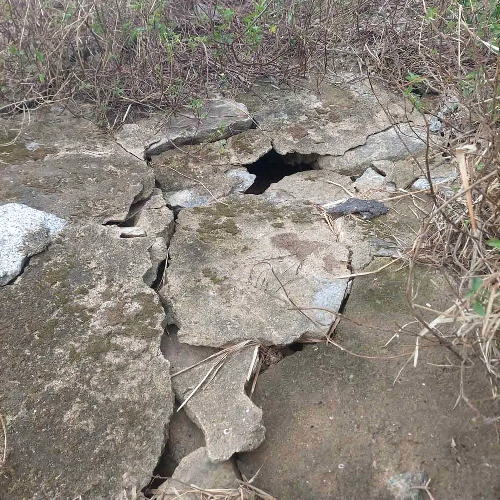
In particular, on the road surface at the beginning of Nay bridge, a "death hole" appeared with a width of nearly 1 meter and a depth of more than 0.5 meter, posing a potential risk to traffic safety, causing difficulties for people and vehicles passing through.

Immediately after receiving feedback from the people, the authorities of Co Dam commune assigned specialized staff to the scene to inspect and assess the subsidence and damage at Nay bridge.
At the same time, we are monitoring the subsidence and landslide developments and taking temporary measures; installing warning signs of bridge subsidence and restricting vehicles with a load capacity of over 2.5 tons from crossing the bridge to ensure safety.


Source: https://www.sggp.org.vn/xuat-hien-ho-tu-than-tren-mat-duong-dau-cau-nay-o-ha-tinh-post817643.html


![[Photo] Solemn opening of the 1st Government Party Congress](https://vphoto.vietnam.vn/thumb/1200x675/vietnam/resource/IMAGE/2025/10/13/1760337945186_ndo_br_img-0787-jpg.webp)


![[Photo] General Secretary To Lam attends the opening of the 1st Government Party Congress](https://vphoto.vietnam.vn/thumb/1200x675/vietnam/resource/IMAGE/2025/10/13/1760321055249_ndo_br_cover-9284-jpg.webp)


Comment (0)