
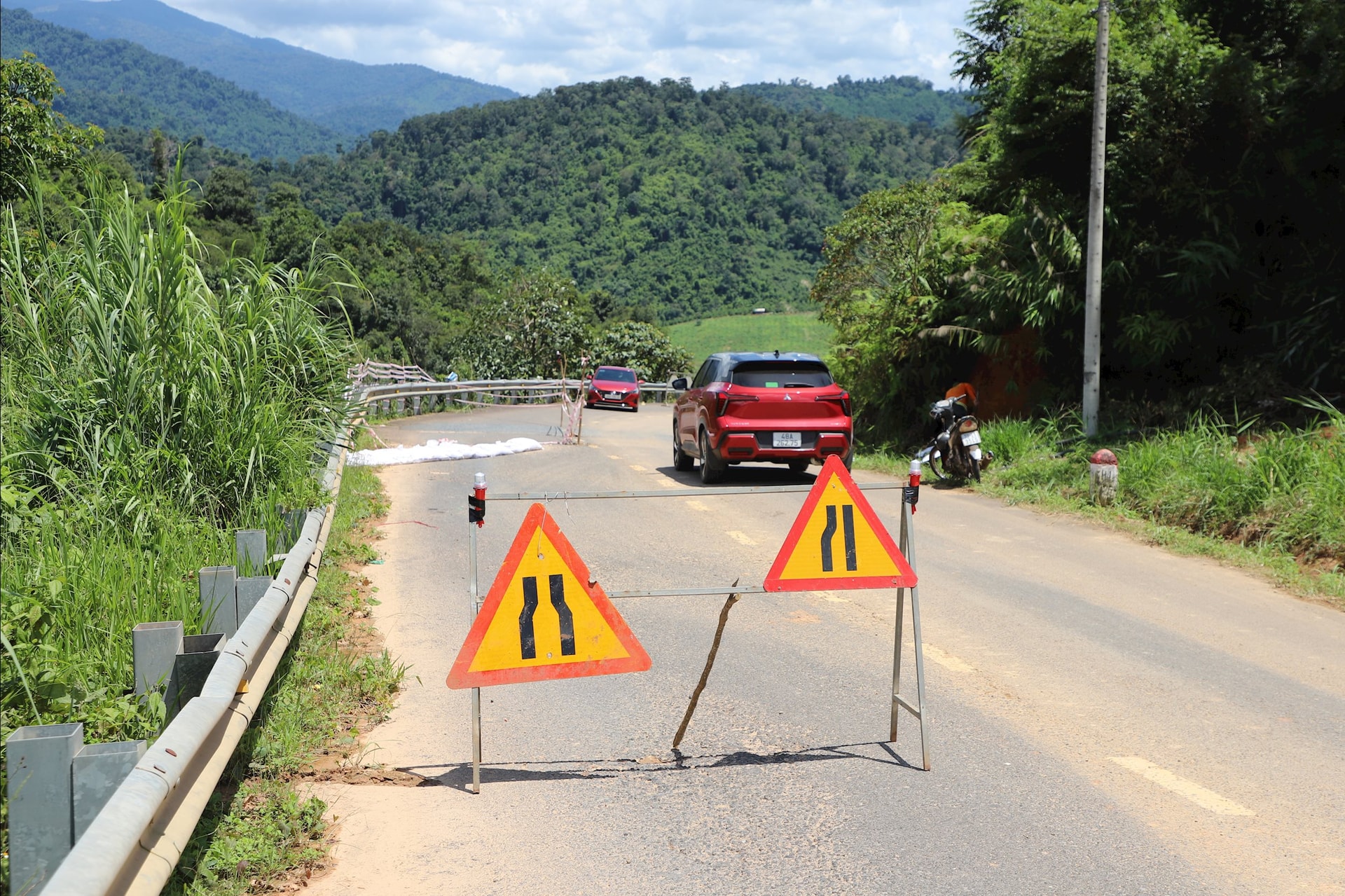
On October 1, Lam Dong Road Maintenance Management Board said that on National Highway 28, through Dinh Trang Thuong commune, many subsidence and erosion points have appeared, causing traffic obstruction and posing a potential safety risk to people traveling.
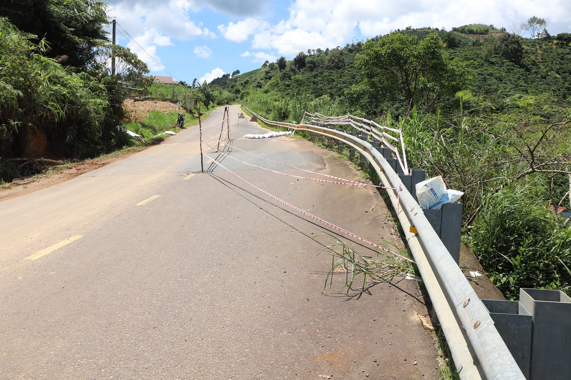
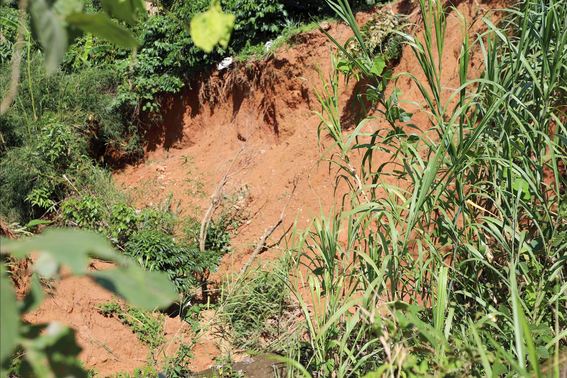
Specifically, at Km125+425, there was erosion of the culvert yard downstream, damage to the cement concrete structure of the culvert yard; soil erosion under the negative slope retaining wall and erosion of the negative slope downstream.
In this area, authorities also recorded erosion of the negative slope retaining wall and erosion of the negative slope flow of the roadbed with dimensions of 20x15x10m.
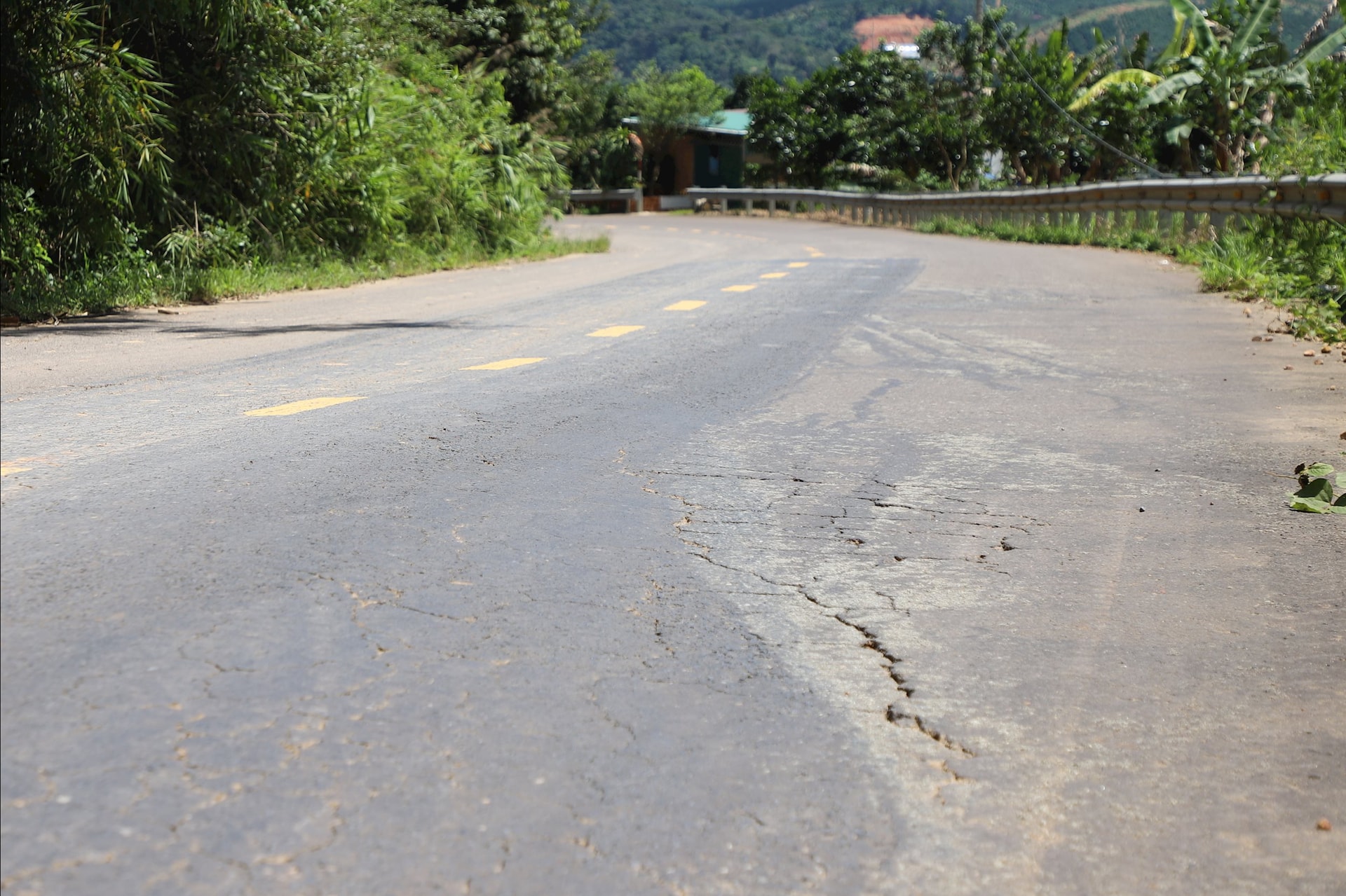
In addition, about 1km away from the subsidence point, at Km123+950, the road surface also appeared to have subsided and cracked along the center of the road with a length of about 100m, the crack was 1-2cm wide; especially, the local subsidence on both sides of the crack created a height difference of 2-8cm.
The leader of Lam Dong Road Maintenance Management Board said that in the eroded area, the maintenance contractor has put up ropes, installed night warning lights, filled the upstream of the culvert at km125+425, and spread a tarpaulin to cover the downstream landslide. At the subsided location, the contractor is preparing asphalt concrete to compensate for the subsidence.
Lam Dong Road Maintenance Management Board also reported and requested the Department of Construction to provide consulting research to find appropriate solutions to protect the infrastructure of the project.
National Highway 28 is more than 300km long, connecting the south of the South Central Coast with the south of the Central Highlands.
The national highway runs from the intersection of National Highway 1 in Binh Thuan province (old) to the intersection with National Highway 14, Dak Nong province (old).
After the merger of the three provinces of Dak Nong , Lam Dong and Binh Thuan, National Highway 28 is the main route for people traveling from the western region of Lam Dong to the provincial administrative center and vice versa.
Source: https://baolamdong.vn/xuat-hien-sut-lun-vet-nut-tren-quoc-lo-28-394074.html


![[Photo] Closing of the 13th Conference of the 13th Party Central Committee](https://vphoto.vietnam.vn/thumb/1200x675/vietnam/resource/IMAGE/2025/10/08/1759893763535_ndo_br_a3-bnd-2504-jpg.webp)


Comment (0)