
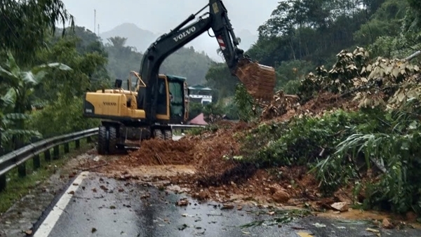
Statistics from the Vietnam Road Administration show that on National Highway 3B, passing through Thai Nguyen province, at Km116+300, the roadbed was broken, the damaged section was 10 meters long, 8 meters deep, and the entire road surface collapsed. This is the location assessed to have the most severe damage, causing the entire route to be cut off.
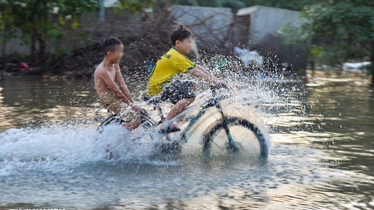
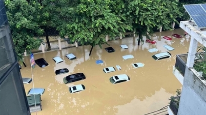
At the Thai Nguyen - Cho Moi BOT project, there are currently 4 locations that are still blocked due to deep flooding and landslides. Specifically, Km96+700 and Km99+600 are heavily flooded, the water has not receded; Tan Long intersection (Km75+300 - Km76) is flooded up to 0.8m, traffic must be diverted. At Km97+700, the estimated landslide volume is 2,500 m³ of earth and rock, units are urgently clearing, but traffic is still stagnant.
Due to the heavy rains in Thai Nguyen province, the water level in rivers and lakes is still high, so the drainage on flooded roads is still slow. Road Management Area I has instructed BOT investors to organize forces to stand guard at flooded areas to ensure traffic.
In Cao Bang alone, the Ho Chi Minh - Pac Bo road section was flooded from 1.1 to 1.5 meters deep at many points, completely paralyzing traffic. Some locations on National Highway 3 through this area had a 60 meter long landslide, eating away more than half of the road surface, forcing the ban on heavy vehicles, only allowing cars and motorbikes to circulate with limited traffic.
In Lao Cai , National Highway 70 (Km189, Phong Hai Commune) collapsed about 5,000 m³ of rock and soil, causing serious congestion. The road management unit is mobilizing cleaning machines and will temporarily clear the route as soon as possible.
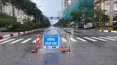
According to statistics, storm No. 11 and the floods after the storm have caused 37 locations and sections of national highways managed by the locality to be blocked, of which 16 locations were due to landslides and 21 locations were due to flooding. Currently, only a few locations have been temporarily repaired, while dozens of locations are still blocked. In addition, the provincial and local road systems have also been severely affected, with about 53 blocked locations (19 due to landslides, 34 due to deep flooding), and the number of cleared locations is still limited.
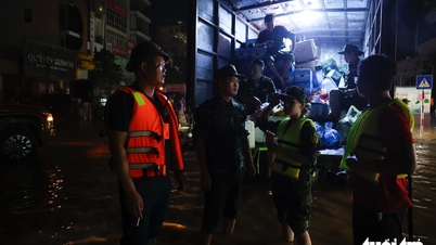
Road management areas have mobilized hundreds of officers and vehicles, organized 24/7 duty, coordinated with police and local forces to set up checkpoints, direct traffic, clear rocks and soil, and ensure traffic safety in the weather conditions where heavy rain continues.
The Vietnam Road Administration said it is currently unable to estimate the damage value, as units are still focusing all their efforts on responding to and overcoming the incident, prioritizing the earliest road clearance for isolated areas.
Source: https://cand.com.vn/Giao-thong/con-hon-30-vi-tri-sat-lo-o-khu-vuc-mien-nui-phia-bac-chua-the-luu-thong-i784000/

![[Photo] Impressions of the Can Gio Whale Festival](https://vphoto.vietnam.vn/thumb/1200x675/vietnam/resource/IMAGE/2025/10/09/1759984089762_image12334-5642-jpg.webp)


Comment (0)