

The weather can change dramatically during the storm (Photo: Son Nguyen)
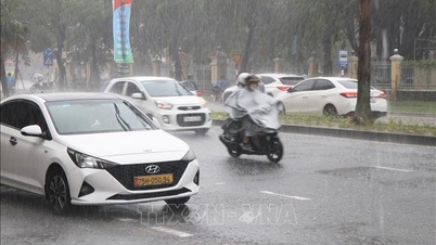
Many have heard the phrase “calm before the storm,” or a moment of calm that seems to be in stark contrast to the destructive force that is approaching. Along with that, the weather immediately after a storm is often beautiful, but why is that?
When the air creates stillness

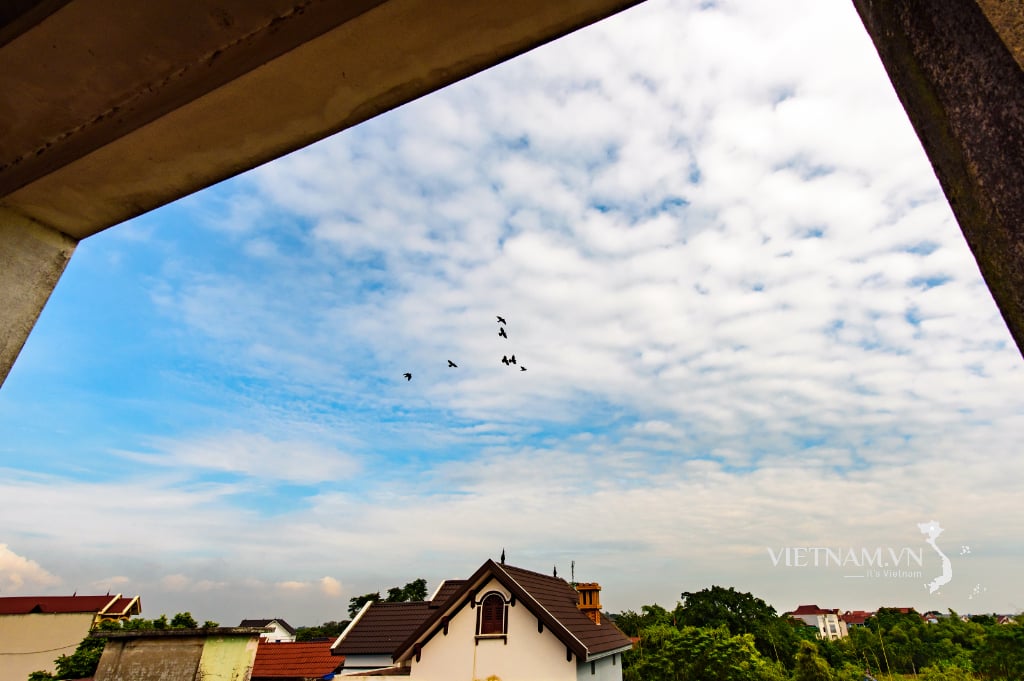
On July 22, a corner of West Lake ( Hanoi ) was covered in a clear, cool beauty with an unusually bright sky, an unbelievably peaceful scene at the time when storm Wipha was approaching the mainland (photo: Manh Quan)
For single-cell thunderstorms, which are the most basic type of storm, “calm” can occur due to air convection.
Near the ground, warm, moist air rises. As it reaches the colder layers of the atmosphere, the water vapor in it condenses into tiny droplets, which combine with dust particles to form clouds. These water droplets grow larger and heavier and eventually fall as rain.
As the warm air rises, it creates a low-pressure area, or “temporary low,” below. This pulls cold air down from above, helping to push rainwater down faster.
At the same time, the surrounding air is sucked into the low-pressure area, causing winds to temporarily stop blowing in the area ahead of the storm.
It is this difference and rotation that creates the “lull” that many people feel before heavy rain begins.
Not every storm is “calm”

Satellite image of Hurricane Idalia in the Gulf of Mexico (US) before making landfall in 2023 (Photo: NOAA).
Most thunderstorms, however, don't actually start out calm. In complex storm clusters or supercells, the air currents move up and down in different directions.
This turbulence causes the air to vibrate violently, so winds tend to speed up rather than stagnate. However, there are special conditions under which calm can occur.
When atmospheric pressure drops sharply and vortices form at high altitudes, the jets can temporarily cancel themselves out. In some cases, the quadrant at the edge of a superstorm, where low pressure and vortices dominate, can cause surface winds to cool significantly before the storm actually hits.
In addition, a layer of high-pressure surface winds moving ahead of a storm can also cause the air to become “still” for a while, as these air masses compress and stabilize low-level convection movements.
That moment, when nature seems to “hold its breath”, is the ideal time for the observer to clearly feel the invisible power that is accumulating.
The calm after the storm
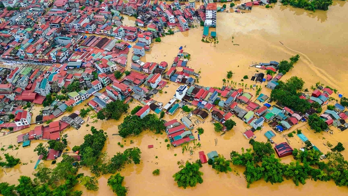
After a violent storm passes, the sky often becomes clear, the air is cool and the wind is gentle. This sudden change makes many people wonder: Why is nature so strangely peaceful after a storm?
To understand this, it is necessary to understand how storms work. According to meteorologists, during the process of formation and movement, tropical storms and hurricanes act like a giant “energy machine”.
There, the eye of the storm, or the center of the system, is where the low pressure is most concentrated, drawing in moist air from the surrounding area, creating heavy rain and violent winds.
As the storm moves out of the area, this low-pressure area is quickly replaced by a high-pressure area in the atmosphere. That shift drastically reduces convection, the process by which warm air rises and cools, reducing cloud cover and virtually eliminating the chance of rain.
This phenomenon is also reinforced by sudden changes in the ocean’s temperature profile. As storms pass, they churn up layers of water, bringing cold water from deep to the surface, a process called “upwelling.”
Colder water reduces evaporation, which reduces the amount of moisture in the air, thereby limiting the formation of clouds and rain. The sky becomes clear, the wind is light and dry, creating the typical “calm” feeling after a storm.
Geography also contributes significantly to the difference of “calm after the storm”. In the equatorial region, thanks to the steady source of solar energy and warm ocean water, the climate will recover more quickly, returning to its typical hot and humid state.
Meanwhile, higher latitudes often experience prolonged cold and dry periods, due to smaller sun angles and low humidity after storms.
Source: https://dantri.com.vn/khoa-hoc/tai-sao-thoi-tiet-thuong-rat-dep-truoc-va-sau-con-bao-20251007074629909.htm


![[Photo] Closing of the 13th Conference of the 13th Party Central Committee](https://vphoto.vietnam.vn/thumb/1200x675/vietnam/resource/IMAGE/2025/10/08/1759893763535_ndo_br_a3-bnd-2504-jpg.webp)


Comment (0)