
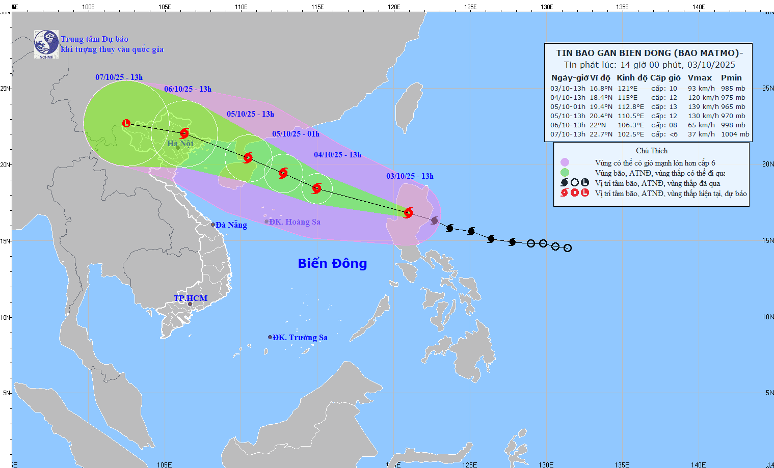
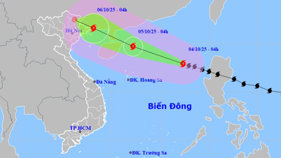
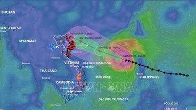
At 5:00 p.m., the center of the storm was at about 17.0 degrees North latitude; 120.0 degrees East longitude, in the sea area east of the North East Sea. The strongest wind near the center of the storm was level 10 (89 - 102 km/h), gusting to level 13. Moving in the West Northwest direction, speed about 25 km/h.
Forecast, by 5:00 p.m. on October 4, the storm in the North East Sea area is about 430 km East Southeast of Leizhou Peninsula (China) with strong winds of level 12, gusts of level 15; moving in the West Northwest direction at a speed of 25 km/h and is likely to strengthen. The affected area is the North East Sea area. Disaster risk level 3.
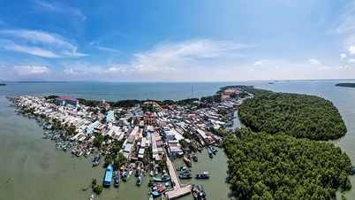
At 5:00 p.m. on October 5, the storm was in the eastern sea of the Northern Gulf of Tonkin, about 240km east-southeast of Mong Cai ( Quang Ninh ) with strong winds of level 11, gusts of level 14; moving in the West-Northwest direction at a speed of about 20-25 km/h. The affected area is the northern East Sea and the northern Gulf of Tonkin. Disaster risk level 3.
By 5:00 p.m. on October 6, the storm was in the mountainous provinces of the North with strong winds of level 6, gusts of level 8; moving in the West Northwest direction at a speed of about 20km/h, entering the mainland of the Northeast region and gradually weakening into a tropical depression. The affected areas are the Northwest sea, the North East Sea, the North Gulf of Tonkin, and the coastal areas of the provinces from Quang Ninh to Ninh Binh . Disaster risk level 3.
From the next 72 to 84 hours, the tropical depression will move in the West Northwest direction, about 15km per hour, go deep inland and gradually weaken into a low pressure area.
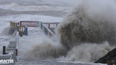
Due to the impact of the storm, the eastern sea area of the North East Sea has strong winds of level 8 - 9, the area near the eye of the storm has strong winds of level 10 - 11, gusts of level 14, waves 4 - 6m high, and rough seas. From the morning of October 4, the northern East Sea area has strong winds of level 8 - 10, the area near the eye of the storm has strong winds of level 11 - 13, gusts of level 16, waves 4 - 6m high, the area near the eye of the storm has strong winds of level 6 - 8m, rough seas.
Vessels operating in the above mentioned dangerous areas are susceptible to the impact of storms, whirlwinds, strong winds and large waves.
Source: https://baotintuc.vn/xa-hoi/bao-matmo-da-di-vao-bien-dong-tro-thanh-bao-so-11-trong-nam-2025-20251003180609626.htm


![[Photo] Students of Binh Minh Primary School enjoy the full moon festival, receiving the joys of childhood](https://vphoto.vietnam.vn/thumb/1200x675/vietnam/resource/IMAGE/2025/10/3/8cf8abef22fe4471be400a818912cb85)

![[Infographic] Notable numbers after 3 months of "reorganizing the country"](https://vphoto.vietnam.vn/thumb/1200x675/vietnam/resource/IMAGE/2025/10/4/ce8bb72c722348e09e942d04f0dd9729)


![[Photo] Prime Minister Pham Minh Chinh chairs meeting to deploy overcoming consequences of storm No. 10](https://vphoto.vietnam.vn/thumb/1200x675/vietnam/resource/IMAGE/2025/10/3/544f420dcc844463898fcbef46247d16)


Comment (0)