
")
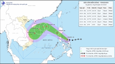
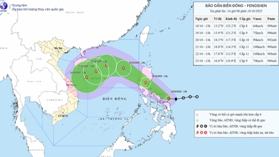
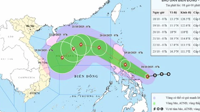
At 7:00 a.m. this morning, October 18, the center of the storm was located at about 13.1 degrees North latitude - 126.5 degrees East longitude, in the sea east of the central Philippines. The strongest wind near the center of the storm reached level 8 (62-74 km/h), gusting to level 10. The storm is moving west at a speed of about 20 km/h.
The National Center for Hydro-Meteorological Forecasting and international meteorological agencies forecast that in the next 48 hours, Typhoon Fengshen will move west-northwest, pass the central Philippines and enter the East Sea around October 20. After entering the East Sea, the storm is likely to strengthen again and become the 12th storm this year.
This is a storm that will have a very complicated path. Currently, forecast models show that the storm's path may be influenced by cold air from the North, causing the storm's trajectory to "bend" or change direction.
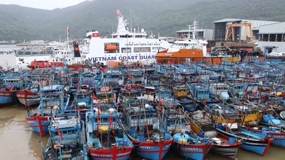
The Vietnam Meteorological Agency forecasts that Typhoon Fengshen may cause strong winds, large waves and widespread rain in the central and southern East Sea, then affect the seas off the Central Central and South Central regions. The coastal localities of the Central region need to closely monitor the development of this storm and proactively take measures to ensure the safety of ships and people operating at sea from an early stage.
Meteorological experts also said that due to the impact of storm No. 12 and cold air, the Central region is about to have a very heavy rain. The rain area may cover the western slope of the Truong Son mountain range, causing floods on the Mekong River.
Source: https://www.sggp.org.vn/bao-phong-than-da-manh-len-dang-huong-vao-bien-dong-post818666.html
![[Photo] Closing ceremony of the 18th Congress of Hanoi Party Committee](https://vphoto.vietnam.vn/thumb/1200x675/vietnam/resource/IMAGE/2025/10/17/1760704850107_ndo_br_1-jpg.webp)
![[Photo] Immerse yourself in the colorful musical world of “Secret Garden Live in Vietnam”](https://vphoto.vietnam.vn/thumb/1200x675/vietnam/resource/IMAGE/2025/10/18/1760805978427_ndo_br_thiet-ke-chua-co-ten-41-png.webp)
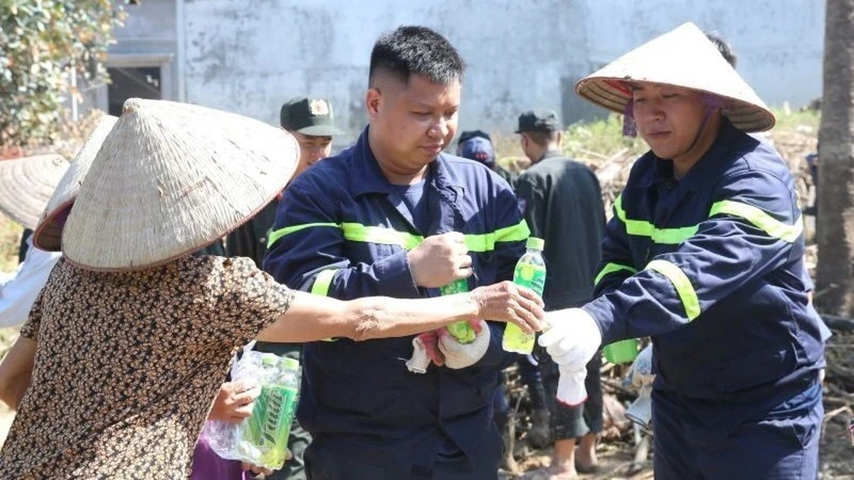
![[Photo] Collecting waste, sowing green seeds](https://vphoto.vietnam.vn/thumb/1200x675/vietnam/resource/IMAGE/2025/10/18/1760786475497_ndo_br_1-jpg.webp)

![[Photo] General Secretary To Lam attends the 95th Anniversary of the Party Central Office's Traditional Day](https://vphoto.vietnam.vn/thumb/1200x675/vietnam/resource/IMAGE/2025/10/18/1760784671836_a1-bnd-4476-1940-jpg.webp)


Comment (0)