
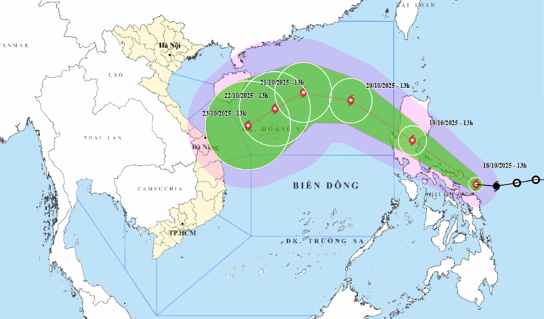
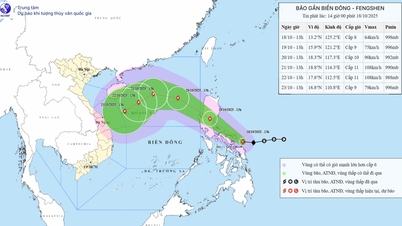
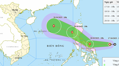
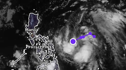
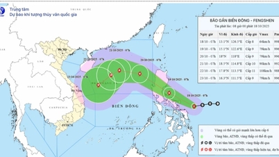
According to the forecast of the National Center for Hydro-Meteorological Forecasting, at 1:00 p.m. on October 19, the center of storm Fengshen was at about 15.9 degrees north latitude, 121.2 degrees east longitude, in the eastern area of Luzon Island (Philippines) with the strongest wind at level 8-9, gusting to level 11.
Storm Fengshen is moving west-northwest at 20km/h and moving into the East Sea, becoming Vietnam's 12th storm of 2025, with the potential to strengthen.
At 1:00 p.m. on October 21, the center of the storm was at about 18.8 degrees north latitude, 114.3 degrees east longitude, in the North East Sea, about 330km northeast of Hoang Sa special zone, with the strongest wind at level 11, gusting to level 13.
The storm then changed direction and moved southwest at a speed of about 10km/h with stable intensity and gradually weakened.
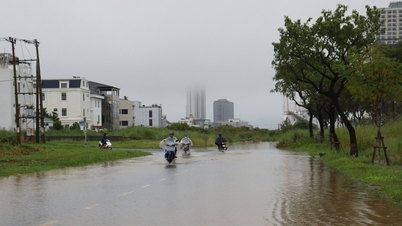
On the day and night of October 18, the eastern area of the North East Sea will have strong northeast winds of level 6, gusting to level 7-8, rough seas, and waves 2.5-3.5m high.
The southern area of the Gulf of Tonkin, the sea area from the south of Quang Tri to Ca Mau, from Ca Mau to An Giang , the Gulf of Thailand, the western area of the North East Sea (including Hoang Sa special zone), the southern area of the East Sea (including Truong Sa special zone) will have scattered showers and thunderstorms; during thunderstorms there is a possibility of tornadoes, strong gusts of wind of level 6-7 and waves over 2m high.
During the day and night of October 19, the North East Sea will have strong northeast winds of level 6, gusting to level 7-8, rough seas; in the eastern region, the northeast winds will gradually increase to level 6-7, near the storm center, strong level 8, gusting to level 10, rough seas, waves 2.5-4.5m high.
In the evening and night of October 19, in the Gulf of Tonkin, the northeast wind gradually increased to level 6, gusting to level 7-8, rough seas, waves 1.5-3m high.
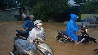
All vessels operating in the danger zone are susceptible to storms, whirlwinds, strong winds and large waves.
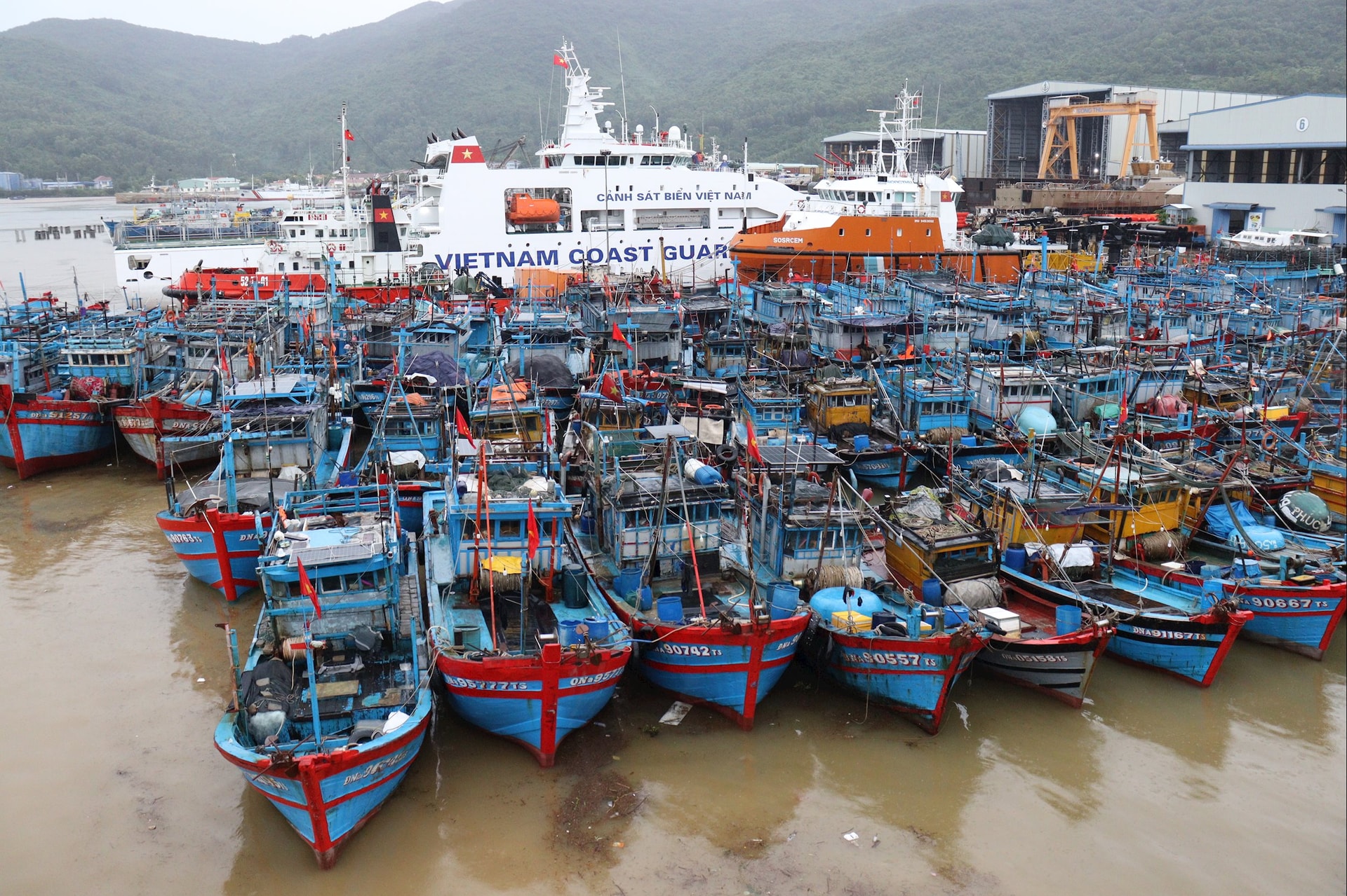
The National Steering Committee for Civil Defense requested provinces and cities to closely monitor warning bulletins, forecasts and developments of the storm; notify captains and owners of vehicles and vessels operating at sea of information to proactively prevent and have appropriate production plans, ensuring safety of people and property; maintain communication to promptly handle bad situations that may occur.
At the same time, prepare forces and means to deploy rescue work when there is a situation; be on duty seriously, regularly report to the National Civil Defense Steering Committee...
Source: https://baodanang.vn/gio-manh-va-song-lon-tren-cac-vung-bien-tau-thuyen-chu-dong-phong-tranh-3306669.html

![[Photo] Collecting waste, sowing green seeds](https://vphoto.vietnam.vn/thumb/1200x675/vietnam/resource/IMAGE/2025/10/18/1760786475497_ndo_br_1-jpg.webp)
![[Photo] General Secretary To Lam attends the 95th Anniversary of the Party Central Office's Traditional Day](https://vphoto.vietnam.vn/thumb/1200x675/vietnam/resource/IMAGE/2025/10/18/1760784671836_a1-bnd-4476-1940-jpg.webp)
![[Photo] Closing ceremony of the 18th Congress of Hanoi Party Committee](https://vphoto.vietnam.vn/thumb/1200x675/vietnam/resource/IMAGE/2025/10/17/1760704850107_ndo_br_1-jpg.webp)


Comment (0)