
Binh Thuan Heavy rain from high terrain poured into the basin where the Dau Giay - Phan Thiet highway crossed, but the area only had a 2.5 meter wide culvert, so the water could not drain in time.
Dau Giay - Phan Thiet Expressway flooded at the section passing through Ham Tan district, early morning of July 29. Video : Tu Huynh
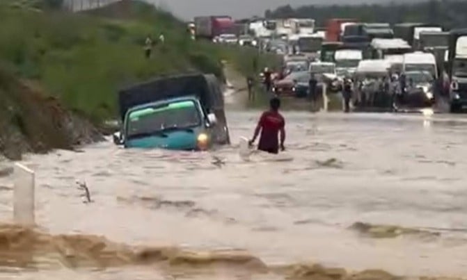
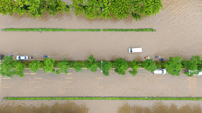
This morning, after a long rain, more than 100 meters of the Dau Giay - Phan Thiet highway, passing through Song Phan commune, Ham Tan district, was deeply flooded, causing traffic congestion from 2am to 7am. At the time of the incident, many passenger cars traveling from Ho Chi Minh City to Phan Thiet for the weekend were affected. By 8am, the water had receded and cars could pass normally.
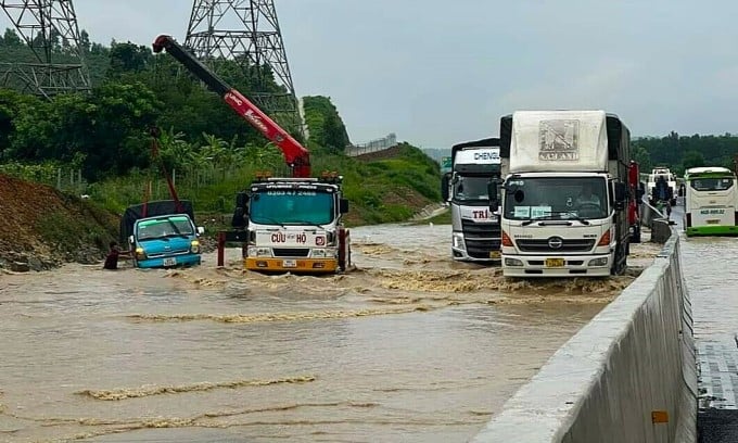
A rescue vehicle is pulling a truck that was swept away by floodwaters on the highway on the morning of July 29. Photo: Anh The
Recorded by VnExpress, area The flooded area is a basin, located between two hillsides and below the stream branch that flows into the Phan River. Water from three directions (Tanh Linh mountain forest, Highway 55 and Tan Lap commune) flows down here like a funnel. However, this depression only has a 2.5 m wide drainage. After the drainage mouth, there is no drainage ditch, when it rains heavily, the water rushes up and floods the highway nearly a meter.
According to the Binh Thuan Hydrometeorological Center, yesterday the province had 30-96 mm of rain. Particularly in the upstream and flooded highway areas, there was very heavy rain. Specifically, from 3 p.m. to 9 p.m., the amount of rain measured at the stations: Suoi Kiet 96.3 mm, Gia Huynh 81.7 mm, Duc Thuan 38.2 mm, Tan Lap 37.2 mm...
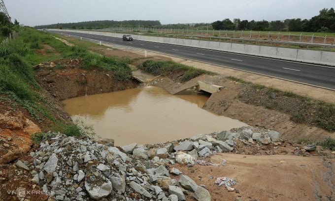
Drainage in the flooded area has no outlet to the downstream. Photo: Viet Quoc
Mr. Dang Hung Thai, Director of the Dau Giay - Phan Thiet Expressway Project Management Board, said that the construction units have followed the design at this location. Up to now, the contractors have completed all construction items in accordance with the approved design documents.
"It is possible that the downstream flow outside the highway construction area was blocked, so the water accumulated," Mr. Thai said after the project management board came to the highway to record the incident.
In an official dispatch sent to the Thang Long Project Management Board (investor) this afternoon, Deputy Minister of Transport Nguyen Danh Huy requested this unit to coordinate with relevant parties to fix the problem, ensure the route is open and handle it according to the technical requirements of the project. The investor needs to notify the Ministry of Transport before August 3 about the specific cause of the flooding and the solution to fix it.
In addition, the leaders of the Ministry of Transport directed the investor to review the collective and individual responsibilities involved, especially the design consultant and examiner if there are any violations.
Thang Long Project Management Board has asked the design consultant to inspect the site tomorrow morning. Binh Thuan Department of Transport has invited relevant parties to a meeting next Monday to carefully assess the cause and find solutions.
The flooded highway section has only one 2.5 meter wide drain. Photo: Viet Quoc
Dr. Pham Viet Thuan, Director of the Ho Chi Minh City Institute of Natural Resources and Environment Economics, said that the foundations of highways are often raised to ensure surface drainage and prevent subsidence. Therefore, the severe flooding of a section of the Phan Thiet - Dau Giay highway is very rare, so the consulting and design stages need to be reviewed.
He also said that the above area is a low-lying area, previously drainage occurred naturally but when the highway was built, it may have blocked the flow. Meanwhile, the drainage system was not invested synchronously to ensure drainage, leading to local flooding when water accumulates. To overcome the above situation, the management unit needs to review the terrain specifically, add a drainage system to increase drainage capacity.
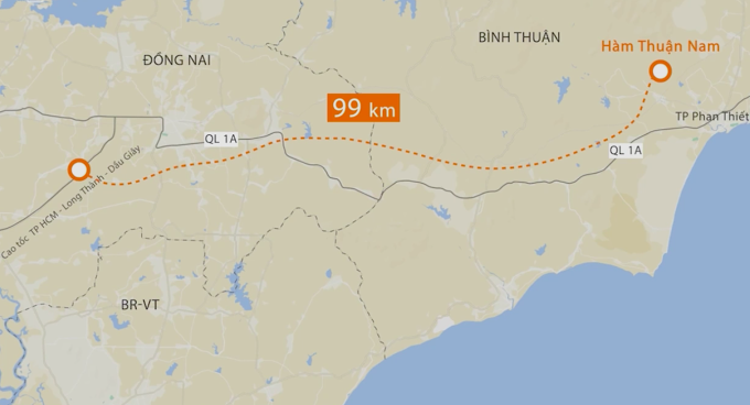
Route of Dau Giay - Phan Thiet Expressway. Graphics: Thanh Huyen
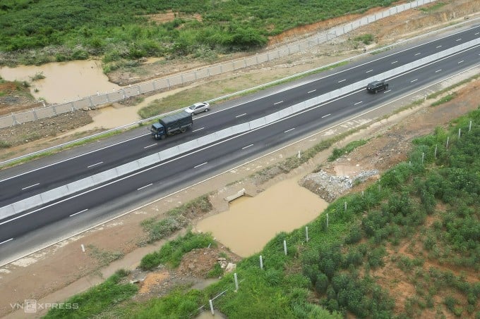
The 99-km Dau Giay - Phan Thiet Expressway connects Dong Nai and Binh Thuan provinces. The project has a total investment of more than VND12,500 billion and was opened to traffic at the end of April. The route starts at the Vinh Hao - Phan Thiet Expressway in Ham Thuan Nam district and ends at the intersection of Ho Chi Minh City - Long Thanh - Dau Giay Expressway in Thong Nhat district, Dong Nai province.
Viet Quoc - Gia Minh
Source link

![[Photo] President of the Cuban National Assembly visits President Ho Chi Minh's Mausoleum](https://vphoto.vietnam.vn/thumb/1200x675/vietnam/resource/IMAGE/2025/10/1/39f1142310fc4dae9e3de4fcc9ac2ed0)
![[Photo] Hanoi morning of October 1: Prolonged flooding, people wade to work](https://vphoto.vietnam.vn/thumb/1200x675/vietnam/resource/IMAGE/2025/10/1/189be28938e3493fa26b2938efa2059e)

![[Photo] Keep your warehouse safe in all situations](https://vphoto.vietnam.vn/thumb/1200x675/vietnam/resource/IMAGE/2025/10/1/3eb4eceafe68497989865e7faa4e4d0e)


Comment (0)