
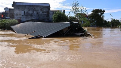
At noon on October 8, the Department of Hydrometeorology ( Ministry of Agriculture and Environment ) said that the water level on the Cau River (Thai Nguyen) at Gia Bay station was 29.68 m, 0.87 m above the historical flood level in 2024 (28.81 m); on the Cau River at Dap Cau station (Bac Ninh) was 6.61 m, 0.31 m above the alarm level 3.
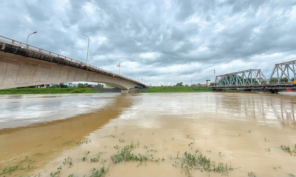
Floods on the Thuong River are likely to peak above the historical level of 1986.
PHOTO: BAC NINH NEWSPAPER
The water level on Thuong River ( Bac Ninh ) at Cau Son station is 17.70 m, 1.7 m above BĐ3, 0.09 m above historical level; at Phu Lang Thuong station is 7.37 m, 1.07 m above BĐ3, 0.16 m below historical level; at Huu Lung station on Trung River (Lang Son) is 24.28 m, 5.28 m above BĐ3, 1.74 m above historical flood level.
It is forecasted that in the next 12 hours, flood on Cau River at Dap Cau station will continue to rise above level 3; flood on Thuong River at Phu Lang Thuong station will rise above level 3 by about 0.08 m; flood on Cau River (Thai Nguyen) at Gia Bay station will continue to slowly fall and be above level 3 by about 1.90 m; flood on Trung River ( Lang Son ) at Huu Lung station will continue to rise slowly and peak at noon and afternoon on October 8, then slowly fall to above level 3.
In the next 12 - 24 hours, the flood on Cau River at Dap Cau station will peak at about 1.15 m above BĐ3, then slowly decrease; at Gia Bay station, it will continue to decrease below the historical flood level but still remain above BĐ3.
Notably, the flood on Thuong River at Phu Lang Thuong station is likely to peak about 0.18 m above the historical flood level in 1986 (7.52 m), after slow change; the flood on Trung River (Lang Son) at Huu Lung station will slowly decrease to level BĐ3.
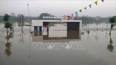
Warning, widespread deep flooding in Thai Nguyen, Bac Ninh, Lang Son, Cao Bang provinces lasting for 3-4 days. Risk of riverbank and dike landslides, flash floods on rivers and streams and landslides on slopes in mountainous areas of the North.
Particularly large flood on Cau River, Hanoi requested to be ready to protect the dike
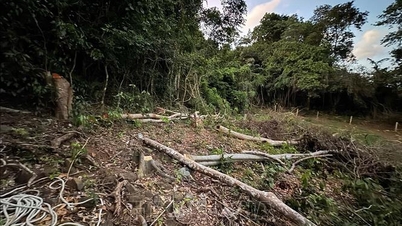
Flash flood and landslide warning in 8 northern provinces
The meteorological agency said that in the past 24 hours (from 10:00 on October 7 to 10:00 on October 8), the Northern provinces had moderate rain, heavy rain, and some places had very heavy rain such as: Phin Ho (Lai Chau) 52.5 mm; Dong Tam (Phu Tho) 88.6 mm; Trinh Tuong (Lao Cai) 136.4 mm; Ho Thau (Tuyen Quang) 132 mm; Boc Nhieu (Thai Nguyen) 171.2 mm; Hong An (Cao Bang) 46.6 mm; Tan Lap (Lang Son) 41.8 mm; Xuan Huong (Bac Ninh) 213.4 mm... The soil moisture model shows that some areas in the above provinces are nearly saturated (over 85%) or have reached a saturated state.
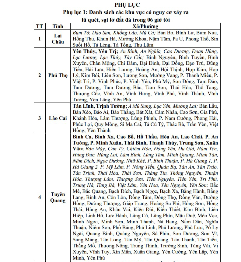
Localities at risk of flash floods and landslides
PHOTO: NCHMF
In the next 3-6 hours, the above provinces will continue to have rain with accumulated rainfall from 5-15 mm, in some places over 40 mm. There is a risk of flash floods on small rivers and streams, landslides on slopes in many communes/wards in the provinces: Lai Chau, Phu Tho, Lao Cai, Tuyen Quang, Thai Nguyen, Cao Bang, Lang Son, Bac Ninh.
Warning level of natural disaster risk due to flash floods, landslides, land subsidence due to heavy rain or flood or flow level 1; Cao Bang and Thai Nguyen level 2.
Thanhnien.vn
Source: https://thanhnien.vn/lu-song-cau-rut-cham-lu-song-thuong-sap-vuot-ky-luc-39-nam-185251008125504513.htm
![[Photo] Prime Minister Pham Minh Chinh inspects and directs the work of overcoming the consequences of floods after the storm in Thai Nguyen](https://vphoto.vietnam.vn/thumb/1200x675/vietnam/resource/IMAGE/2025/10/08/1759930075451_dsc-9441-jpg.webp)
![[Photo] Prime Minister Pham Minh Chinh attends the World Congress of the International Federation of Freight Forwarders and Transport Associations - FIATA](https://vphoto.vietnam.vn/thumb/1200x675/vietnam/resource/IMAGE/2025/10/08/1759936077106_dsc-0434-jpg.webp)


![[Photo] Closing of the 13th Conference of the 13th Party Central Committee](https://vphoto.vietnam.vn/thumb/1200x675/vietnam/resource/IMAGE/2025/10/08/1759893763535_ndo_br_a3-bnd-2504-jpg.webp)


Comment (0)