
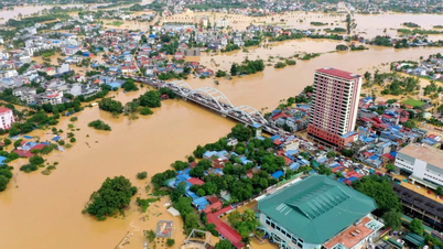
Warning: In the next 12 hours, the flood on the Thuong River at Cau Son is likely to peak and above alert level 3 by about 2.45m; at Phu Lang Thuong station, it will peak and above the historical flood level of 1986 by about 0.23m; the flood on the Cau River at Dap Cau is likely to peak and above alert level 3 by 1.1m. In the next 12 - 24 hours, the flood on the rivers will continue to decrease, the water level on the Cau River at Gia Bay station will be 0.2m below alert level 3, at Dap Cau station will be 0.85m above alert level 3; the water level on the Thuong River at Cau Son station will be 1.3m above alert level 3, at Phu Lang Thuong station will be 1.1m above alert level 3.
Warning, from now October 8 to October 9, flood on Luc Nam River (Bac Ninh) at Luc Nam station, flood on Thai Binh River (Hai Phong) at Pha Lai station fluctuates at alert level 1 - alert level 2.
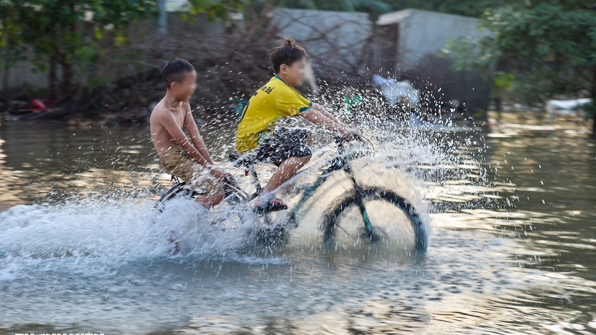
Widespread flooding in Thai Nguyen, Bac Ninh , Lang Son provinces in the next 2-3 days and risk of flooding in low-lying areas along rivers, urban areas in the Northern region; risk of landslides on river banks, river dykes, risk of flash floods on rivers and streams and landslides on slopes in the mountainous areas of the Northern region. Real-time warning information on areas at risk of flash floods and landslides is provided online on the website of the Department of Hydrometeorology at: https://luquetsatlo.nchmf.gov.vn and in separate bulletins warning of flash floods and landslides).
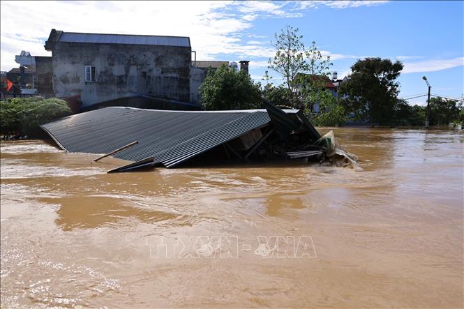
The National Center for Hydro-Meteorological Forecasting has issued a warning that the level of natural disaster risk due to floods is level 3. River floods cause inundation of low-lying areas along the river, affecting activities such as waterway transport, aquaculture, agricultural production, people's lives and socio-economic activities.
Source: https://baotintuc.vn/van-de-quan-tam/lu-tren-song-cau-thai-nguyen-dang-xuong-20251008220502924.htm

![[Photo] Impressions of the Can Gio Whale Festival](https://vphoto.vietnam.vn/thumb/1200x675/vietnam/resource/IMAGE/2025/10/09/1759984089762_image12334-5642-jpg.webp)


![[Photo] Prime Minister Pham Minh Chinh inspects and directs the work of overcoming the consequences of floods after the storm in Thai Nguyen](https://vphoto.vietnam.vn/thumb/1200x675/vietnam/resource/IMAGE/2025/10/08/1759930075451_dsc-9441-jpg.webp)
![[Photo] Prime Minister Pham Minh Chinh attends the World Congress of the International Federation of Freight Forwarders and Transport Associations - FIATA](https://vphoto.vietnam.vn/thumb/1200x675/vietnam/resource/IMAGE/2025/10/08/1759936077106_dsc-0434-jpg.webp)


Comment (0)