
Authorities warn of the risk of flash floods on small rivers and streams in mountainous areas, landslides on steep slopes, and land subsidence in 18 communes and wards including: Phu Loc, A Luoi 4, Chan May - Lang Co, Khe Tre, Loc An, Kim Long, Phong Dien, A Luoi 1, A Luoi 5, Binh Dien, Hung Loc, Long Quang, Nam Dong, Huong An, Huong Tra, Kim Tra, Phong Thai, and Phu Bai.
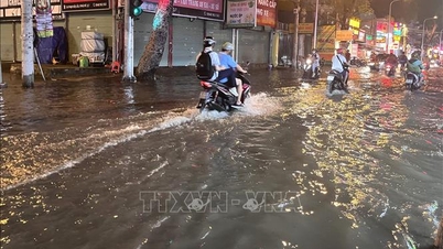
Warning: Flash floods can have very negative impacts on the environment, threaten people's lives; cause local traffic congestion, affect the movement of vehicles; destroy civil and economic works, causing damage to production and socio-economic activities.
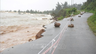
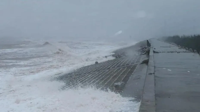
Along with that, the coastline through Vinh Loc commune is eroding 2 km long, eroding 10 - 30 meters deep into the mainland, affecting Provincial Road 21, essential infrastructure works, and posing a risk of opening the sea gate.
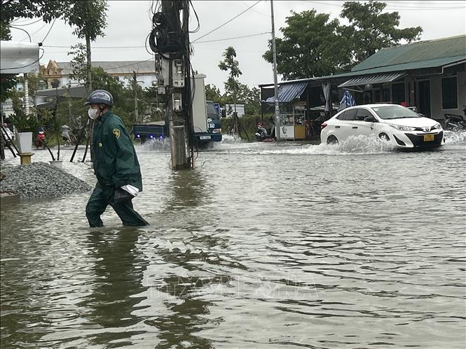
According to the forecast, from the morning of October 23 to the morning of October 25, in Hue city there will be heavy rain, very heavy rain with total rainfall of 150 - 300mm, in some places over 400mm.
Due to big waves and high tides, water from the sea overflowed into Tam Giang lagoon, causing local flooding in some coastal communes and wards and lagoon banks. Some inter-village, residential group and inter-commune roads of 7 communes and wards including Dan Dien, Quang Dien, Hoa Chau, Thuan An, Loc An, Thanh Thuy, Vinh Loc were flooded from 0.3 - 0.5m. Some places were flooded 0.8m deep such as the villages: Mai Duong, Lam Ly, Phuoc Ly in Quang Dien commune; Ha Trung, Thuong Tay in Thuan An ward.
The coastline through Hoa Duong Residential Group, Thuan An Ward has suffered severe erosion with a length of 1 km; eroding 50 - 70m deep into the mainland, affecting essential infrastructure works, tourism services and the risk of opening a new sea gate.
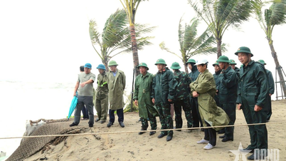
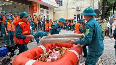
In the area of pass No. 5, Loc Hung village, Khe Tre commune, there is a high risk of landslides, which can isolate about 40 households. The central area of Khe Tre commune adjacent to the landslide site between Da Phu and Ha An villages has 38 households and Village 2 has 27 households, which is at risk of affecting households. The locality has developed a plan to evacuate people to ensure safety.
On the morning of October 23, the water level on the Huong River at Kim Long station was 0.37m below alert level 2; the Bo River at Phu Oc station was 0.63m above alert level 1. Most of the water levels at reservoirs are maintaining lower levels than normal water levels. The current water levels of Huong Dien and Binh Dien reservoirs are capable of cutting off the flood peak of a 400mm rain event, and Ta Trach reservoir is capable of cutting off the flood peak of a 500mm rain event.
Source: https://baotintuc.vn/xa-hoi/mua-lon-sau-bao-so-12-nhieu-khu-vuc-tai-hue-co-nguy-co-sat-lo-va-ngap-lut-20251023112507713.htm

![[Photo] Prime Minister Pham Minh Chinh chairs meeting on railway projects](https://vphoto.vietnam.vn/thumb/1200x675/vietnam/resource/IMAGE/2025/10/23/1761206277171_dsc-9703-jpg.webp)
![[Photo] Prime Minister Pham Minh Chinh meets with South African President Matamela Cyril Ramaphosa](https://vphoto.vietnam.vn/thumb/1200x675/vietnam/resource/IMAGE/2025/10/23/1761226081024_dsc-9845-jpg.webp)


![[Photo] President Luong Cuong holds talks with South African President Matamela Cyril Ramaphosa](https://vphoto.vietnam.vn/thumb/1200x675/vietnam/resource/IMAGE/2025/10/23/1761221878741_ndo_br_1-8416-jpg.webp)


Comment (0)