
Due to the impact of storm No. 12, the coastal area in Da Nang in Tan Thanh block, Hoi An Tay ward suffered a landslide of more than 100m, with waves hitting the shore nearly 30m deep.
In the prolonged rainy conditions, military forces, border guards, and militia of the Da Nang City Military Command were mobilized, using materials, mechanical vehicles, and sandbags to build embankments, prevent wave attacks, and protect coastal residential areas.
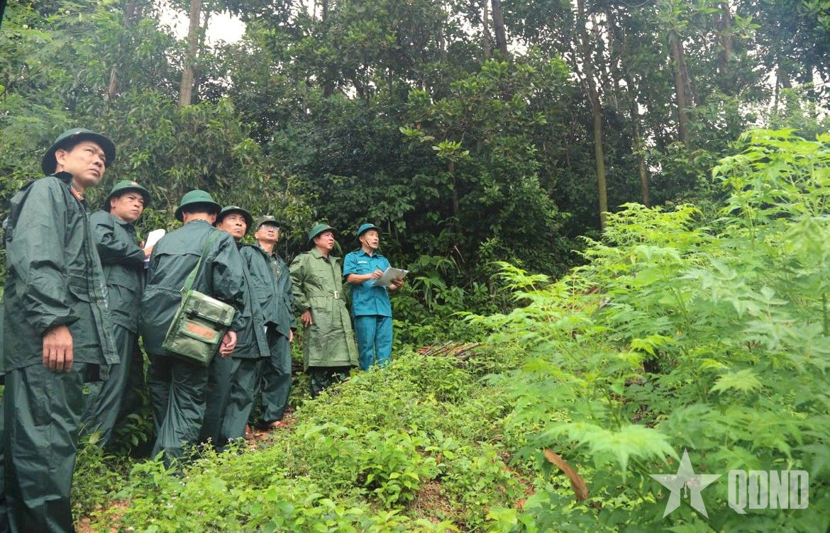
Through on-site inspection, Military Region 5 and local authorities determined that there are still many areas at risk of landslides, up to hundreds of meters.
 |
Landslides in Hoi An Tay ward. |
 |
 |
Military Region 5 and local working group inspected landslide sites in Hoi An Tay ward. |
Colonel Cao Van Muoi requested the locality to put up signs, stretch warning ropes and barricades to prevent people and tourists from approaching; directed the Da Nang City Military Command to continue assigning forces to coordinate with local authorities and functional agencies to monitor the situation and developments at landslide-prone areas; develop response plans, promptly overcome them, and limit the risk of insecurity for people.
 |
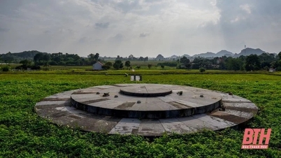
Military Region 5 working group inspected the high-risk landslide location at the foot of Hill 37 (Dai Loc Commune, Da Nang City). |
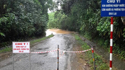
The working group also inspected Dai Lo commune (Da Nang city) - a locality that often experiences flooding during heavy rains.
Currently, households in vulnerable areas have been evacuated to safety by the army. The military region requires units to strictly maintain 24/7 command, on-duty, and rescue duty, and prepare adequate means to mobilize and rescue people when situations arise.
News and photos: LE TAY
Source: https://www.qdnd.vn/quoc-phong-an-ninh/tin-tuc/quan-khu-5-kiem-tra-cac-diem-sat-lo-tai-da-nang-899630


![[Photo] Prime Minister Pham Minh Chinh chairs meeting on railway projects](https://vphoto.vietnam.vn/thumb/1200x675/vietnam/resource/IMAGE/2025/10/23/1761206277171_dsc-9703-jpg.webp)


Comment (0)