
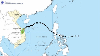
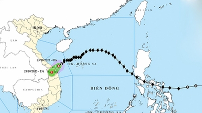
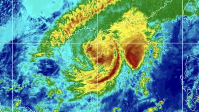
Data from the National Center for Hydro-Meteorological Forecasting shows that the tropical depression has not changed in intensity or direction of movement. It is forecast that on October 24, the tropical depression will gradually weaken into a low pressure area.
Accordingly, at 7:00 p.m. on October 23, the center of the tropical depression was at about 18.2 degrees North latitude; 118.8 degrees East longitude, in the eastern sea area of the North East Sea. The strongest wind near the center of the tropical depression was level 6 (39-49 km/h), gusting to level 8. Moving southwest at a speed of about 25 km/h.
Forecast until 7am on October 24, the tropical depression in the North East Sea with wind speed below level 6, moving southwest at a speed of 25km/h, gradually weakening into a low pressure area, the affected area is the sea area east of the North East Sea. Disaster risk level: level 3.
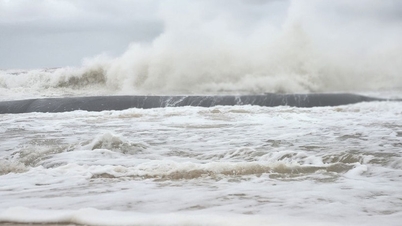
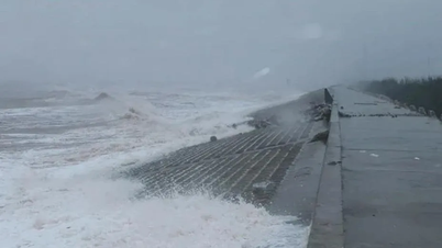
Due to the influence of low pressure combined with strengthening cold air, the eastern sea area of the North East Sea has strong winds of level 6-7, gusts of level 9, waves 3-5m high, and rough seas.
Vessels operating in the above mentioned danger zones are susceptible to the effects of storms, whirlwinds, strong winds and large waves.
Source: https://www.sggp.org.vn/du-bao-ap-thap-nhiet-doi-se-suy-yeu-dan-thanh-mot-vung-ap-thap-post819634.html
![[Photo] Prime Minister Pham Minh Chinh chairs meeting on railway projects](https://vphoto.vietnam.vn/thumb/1200x675/vietnam/resource/IMAGE/2025/10/23/1761206277171_dsc-9703-jpg.webp)
![[Photo] Prime Minister Pham Minh Chinh meets with South African President Matamela Cyril Ramaphosa](https://vphoto.vietnam.vn/thumb/1200x675/vietnam/resource/IMAGE/2025/10/23/1761226081024_dsc-9845-jpg.webp)
![[Photo] President Luong Cuong holds talks with South African President Matamela Cyril Ramaphosa](https://vphoto.vietnam.vn/thumb/1200x675/vietnam/resource/IMAGE/2025/10/23/1761221878741_ndo_br_1-8416-jpg.webp)


Comment (0)