
According to the Department of Agriculture and Environment, the long-term waterlogged dike system has led to the risk of landslides and seepage. As of October 10, the entire province had 352 meters of landslides and more than 29 kilometers of seepage and seepage.
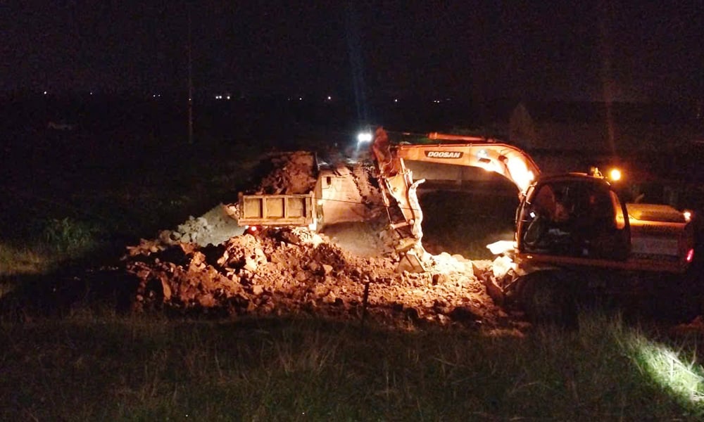 |
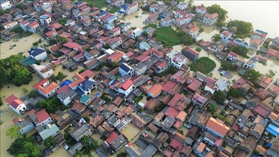
Authorities handle landslide incident on left dike of Cau bridge through Hop Thinh commune. |
On the left dike of Cau, at K9+450, there was a landslide incident with the dike slope on the plain side 8m from the dike surface, 50m long, 1.2m deep; at K9+550, the landslide was 5m from the dike surface on the plain side, 15m long, 1.2m deep. The People's Committee of Hop Thinh commune has directed to temporarily handle the incidents by opening drainage ditches to direct the water flow out of the cracks, limiting the development of the landslide; and building a counter-pressure mechanism to hold the toe of the landslide. The People's Committee of the commune is continuing to build the toe of the landslide with a volume of about 200 m3.
At K10+200, the Da Hoi dike had its dike slope eroded on the river side (the dike head had collapsed) due to the flow tending to approach the left bank, causing the landslide. The incident was immediately handled by Hop Thinh commune by using earthen sacks to reinforce the dike slope, directing the flow away from the landslide area. By 2:00 a.m. on October 11, the incident repair work was completed.
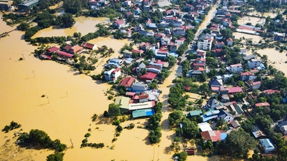
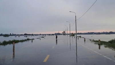
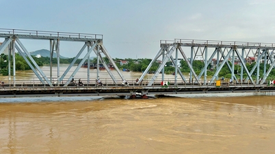
Although water levels on rivers are gradually receding, many low-lying areas along Thuong, Cau and Duong rivers are still deeply flooded, and traffic is cut off.
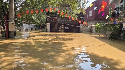
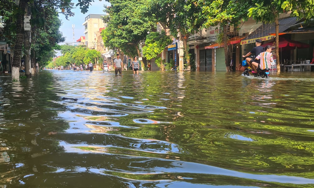 |
Water from Da Mai stream flooded My Do street, residential group 2, Da Mai ward. Photo by Quoc Truong |
In Da Mai ward, from the afternoon of October 10 to the morning of October 11, due to high river water levels, Da Mai sluice gate was closed, unable to pump water into the river, leading to flooding in the basin, affecting people's lives and the safety of the North-South railway and some national and provincial highways. Comrade Do Van Quy, Chairman of Da Mai ward People's Committee, said: "As soon as the incident was discovered, the ward commanded forces to build embankments to prevent water from flooding into residential areas, and at the same time supported people in affected areas to evacuate people and property to safety."
According to the Bac Ninh Hydrometeorological Station, on the morning of October 11, the water level on the Thuong and Cau rivers is slowly decreasing, still at level 3 above alert. It is forecasted that in the next 24 hours, the water level will continue to decrease but will remain high, and the risk of flooding in low-lying areas along the river still exists. Localities need to closely monitor developments and proactively take measures to ensure the safety of people and dike works.
Currently, the water level on river banks continues to fall, the risk of landslides is very high. The Department of Agriculture and Environment recommends that localities with dikes closely coordinate with dike management forces to increase patrols and guard the dikes, promptly handle dike incidents such as: ebbs and flows, landslides, and culverts under the dikes.
Relevant departments, branches and localities mobilize maximum forces and means to drain water, clear water flows, and provide relief supplies to isolated households affected by floods.
Source: https://baobacninhtv.vn/bac-ninh-tang-cuong-kiem-soat-khac-phuc-su-co-de-dieu-sau-mua-lu-postid428621.bbg
![[Photo] Opening of the World Cultural Festival in Hanoi](https://vphoto.vietnam.vn/thumb/1200x675/vietnam/resource/IMAGE/2025/10/10/1760113426728_ndo_br_lehoi-khaimac-jpg.webp)

![[Photo] Discover unique experiences at the first World Cultural Festival](https://vphoto.vietnam.vn/thumb/1200x675/vietnam/resource/IMAGE/2025/10/11/1760198064937_le-hoi-van-hoa-4199-3623-jpg.webp)


![[Photo] General Secretary attends the parade to celebrate the 80th anniversary of the founding of the Korean Workers' Party](https://vphoto.vietnam.vn/thumb/1200x675/vietnam/resource/IMAGE/2025/10/11/1760150039564_vna-potal-tong-bi-thu-du-le-duyet-binh-ky-niem-80-nam-thanh-lap-dang-lao-dong-trieu-tien-8331994-jpg.webp)


![[Photo] Ho Chi Minh City is brilliant with flags and flowers on the eve of the 1st Party Congress, term 2025-2030](https://vphoto.vietnam.vn/thumb/1200x675/vietnam/resource/IMAGE/2025/10/10/1760102923219_ndo_br_thiet-ke-chua-co-ten-43-png.webp)


Comment (0)