
Commenting on storm Fengshen and scenarios of its impact on Vietnam's mainland weather, the National Center for Hydro-Meteorological Forecasting said: The storm is likely to weaken into a tropical depression before affecting the mainland of the Central provinces.
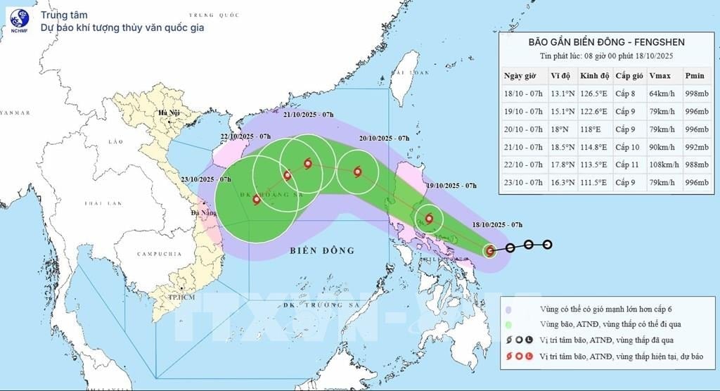
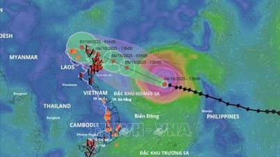
Accordingly, when the storm moves into the East Sea, the East Sea is under the influence of cold air, the cold air mass blocking the western part of the storm makes it less likely for the storm to move in the main west direction to move into the North or go up to the Chinese region (due to being blocked in the North and blocked in the West). Therefore, when moving into the Hoang Sa special economic zone, reaching the strongest wind intensity of level 11, gusting to level 13, the storm will be penetrated by cold air and gradually weaken.
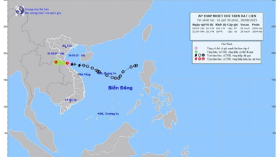
The National Center for Hydro-Meteorological Forecasting said: Although the possibility of maintaining the storm's intensity to affect the mainland of the Central region is not high, however, with the impact of the storm's circulation combined with cold air in the Northern seas, the middle of the East Sea (including Hoang Sa special zone), the Gulf of Tonkin as well as the sea area from Quang Tri - Quang Ngai in the coming days, there will often be strong winds from level 6-8 or higher, waves from 3-4m high. rough seas.
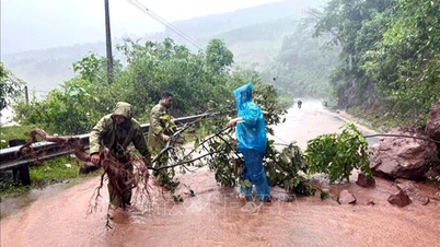
Due to the influence of post-storm circulation No. 12 combined with the impact of cold air from October 23-26, in the area from Ha Tinh to Quang Ngai, there will be a widespread period of moderate to heavy rain.
In addition, the interaction of cold air and storms is one of the types of interaction with many scenarios: If the storm comes first, the cold air comes later, or the storm and cold air influence each other, it will cause very heavy rain. In the case where the cold air comes first, then the storm comes, the rain will not be too heavy.
Currently, the rain scenarios as well as the impact of storms on mainland Vietnam still depend a lot on the development of cold air, so it is necessary to closely monitor both the path of the storm and the impact of cold air.
Early on the morning of October 18, the tropical depression in the sea east of the Philippines intensified into a storm, the 24th storm in the Northwest Pacific region and has the international name Fengshen (the name of the storm Fengshen was given by China, Fengshen in Chinese means god of wind). At 7:00 a.m. this morning, the center of storm Fengshen was at about 13.1 degrees North latitude; 126.5 degrees East longitude, in the sea east of the central Philippines. The storm intensity is level 8 (62-74km/h), gusting to level 10.
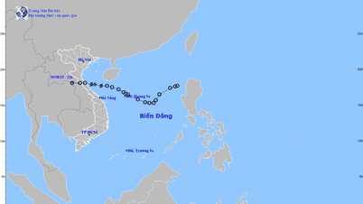
It is forecasted that around the morning of October 19, storm Fengshen will make landfall in the Luzon Island area (Philippines). In the afternoon and evening of October 19, storm Fengshen will pass through Luzon Island (Philippines) and enter the East Sea, becoming storm number 12. After moving into the East Sea, storm number 12 will move mainly in the West-Northwest direction, and its intensity will continue to increase. By around October 22, when the storm moves to the northern area of Hoang Sa special zone, the intensity of storm number 12 will increase to level 11, gusting to level 13.
According to VNASource: https://baohaiphong.vn/bao-fengshen-co-the-suy-yeu-truoc-khi-vao-dat-lien-viet-nam-523937.html

![[Photo] General Secretary To Lam attends the 95th Anniversary of the Party Central Office's Traditional Day](https://vphoto.vietnam.vn/thumb/1200x675/vietnam/resource/IMAGE/2025/10/18/1760784671836_a1-bnd-4476-1940-jpg.webp)


![[Photo] Closing ceremony of the 18th Congress of Hanoi Party Committee](https://vphoto.vietnam.vn/thumb/1200x675/vietnam/resource/IMAGE/2025/10/17/1760704850107_ndo_br_1-jpg.webp)
![[Photo] Collecting waste, sowing green seeds](https://vphoto.vietnam.vn/thumb/1200x675/vietnam/resource/IMAGE/2025/10/18/1760786475497_ndo_br_1-jpg.webp)


Comment (0)