
.jpeg)
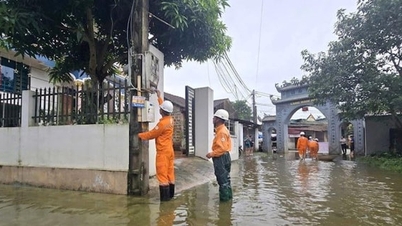
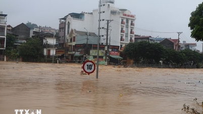
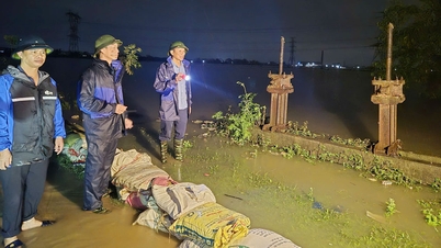
According to the city's Hydrometeorological Station, from October 6 until now, Hai Phong has had moderate to heavy rain, and some places have had very heavy rain such as: Vinh Bao 111mm, Cat Ba 109.6mm; Mao Dien 107.4mm; Phu Lien 85.4mm...
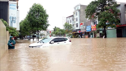
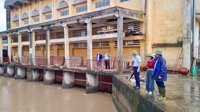
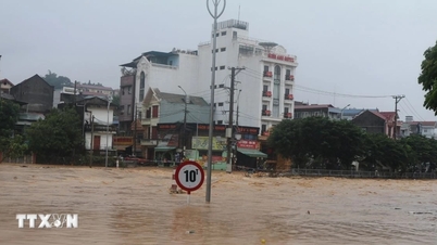
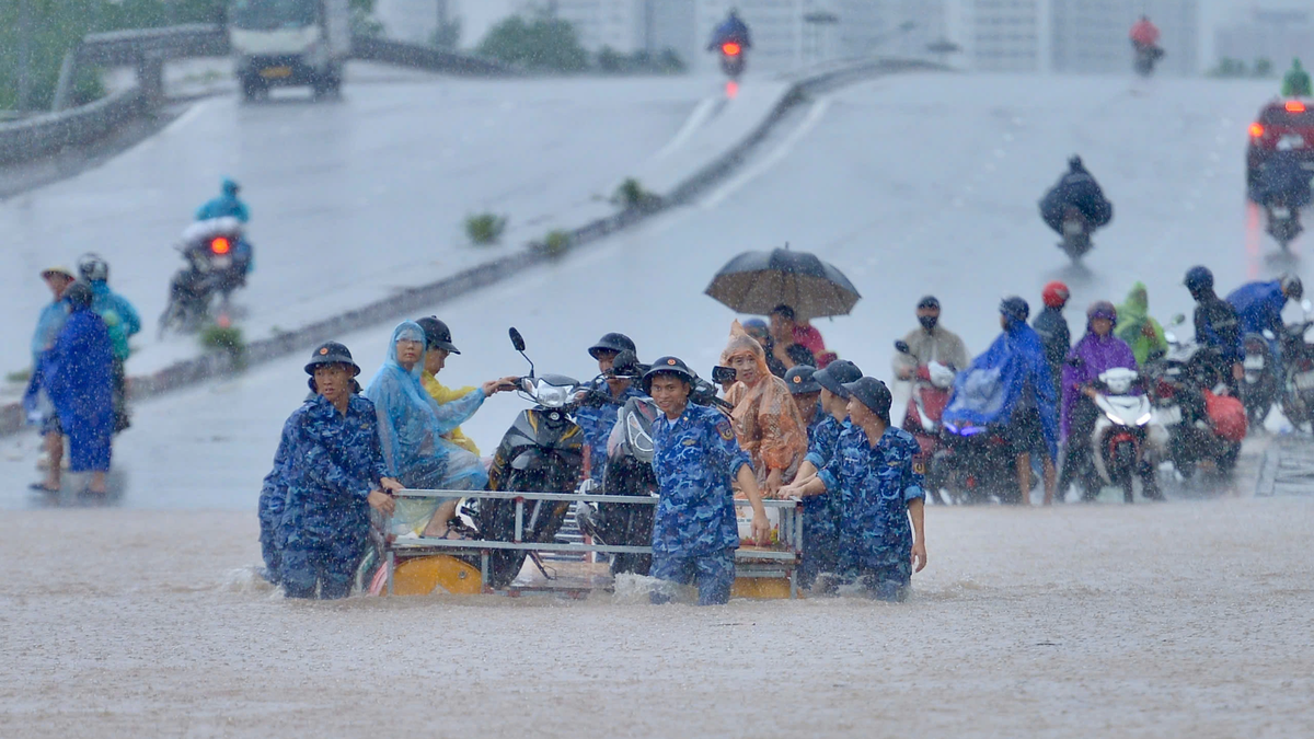
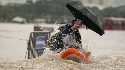
Although the tide was not high, the floodwater from upstream caused the water level of the rivers in the eastern part of the city to rise to an average of 3.55m - 3.75m, causing flooding on some roads. Some roads were flooded 45 - 55cm deep, such as Tran Tat Van section (Provincial Road 354) in Phu Lien Ward (from Kien An Hospital gate - Nguyen Ang bridge).
It is forecasted that it will continue to rain, possibly causing flooding and affecting traffic on some other streets. Specifically as follows:
| Ward/commune | Points/streets at risk of flooding |
| Hai Duong | Do Luong, Nguyen Van To |
| Thanh Dong | North Ngo Quyen area, Han bridge, Quan Thanh, Hoang Dieu, Tran Canh, Phan Dinh Phung, Dinh Dam. |
| Le Thanh Nghi | Tuy Hoa, Ngan Son, Pham Ngu Lao, Ba Trieu, East Ngo Quyen area, Dang Quoc Chinh, Mac Dinh Chi, Nguyen Luong Bang - Vu Huu to Ngo Quyen intersection, Nguyen Thi Due, Duc Minh from Nguyen Van Linh to lane 113, Vu Huu from Nguyen Van Linh to Nguyen Luong Bang |
| Tan Hung | East Nam Cuong area (Vu Thanh, Nguyen Van Ngoc, Nguyen Tuan Trinh, Do Nhuan...) |
| Kien An | Tran Tat Van, Phan Dang Luu, Tran Nhan Tong, Tran Thanh Ngo |
| Hong Bang | Tran Hung Dao, Cau Binh, Hung Vuong, Nguyen Tri Phuong |
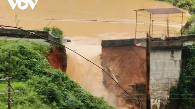
Soil moisture model shows that some areas in Hai Phong city are nearly saturated (over 80%) or have reached saturation. Some areas are at high risk of landslides. Specifically:
| Commune/ward | Residential group, village, landslide point |
| Cat Hai Special Economic Zone | Khe Au, Hien Hao, Xuan Dam, Phu Long, Hai Son, Cat Ba, Viet Hai areas |
| South Do Son | Ngoc Xuyen |
| Do Son | Van Huong, Hai Son |
| Phu Lien | Astronomy Hill |
| Lai Xuan |
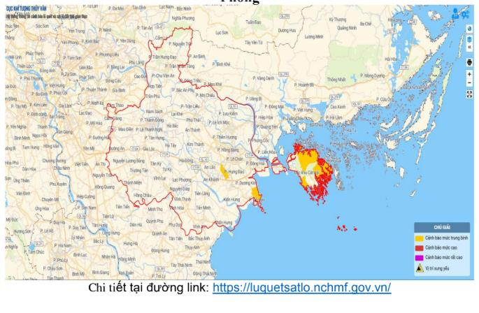
Source: https://baohaiphong.vn/canh-bao-cac-diem-co-nguy-co-ngap-lut-sat-lo-o-hai-phong-522872.html
![[Photo] Prime Minister Pham Minh Chinh chairs the 16th meeting of the National Steering Committee on combating illegal fishing.](https://vphoto.vietnam.vn/thumb/1200x675/vietnam/resource/IMAGE/2025/10/07/1759848378556_dsc-9253-jpg.webp)


![[Photo] Super harvest moon shines brightly on Mid-Autumn Festival night around the world](https://vphoto.vietnam.vn/thumb/1200x675/vietnam/resource/IMAGE/2025/10/07/1759816565798_1759814567021-jpg.webp)


Comment (0)