
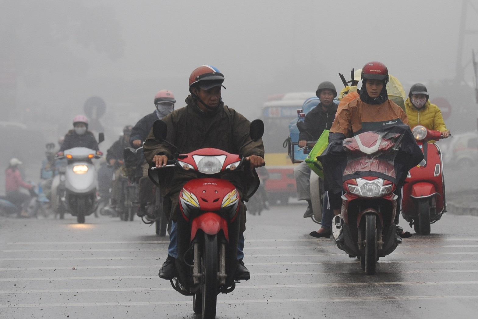
The weather in Ho Chi Minh City in November begins to be affected by cold air waves that intensify and diffuse southward. It is forecasted that by the end of the month, the rainy season in the South will end and the dry season will begin.
The Southern Hydrometeorological Station has just announced the general weather trend. Accordingly, in the latest forecasts on ENSO trends in the NINO 3-4 region of the world's Climate Centers, the probability of the neutral state transitioning to La Nina is lower and later than previous forecasts. Even the IRI forecast, in the forecast session on October 18, showed that the neutral phase will continue to last from October to December 2024 with a probability of 53%.
Regarding the weather in the Ho Chi Minh City area, according to the Meteorological Station, in November, rain tends to decrease a lot compared to October, but there are still days with rain mixed with no rain.
Specifically, in the first week (November 1-10) , cold air continues to strengthen in the North and Central regions on November 1-2; a stronger strengthening period will occur around November 5-6 and then continuously be supplemented until the weekend.

The low pressure trough passes through the Southern region, with an axis at about 7-10 degrees North latitude; the first half of the week connects with low pressure areas in the central or southern East Sea; from the middle to the end of the week, it tends to weaken and be compressed to the south and weaken.
Regional weather on November 1-2: The area is affected by two weather systems: cold air strengthening and diffusing to the south and a low pressure trough with an axis at about 8-12 degrees North latitude. Therefore, the weather will be rainy over a wide area with the possibility of rain in the early morning of November 2.
November 3-4: The cold front has not weakened yet, but the conflict between the two systems is less intense. Rain has decreased, only scattered in some places; the days are more sunny and the temperature has increased slightly.
November 5-7: Cold air will intensify and diffuse more strongly to the south, accompanied by disturbances in the easterly wind zone causing rain in the area; there is a possibility of rain in the early morning but only light rain, some places will have moderate rain.
November 8-10: This is the period when cold air diffuses deep to the south, greatly affecting the weather in the region, so the rain decreases, mostly just insignificant light rain.
Cold air strengthens and diffuses strongly to the south.
During the week of mid-November (November 11-20) , there is a possibility of 2-3 cold air intensifications, some lasting 4-5 days. Accompanying these intensifications are disturbances in the easterly wind zone that are likely to cause showers and thunderstorms in the area for about 1-2 days.
The weather in the area has reduced rain compared to the first week of the month, with only scattered rains with small amounts of rain lasting for 1-2 days and then returning to dry weather in the entire area. The northeast monsoon is quite stable with increasing intensity. In some places, it is likely that the rainy season will end in the middle of November or from the last few days of the first week of November.
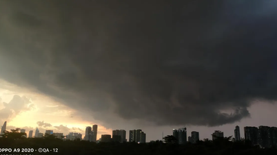
Widespread rain before the dry season
Last week (November 21-30) : There will be about 2-3 waves of strengthening to the south and spreading to the cold air area. The low pressure trough is active and tends to lift its axis slightly to the north with the possibility of low pressure areas appearing in the southern East Sea and affecting the weather in coastal areas and mainland of the South.
The subsequent strengthening of the cold front will also cause the interaction between the two systems and potentially cause widespread rain in the region. This rain, in some places, may be unseasonal rain because the rainy season has ended earlier, but in some places it will likely be the last rainy days of the rainy season in 2024.
The weather in the area is rainier than the middle of the month with the possibility of scattered rain lasting for about 2-3 days with scattered thunderstorms; some places are likely to have moderate to heavy rain. Beware of tornadoes, lightning, and gusts of wind during thunderstorms.
After this widespread rain that lasts for several days, it is likely that most of the Southern region will end the rainy season and begin to enter the dry season. However, it is not impossible that there are still a few places where, although the rain has decreased a lot, the rainy season will continue until early next month.
In general, November temperatures are generally higher than the average, but not much, including average, highest and lowest temperatures. Average temperatures range from 27-28 degrees; highest from 31-33 degrees; lowest from 23-26 degrees.
Total monthly rainfall is generally approximately equal to or higher than the average for the same period, in which the first week is 5-10% higher; the middle week is approximately equal to and the last week is 5-15% higher.
Many bad weather combinations appear one after another, the North is about to welcome the first cold spell

Weather forecast for the next 10 days: The North welcomes strong cold air, turning to cold rain
Source: https://vietnamnet.vn/khong-khi-lanh-khuech-tan-thoi-tiet-tphcm-nhieu-bat-ngo-trong-thang-11-2337596.html
![[Photo] Prime Minister Pham Minh Chinh chairs the Government's online conference with localities](https://vphoto.vietnam.vn/thumb/1200x675/vietnam/resource/IMAGE/2025/10/5/264793cfb4404c63a701d235ff43e1bd)


![[Photo] Prime Minister Pham Minh Chinh launched a peak emulation campaign to achieve achievements in celebration of the 14th National Party Congress](https://vphoto.vietnam.vn/thumb/1200x675/vietnam/resource/IMAGE/2025/10/5/8869ec5cdbc740f58fbf2ae73f065076)


![[VIDEO] Summary of Petrovietnam's 50th Anniversary Ceremony](https://vphoto.vietnam.vn/thumb/402x226/vietnam/resource/IMAGE/2025/10/4/abe133bdb8114793a16d4fe3e5bd0f12)

![[VIDEO] GENERAL SECRETARY TO LAM AWARDS PETROVIETNAM 8 GOLDEN WORDS: "PIONEER - EXCELLENT - SUSTAINABLE - GLOBAL"](https://vphoto.vietnam.vn/thumb/402x226/vietnam/resource/IMAGE/2025/7/23/c2fdb48863e846cfa9fb8e6ea9cf44e7)


Comment (0)