
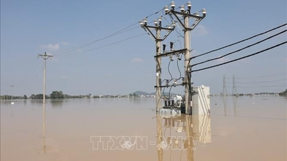
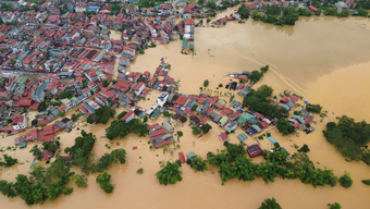
Specifically, up to now, the whole province has 17 locations with water depths of 0.3 - 0.5m on National Highway 31 passing through the communes of Phuong Son, Luc Ngan, Bien Dong, Yen Dinh, Son Dong, Van Son; National Highway 37 passing through the communes of Cam Ly, Bac Lung, Viet Yen, Tu Lan; National Highway 17 passing through the communes of Xuan Luong, Tam Tien, Yen The.
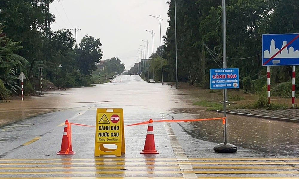 |
Flooded provincial road 298. |
Water is still flooding provincial roads: 242, 248, 289, 290, 291, 292C, 293, 294, 295, 296, 298, 398, 292 passing through communes and wards such as: Dong Ky, Xuan Luong, Yen The, Bo Ha, Phuc Hoa, Tien Luc, Tan Yen, Ngoc Thien, Viet Yen, Tu Lan, My Thai, Phuong Son, Chu, Yen Dinh, Son Dong... with a total length of 1,490m.
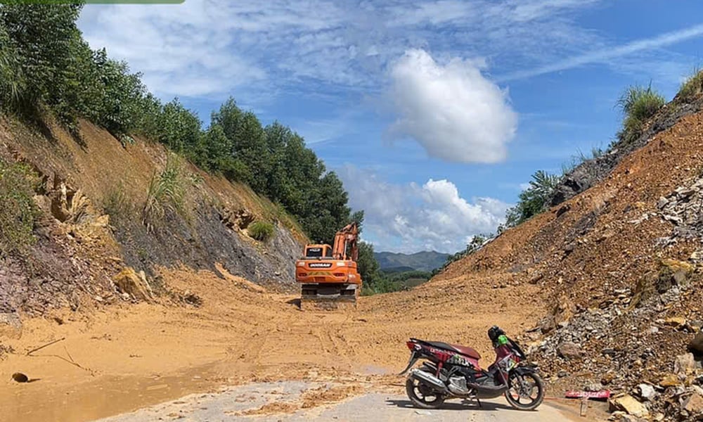 |
The Department of Construction directed functional units to clean up soil and mud spilled onto road 294B. |
In addition to flooding, prolonged heavy rains also caused landslides on Highway 31, with soil, rocks, and mud spilling onto the road surface, cutting off some locations at Km67-Km69 passing through Yen Dinh commune and the section from Km71+00 to Km71+500 passing through Son Dong commune. At the same time, there were 73 locations where rocks were pushed onto the road surface and filled longitudinal ditches with a total length of more than 1.4 km; the road surface structure was damaged at 7 locations.
On National Highway 31, there were also landslides at 26 locations with a length of 366 m; broken roadbed and surface disrupted traffic at Km96+800 passing through Van Son commune with a length of about 30 m and a slope slide of about 50 m.
National Highway 37 had a landslide at Km43+600, Km44+620 passing through Bao Dai commune with a volume of about 600m. National Highway 279 passing through Duong Huu, An Lac, Bien Son, Tan Son communes had a landslide at 26 locations, with rocks and soil spilling onto the road surface, filling the longitudinal ditch with a total length of about 421m; and a landslide at 3 locations. On Highway 248, there were landslides at 144 locations, and landslides at 9 locations.
Faced with the above situation, to ensure traffic safety, for areas with deep flooding and traffic disruption, the Department of Construction has directed units to arrange forces to guard and direct traffic on the route.
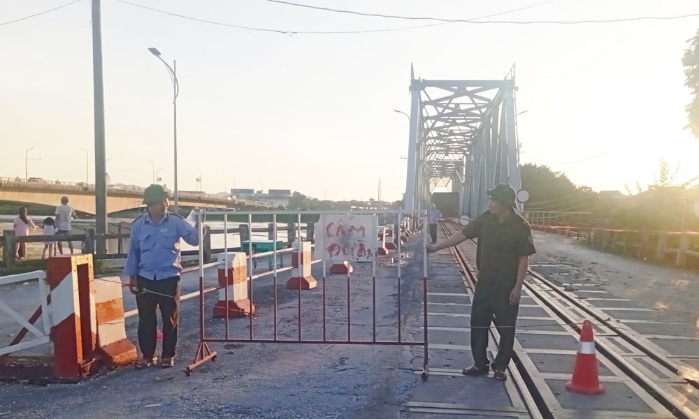 |
Railway bridge is prohibited in Bac Giang ward and Da Mai ward. |
For landslides on the positive slope, filled in the longitudinal ditch, and spilled soil and rocks onto the road surface, the Department requires Bac Giang Road Joint Stock Company to mobilize means and equipment to clean up. For damaged roadbeds, road surfaces, landslides on the negative slope, and damage to auxiliary works, Bac Giang Road Joint Stock Company will fence and put up warning signs.
As for Highway 31, which has suffered landslides at 26 locations, the Department of Construction has directed the opening of bypass roads to temporarily open the road. Up to now, the Department's functional units have built temporary roads on the left side of the route, ensuring temporary traffic during the repair and troubleshooting process.
The Department of Construction recommends that at this time, the water is deep, so people should not go through the roads with warning signs, especially Provincial Road 298 at Km6+100; Km5+440-Km5+979; Provincial Road 294B at Km3+500; Provincial Road 292 at Km12+800, Km14+180; Provincial Road 294 at Km0+200...
According to regulations, due to the rising water level on the Thuong River, to protect the dike, from 8:00 a.m. on October 8, the People's Committee of Bac Giang Ward banned all vehicles, including cars with 5 seats or more, and trucks from circulating on the dike routes.
From 9:30 this morning, authorities announced a ban on all vehicles traveling on the railway bridge in Bac Giang ward and Da Mai ward.
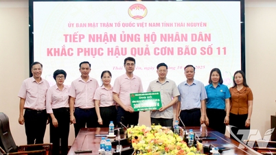
Source: https://baobacninhtv.vn/nhieu-tuyen-duong-giao-thong-bi-ngap-ung-hu-hong-ket-cau-ha-tang-postid428387.bbg
![[Photo] Opening of the World Cultural Festival in Hanoi](https://vphoto.vietnam.vn/thumb/1200x675/vietnam/resource/IMAGE/2025/10/10/1760113426728_ndo_br_lehoi-khaimac-jpg.webp)


![[Photo] Unique Phu Gia horse hat weaving craft](https://vphoto.vietnam.vn/thumb/1200x675/vietnam/resource/IMAGE/2025/10/10/1760084018320_ndo_br_01-jpg.webp)

![[Photo] Ho Chi Minh City is brilliant with flags and flowers on the eve of the 1st Party Congress, term 2025-2030](https://vphoto.vietnam.vn/thumb/1200x675/vietnam/resource/IMAGE/2025/10/10/1760102923219_ndo_br_thiet-ke-chua-co-ten-43-png.webp)


Comment (0)