
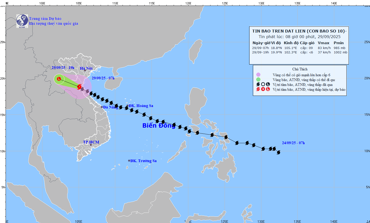
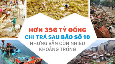
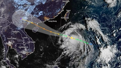
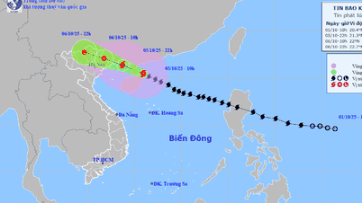
This morning (September 29), Mr. Mai Van Khiem, Director of the National Center for Hydro-Meteorological Forecasting, said that storm No. 10 Bualoi has weakened, currently only level 9 (75-88km/h), gusting to level 11. At 8:00 a.m., the center of the storm was on land in the Southwest region of Nghe An .
It is forecasted that at around 10am the same day, the storm will continue to weaken into a tropical depression, then move further inland and gradually dissipate into a low pressure area.
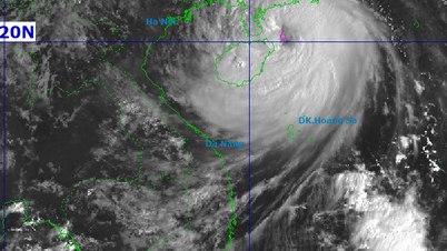
Storm No. 10 gradually weakened on the morning of September 29. Source: NCHMF
“However, although the storm's intensity has decreased, the circulation of storm No. 10 still causes serious impacts over a wide area,” Mr. Khiem emphasized.
Specifically, today, Nghe An, Thanh Hoa, Ha Tinh continue to have heavy to very heavy rain. The heavy rain area also spreads to the Northern Delta and midland areas, with common rainfall from 150-250mm, in some places it can reach up to 350mm.
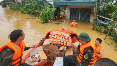
Due to prolonged heavy rain, many river systems in the North Central and Northern regions are experiencing high floods, generally at alert levels 2-3, with some rivers above alert level 3.
In particular, Mr. Khiem informed that in Quang Tri , the flood on Kien Giang River last night exceeded alert level 3 and is currently showing a decreasing trend, but flooding in riverside areas continues.
In Ha Tinh, water levels on the Ngan Sau and Ngan Pho rivers are rising rapidly, forecast to exceed alert level 3 this morning, causing the risk of widespread flooding today and the following days.
In addition, with heavy rainfall of up to several hundred mm today and tomorrow (September 30), the risk of flash floods and landslides is very high, especially in the mountainous areas of the West of the North Central provinces, as well as the midlands and mountainous areas of the North.
Warning of heavy rain, floods, landslides
According to the National Center for Hydro-Meteorological Forecasting, in the coming hours, storm No. 10 will continue to move west-northwest, 20-25km/h, moving deep inland, gradually weakening into a tropical depression, then a low pressure area. By 7pm tonight, the low pressure area will be in the Upper Laos region.
Due to the impact of the storm, the sea area from Thanh Hoa to Northern Quang Tri (including Hon Ngu island, Con Dao special zone)
Grass) has strong winds of level 6-7, near the storm center level 8-9, gusts of level 12, waves 3-5m high, very rough seas.
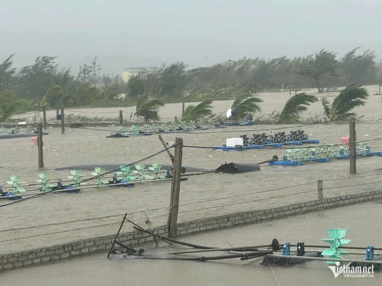
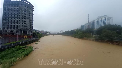
An Chau coastal commune, Nghe An province was heavily flooded on the morning of September 29. Photo: Thanh Hai
The Northern Gulf of Tonkin area (including Bach Long Vi, Van Don, Co To, Cat Hai and Hon Dau islands) has strong winds of level 6-7, gusts of level 8-9, waves 2-4m high, and rough seas.
Coastal areas and islands of provinces from Quang Ninh to Nghe An have storm surges of 0.5-1m high. Warning of high risk of flooding in low-lying areas, coastal roads, and riverside areas due to storm surges combined with high tides and big waves this morning and afternoon.
At the same time, on land in the area from Quang Ninh to Ha Tinh, there are strong winds of level 6-7, gusting to level 8-9, in some places level 8, gusting to level 10; near the storm's eye, level 8-9, gusting to level 12.
Notably, from today to tomorrow, the Northern Delta region, Phu Tho, the southern provinces of Son La, Lao Cai and the provinces from Thanh Hoa to Ha Tinh will have heavy to very heavy rain with total rainfall ranging from 100-200mm, locally over 350mm. Warning of the risk of heavy rain (>200mm/3 hours).
Other places in the North have moderate rain, heavy rain, and in some places very heavy rain with total rainfall ranging from 70-120mm, locally over 200mm.
Authorities recommend that people closely monitor weather conditions, proactively prevent floods, inundation and landslides, and ensure safety of life and property.
Vietnamnet.vn
Source: https://vietnamnet.vn/bao-so-10-bualoi-tan-dan-mien-bac-den-ha-tinh-doi-mat-mua-lu-khac-nghiet-2447056.html


![[Photo] Prime Minister Pham Minh Chinh launched a peak emulation campaign to achieve achievements in celebration of the 14th National Party Congress](https://vphoto.vietnam.vn/thumb/1200x675/vietnam/resource/IMAGE/2025/10/5/8869ec5cdbc740f58fbf2ae73f065076)


![[Photo] Bustling Mid-Autumn Festival at the Museum of Ethnology](https://vphoto.vietnam.vn/thumb/1200x675/vietnam/resource/IMAGE/2025/10/4/da8d5927734d4ca58e3eced14bc435a3)


![[VIDEO] Summary of Petrovietnam's 50th Anniversary Ceremony](https://vphoto.vietnam.vn/thumb/402x226/vietnam/resource/IMAGE/2025/10/4/abe133bdb8114793a16d4fe3e5bd0f12)

![[VIDEO] GENERAL SECRETARY TO LAM AWARDS PETROVIETNAM 8 GOLDEN WORDS: "PIONEER - EXCELLENT - SUSTAINABLE - GLOBAL"](https://vphoto.vietnam.vn/thumb/402x226/vietnam/resource/IMAGE/2025/7/23/c2fdb48863e846cfa9fb8e6ea9cf44e7)


Comment (0)