
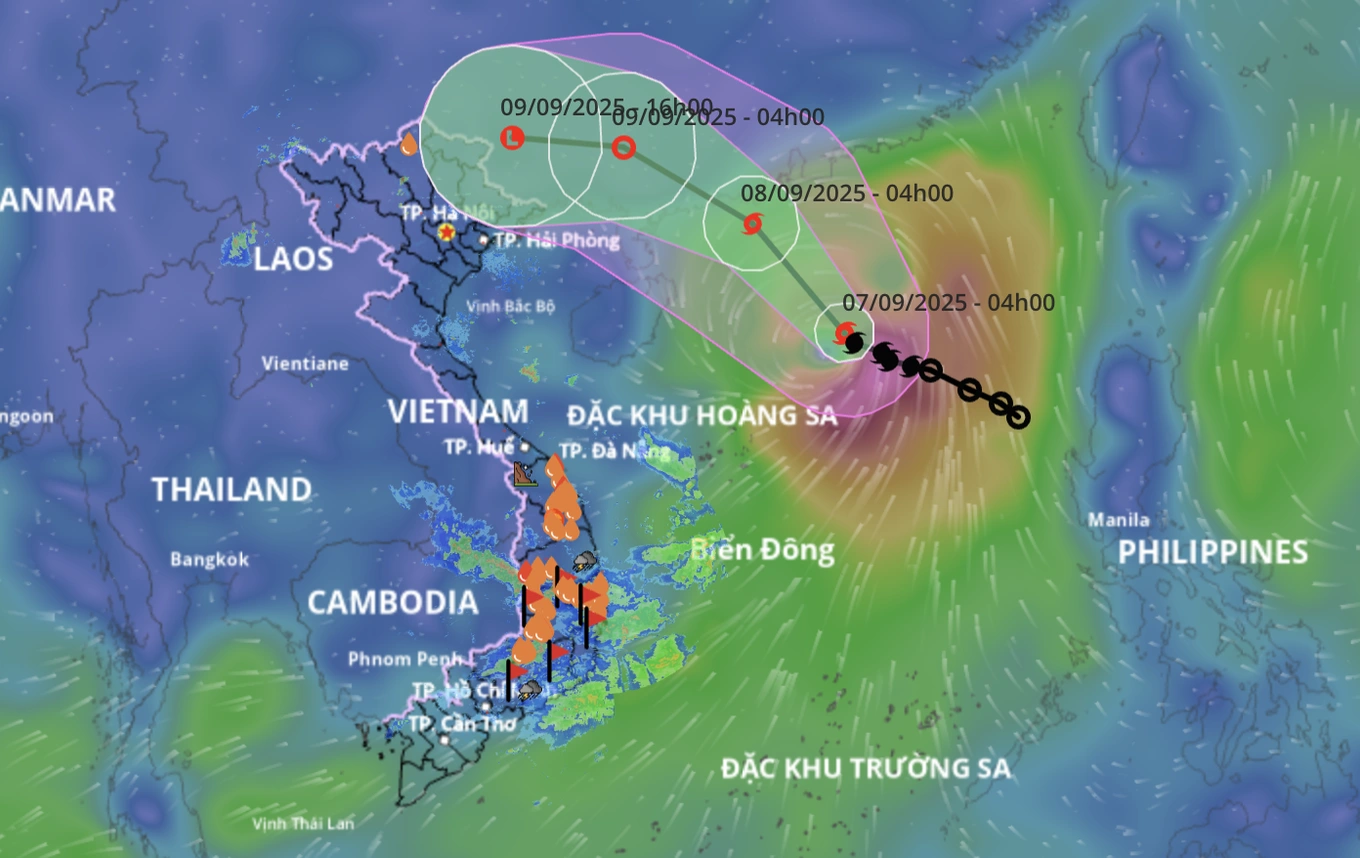
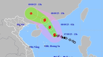
On the morning of September 7, the National Center for Hydro-Meteorological Forecasting said that the center of storm Tapah (storm No. 7) is active in the northern waters of the East Sea with the strongest wind near the center of the storm at level 8-9 (62-88km/h), gusting to level 11. The storm is moving in the West-Northwest direction at a speed of 10km/h.
It is forecasted that at around 4am on September 8, the storm will strengthen to level 10, gusting to level 13 in the sea south of Guangdong province, China.
At 4:00 a.m. on September 9, the storm weakened to level 6-7, gusting to level 9 on the mainland of Guangdong province, China, and continued to weaken into a tropical depression.

Storm No. 7 makes landfall in China but will cause widespread heavy rain in the North, focusing on the Northeast (Photo: NCHMF).
Due to the storm's influence, the North East Sea area has strong winds of level 7-8, near the storm's eye level 9-10, gusts of level 13, waves 3-5m high, very rough seas.
Vessels in danger zones are susceptible to storms, whirlwinds, strong winds and large waves.
The hydrometeorological agency said that after making landfall in China, storm No. 7 will quickly weaken into a low pressure area, then drift westward, towards our country.
According to forecasts, from the afternoon and night of September 9 to September 11, the post-storm circulation No. 7 will cause widespread heavy rain in the North, focusing on the midland and mountainous areas of the Northeast.
Source: https://dantri.com.vn/xa-hoi/bao-tapah-co-the-manh-len-cap-10-bac-bo-sap-mua-lon-dien-rong-20250907064553419.htm


Comment (0)