
On October 5, there were 10 earthquakes in this area. Thus, in just two days, October 5-6, there were 21 earthquakes in this area.
Triggered earthquakes rarely cause serious damage.
Explaining the cause of the consecutive occurrence of earthquakes, Dr. Nguyen Xuan Anh, Director of the Earthquake Information and Tsunami Warning Center (Institute of Earth Sciences ), said that these are stimulated earthquakes, usually of weak or medium intensity, and rarely cause serious damage like natural tectonic earthquakes.
According to scientists and geologists, induced earthquakes are a type of earthquake that occurs due to human activities, not due to natural tectonic processes. The most common cause of induced earthquakes is the process of water storage in large hydroelectric reservoirs. When a huge amount of water is stored in the reservoir of a hydroelectric dam, this volume of water creates a huge pressure on the soil and rock layers below. Water can seep into the fault zones in the ground, changing the state of stress, increasing pore pressure and reducing the shear strength of the rock. This can activate existing but "dormant" geological faults, causing earthquakes.
In addition, large-scale mining can also change the geological structure, causing subsidence and triggering earthquakes due to the process of injecting liquid into the ground. Large underground explosions for underground nuclear testing are also the cause of stimulated earthquakes.
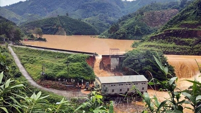
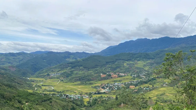
Scientists say that induced earthquakes are usually weak or medium in intensity, rarely causing serious damage like natural tectonic earthquakes; there may be a pre-seismic period, meaning that many small earthquakes occur continuously before the main earthquake. Seismic activity can last for a certain period of time (from several months to several years) after the induced activity occurs, then gradually decrease. In Vietnam, induced earthquakes are often recorded in areas with large hydroelectric reservoirs such as Song Tranh 2 (formerly Quang Nam ) or Kon Plong (formerly Kon Tum).
Dr. Nguyen Xuan Anh explained that the two localities of Da Nang (formerly Quang Nam area) and Quang Ngai (formerly Kon Tum area) frequently experience earthquakes mainly due to a combination of natural geological factors and earthquakes stimulated by human activities. Specifically, these two areas are located on active or potentially active geological faults. However, the most important factor causing the recent high frequency of earthquakes is the operation of large hydroelectric reservoirs.
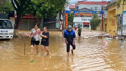
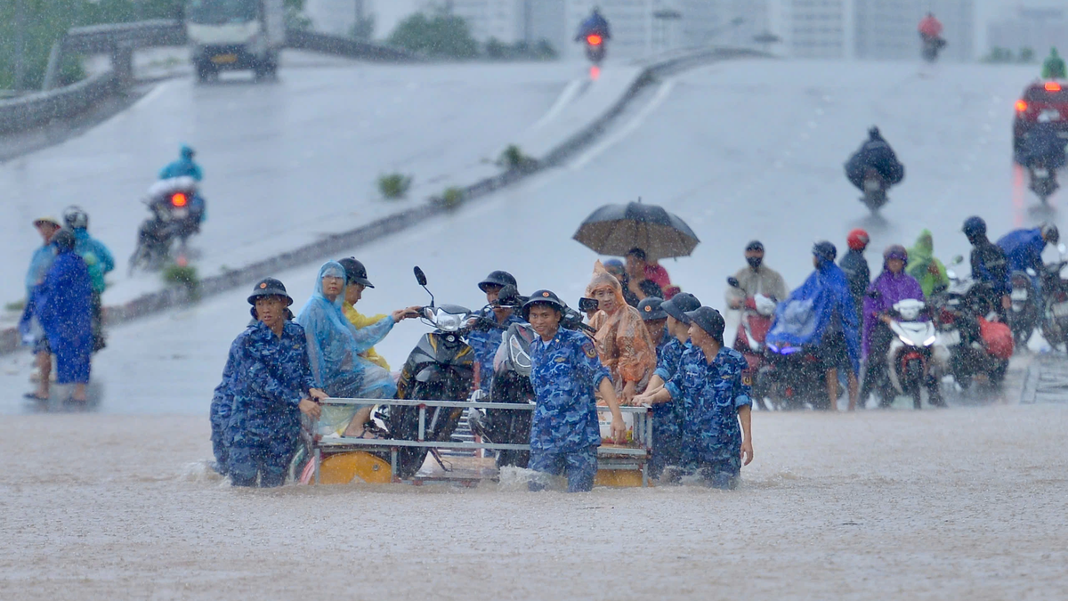
In the Song Tranh 2 Hydropower Plant area, the huge volume of water in the reservoir has created pressure on the faults, changing the stress and triggering earthquakes. Similarly, in the old Kon Tum area, hydropower reservoirs such as Thuong Kon Tum have also been identified as the cause of hundreds of small and medium earthquakes. These earthquakes, although usually not too large in magnitude (under 5.5), occur continuously, causing tremors and somewhat affecting people's lives. It is forecasted that stimulated seismic activity in these areas can last for many years.
Data from the Institute of Earth Sciences shows that from April 2021 to now, hundreds of earthquakes have occurred in these areas, many of which caused felt tremors. The strongest earthquake in Kon Plong occurred at noon on July 28, 2024 with a magnitude of 5.0. This is considered the strongest earthquake ever in this area, causing tremors felt in many neighboring provinces and cities such as Da Nang and Ho Chi Minh City.
Timely updates on earthquake information
Sharing about how to record information about earthquakes, Dr. Nguyen Xuan Anh said that when there is an unusual vibration in the ground, it will generate seismic waves that spread underground. Vietnam's monitoring stations stretching from North to South will record these vibrations and transmit data via the internet to the Earthquake Information and Tsunami Warning Center.
Here, on the monitor screen of the officer on duty, the wave signal will suddenly change, turning red. The officer on duty will download this wave segment, conduct a very quick analysis within about 5 minutes to get specific information about the earthquake such as date, time, location, magnitude and risk level. This information will be immediately transferred to the Center's leadership and then the earthquake bulletin will be broadcast in the following order: Earthquakes with a magnitude of 3.5 or higher will be reported first to the national agencies with the function of transmitting information and responding the fastest; the remaining earthquakes will be announced immediately on the center's website.
Dr. Nguyen Xuan Anh said: Earthquake data is not only recorded in Vietnam but also recorded in the region and internationally. For earthquakes occurring abroad, the recording is also done similarly. The whole country currently has 40 national earthquake monitoring stations operating stably and smoothly. The distance between stations fluctuates from 200-300 km, capable of measuring earthquakes of magnitude 3.5 or higher.
When at least 8 Vietnamese monitoring stations record, the system will automatically process the information and provide the earthquake magnitude for quick warning. The processing staff will then assess the earthquake magnitude more accurately.
According to Decision 18/2021/QD-TTG regulating the forecasting, warning, transmission of natural disasters and disaster risk levels of the Prime Minister, level 1 natural disaster risk for earthquakes is determined when the observed ground vibration intensity is from level V to level VI, occurring in any area within the territory of Vietnam. The level of damage, causing small impacts with limited damage to people and property, can be easily controlled.
Source: https://baotintuc.vn/thoi-su/dong-datoquang-ngaila-dong-dat-kich-thich-it-nguy-hiem-20251006104941673.htm
![[Photo] Super harvest moon shines brightly on Mid-Autumn Festival night around the world](https://vphoto.vietnam.vn/thumb/1200x675/vietnam/resource/IMAGE/2025/10/07/1759816565798_1759814567021-jpg.webp)


Comment (0)