
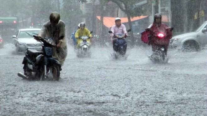
According to data sent to the National Center for Hydro-Meteorological Forecasting: Rainfall from 7:00 p.m. on October 6 to 9:00 a.m. on October 7 in some places in Thai Nguyen was over 450mm, such as Hoa Thuong station 526mm, Cay Thi station 462mm. Bac Ninh, Hanoi , Lang Son, Quang Ninh recorded rain over 200mm.
The cause of this rain is the influence of the weakened low pressure circulation from storm No. 11, combined with the southeast wind zone of the subtropical high pressure tongue encroaching strongly from the east, creating a convergence zone of meridional winds in the Northeast region, running along the above provinces.
This is also the form that caused the exceptionally heavy rain on September 30 in the North, with the focus on Hanoi, leading to widespread flooding in the capital and many northern provinces. This form of rain is characterized by very long rain duration, high intensity rain accompanied by strong thunderstorms.
The convergence of the meridional winds is showing signs of weakening, so this afternoon, the North will still have moderate to heavy rain with rainfall in Tuyen Quang, Thai Nguyen , and Hanoi around 30-60mm, some places over 100mm, other places rain from 20-30mm. From the evening of October 7, the rain will decrease, but by the early morning of October 8, the Northeast region may have rain and moderate rain again.
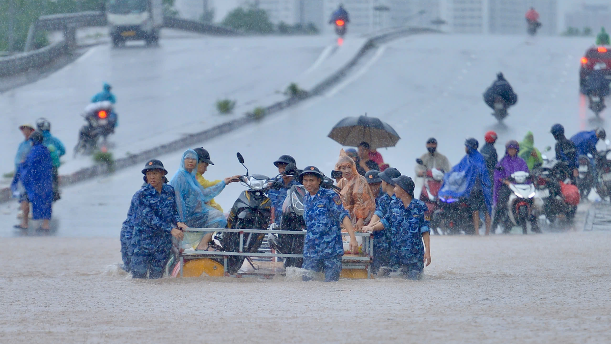
Due to the impact of heavy rain from today (October 7) to October 10, floods on rivers in the Northern region and Thanh Hoa continue to rise. In addition, there is a very high risk of landslides on river banks, river dykes, flash floods on rivers and streams and landslides on steep slopes in the mountainous areas of the Northern region and Thanh Hoa.
Source: https://quangngaitv.vn/hinh-thai-thoi-tiet-gay-mua-dac-biet-nguy-hiem-o-mien-bac-6508334.html


![[Photo] Prime Minister Pham Minh Chinh chairs the 16th meeting of the National Steering Committee on combating illegal fishing.](https://vphoto.vietnam.vn/thumb/1200x675/vietnam/resource/IMAGE/2025/10/07/1759848378556_dsc-9253-jpg.webp)


![[Photo] Super harvest moon shines brightly on Mid-Autumn Festival night around the world](https://vphoto.vietnam.vn/thumb/1200x675/vietnam/resource/IMAGE/2025/10/07/1759816565798_1759814567021-jpg.webp)


Comment (0)