
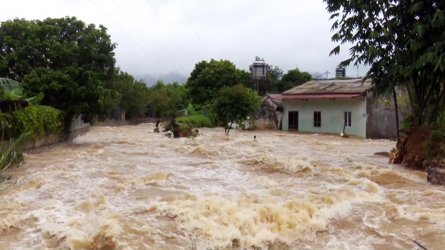
According to the National Center for Hydro-Meteorological Forecasting, the flood on Cau River (Thai Nguyen) at Gia Bay station, Trung River (Lang Son) at Huu Lung station is receding. The flood on Cau River, Thuong River ( Bac Ninh ) is rising; only the flood on Thuong River at Cau Son station is fluctuating at its peak.
It is forecasted that in the next 12 hours, floods on Cau River and Thuong River are likely to peak, the flood peak at Dap Cau station is about 1.1m above alert level 3, the flood peak at Phu Lang Thuong station is about 0.18m above the historical flood in 1986; floods on Trung River at Huu Lung station, Cau River at Gia Bay station, Thuong River at Cau Son station continue to decrease and are above alert level 3.
In the next 12-24 hours, floods on rivers will continue to decrease, the water level on Cau River at Gia Bay station is at alarm level 2, at Dap Cau station is about 0.5m above alarm level 3; the water level on Thuong River at Cau Son station is about 1.2m above alarm level 3, at Phu Lang Thuong station is about 0.7m above alarm level 3, flood on Trung River at Huu Lung station is about 3.0m above alarm level 3.
Widespread flooding in Thai Nguyen, Bac Ninh, and Lang Son provinces in the next 2-3 days and risk of flooding in low-lying areas along rivers and urban areas in the Northern region; risk of landslides on river banks and river dykes, risk of flash floods on rivers and streams, and landslides on slopes in mountainous areas of the Northern region.
The National Center for Hydro-Meteorological Forecasting warned of flood disaster risk at level 3 and warned that river floods could inundate low-lying areas along the river, affecting activities such as waterway transport, aquaculture, agricultural production, people's lives and socio- economic activities.
Source: https://baolaocai.vn/lu-tren-song-cau-song-thuong-co-kha-nang-dat-dinh-vao-hom-nay-post884054.html
![[Photo] Prime Minister Pham Minh Chinh attends the World Congress of the International Federation of Freight Forwarders and Transport Associations - FIATA](https://vphoto.vietnam.vn/thumb/1200x675/vietnam/resource/IMAGE/2025/10/08/1759936077106_dsc-0434-jpg.webp)


![[Photo] Prime Minister Pham Minh Chinh inspects and directs the work of overcoming the consequences of floods after the storm in Thai Nguyen](https://vphoto.vietnam.vn/thumb/1200x675/vietnam/resource/IMAGE/2025/10/08/1759930075451_dsc-9441-jpg.webp)


Comment (0)