
With a length of about 586km, Dong Nai River is the longest inland river in Vietnam. In Dong Nai alone, Dong Nai River flows through the province with a length of about 200km.
Exploiting the advantages of river landscape
According to Provincial Party Committee member and Vice Chairman of the Provincial People's Committee Ho Van Ha, for Dong Nai province, Dong Nai river plays a very important role in the socio -economic development of the province. In particular, the area along Dong Nai river still has a lot of potential, if exploited in the right direction, it will contribute greatly to the development of the province.
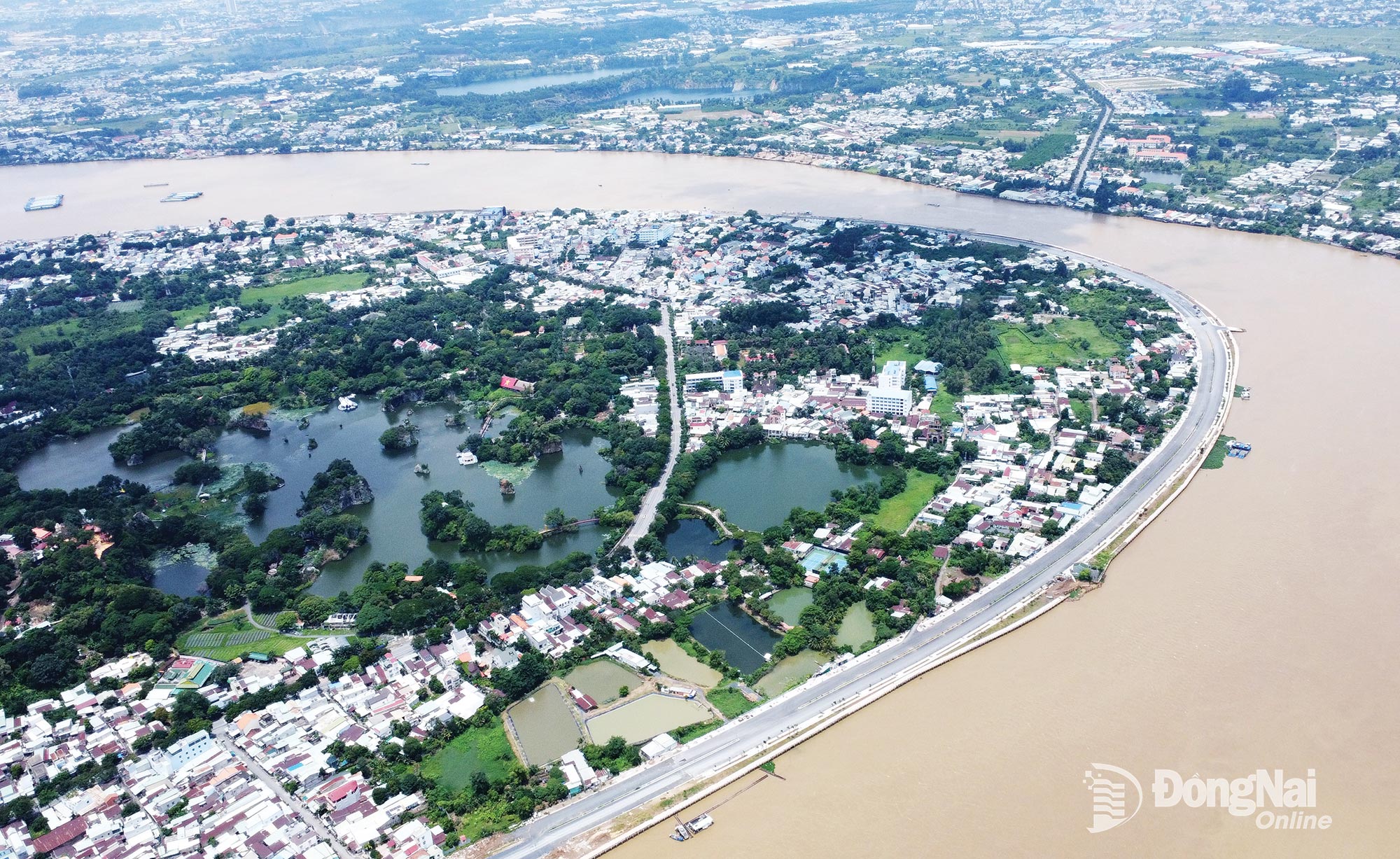 |
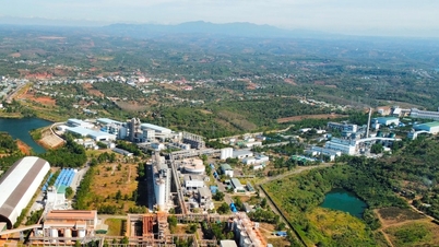
| The Dong Nai riverside road through Tran Bien ward, Dong Nai province, was invested in and built to exploit the development potential of the riverside area. Photo: Pham Tung |
Dong Nai River is the most important development corridor of the province, because it belongs to the international maritime axis (group 5), gathering many inland waterways and channels deep into the mainland. On the other hand, throughout the river route from North to South, Dong Nai River is the axis of urban, rural and natural landscape, the main feature of the province's spatial layout, and at the same time the dynamic axis of urban development of the Southeast region.
Dong Nai River is also an important natural axis for water supply, climate regulation, energy development and climate change prevention. For Dong Nai province, Dong Nai River is also a spiritual and historical cultural axis closely linked to the formation and development of the province.
With its position and potential, the Dong Nai riverside corridor has been identified as one of the two driving forces for development in Dong Nai province in the coming time.
Currently, Dong Nai is implementing adjustments to the Provincial Planning for the period 2021-2030, with a vision to 2050. In particular, the Dong Nai riverside economic corridor is oriented to become one of the three strategic economic corridors of the province with the goal of exploiting the advantages of river landscape to develop ecological urban areas, resort tourism and high-class services.
Riverside economy will be the future of Dong Nai
According to Dr. of Science, Architect Ngo Viet Nam Son, Chairman of NgoViet Architects & Planners (based in Ho Chi Minh City), the Dong Nai riverside area has great potential to develop a chain of riverside urban areas. This riverside urban chain can be combined with the orientation of developing more urban chains along Tri An lake. With the great potential of the Dong Nai riverside area, Mr. Son believes that: The future of Dong Nai will be a riverside economy.
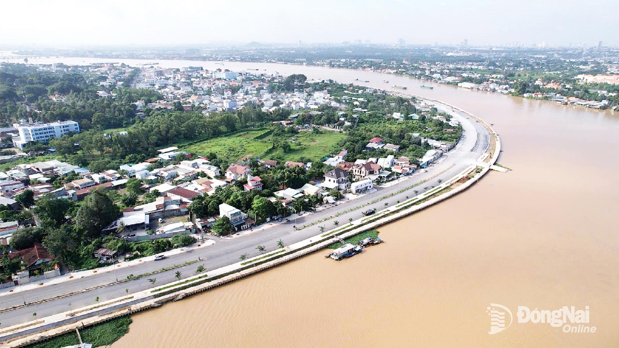 |
| The Dong Nai riverside road through Tran Bien ward is being invested in and built to exploit the development potential of the riverside area. Photo: Dang Tung |
Also according to Mr. Ngo Viet Nam Son, in the new context, economic development along the Dong Nai river needs to be closely linked with urban development according to the TOD (Transit-Oriented Development) model, an urban development model focused around public transport hubs.
Mr. Son said: The development of the TOD urban model has been implemented by Ho Chi Minh City with the motivation of the Central Government's resolutions to apply some specific mechanisms. "I hope that, with Dong Nai, the province will also have recommendations to the Central Government to be able to apply these mechanisms to develop the TOD urban model in the direction of economic development along the river" - Mr. Ngo Viet Nam Son shared.
According to the Provincial People's Committee, currently, in the process of implementing the Dong Nai Provincial Planning Adjustment Project for the period 2021-2030, 3 strategic economic corridors of the province will be shaped for development, including: Urban - industrial economic corridor along National Highways 13, 14, Ring Road 4 - Ho Chi Minh City and expressways, connecting major industrial centers of the province; high-tech agricultural economic corridor and eco-tourism, developed in the northern region of the province, associated with specialized agricultural areas and national parks; Dong Nai riverside economic corridor to exploit the advantages of river landscape to develop ecological urban areas, resort tourism and high-class services.
For Dong Nai province, to realize the economic development strategy along the river, in recent times, the province has implemented projects, especially vertical transport infrastructure projects to create favorable conditions to attract investment for projects in this corridor such as: Dong Nai riverside road, inter-port road.
Along with that, the province is also launching a series of projects to build road bridges across the Dong Nai River connecting with Ho Chi Minh City such as Cat Lai Bridge, Long Hung Bridge...
From the "launching pad" of connecting traffic infrastructure, many urban development projects along the Dong Nai River in the province are also being invested and constructed.
Source: https://baodongnai.com.vn/kinh-te/202510/phat-trien-kinh-te-ven-song-dong-nai-bc3115a/


![[Photo] Discover unique experiences at the first World Cultural Festival](https://vphoto.vietnam.vn/thumb/1200x675/vietnam/resource/IMAGE/2025/10/11/1760198064937_le-hoi-van-hoa-4199-3623-jpg.webp)


![[Photo] General Secretary attends the parade to celebrate the 80th anniversary of the founding of the Korean Workers' Party](https://vphoto.vietnam.vn/thumb/1200x675/vietnam/resource/IMAGE/2025/10/11/1760150039564_vna-potal-tong-bi-thu-du-le-duyet-binh-ky-niem-80-nam-thanh-lap-dang-lao-dong-trieu-tien-8331994-jpg.webp)


Comment (0)