
Deputy Prime Minister Tran Hong Ha signed Decision No. 2307/QD-TTg approving the Mekong River Basin Irrigation Planning for the period up to 2030, with a vision to 2050.
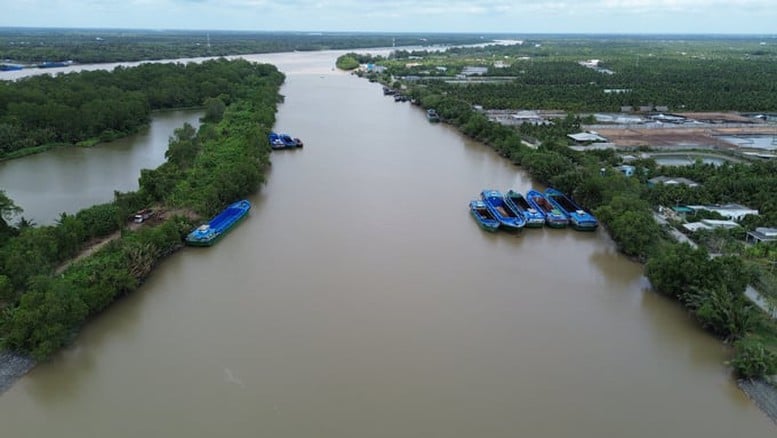 |
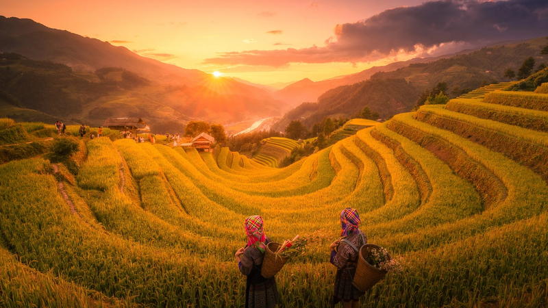
| Mekong River Basin Irrigation Planning - Illustration photo. |
According to approval, the planning scope includes the entire administrative boundaries of the provinces in the Mekong Delta region, including Can Tho city and the provinces of Vinh Long, Ca Mau, An Giang , Dong Thap and part of Tay Ninh province, with an area of about 4 million hectares (excluding islands).
Regulating water resources, adapting to upstream development and climate change
The general objective of the Planning is to proactively regulate water resources, adapt to upstream development and climate change to supply water, drain and drain water for agricultural production, create a sustainable water supply for people's lives and economic sectors; meet the requirements of flexible production model conversion; improve the capacity to proactively prevent and combat natural disasters, be ready to respond to the most adverse situations; meet the requirements of serving sustainable socio-economic development, protecting the environment; contribute to ensuring water security, maintaining national defense and security.
The plan sets out specific goals to strive for by 2030. Specifically:
Irrigation and water supply: Ensuring and creating a source of domestic water for about 17 - 18 million people; creating a source of water for industrial parks, export processing zones, and high-tech zones from irrigation systems.
Ensure proactive water supply for rural living and agricultural production in case of drought, water shortage, and saltwater intrusion equivalent to the 2015-2016 drought in the Mekong Delta. By 2030, completely solve the problem of domestic water for rural people in areas affected by drought, water shortage, and saltwater intrusion.
Upgrading, repairing, and constructing new irrigation works and completing the canal and ditch system, combined with intra-field traffic to proactively irrigate, drain, and regulate salt and fresh water for one million hectares of high-quality and low-emission rice cultivation associated with green growth in the Mekong Delta region...
Drainage: Actively drain water to main rivers, increase drainage area by motor, ensure drainage in low-lying areas to serve people's lives and agriculture with a frequency of 5% to 10%; meet drainage requirements for urban and industrial areas; actively drain 1.6 million hectares of 2-3 crop rice areas, 0.4 - 0.45 million hectares of fruit trees, 0.21 million hectares of annual crops, 0.8 million hectares of aquaculture.
Flood prevention and control: Flood prevention and control with a frequency of 1% for urban areas in the following provinces and cities: Can Tho, Ca Mau, Vinh Long, An Giang, Dong Thap, reserve water storage space of 7 - 10% of land area for flood prevention in urban areas, combined with creating environmental and ecological landscapes.
Salinity control: Actively control salinity on about 1.35 million hectares of agricultural land according to salinity control points from 1g/l to 4g/l in the region.
By 2050, ensure proactive water resources in all adverse situations.
The vision for 2050 is to proactively ensure water sources for production and people's lives in all adverse situations, minimizing damage to people's lives and production caused by drought, water shortage, and saltwater intrusion to the lowest level. Ensure synchronous and closed investment in irrigation systems from the source to the field, gradually increasing the level of ensuring water supply, drainage, and flood prevention of irrigation systems. Complete the storage, regulation, and inter-regional water source connection systems, ensuring proactive flood control, saltwater control, and limiting natural disasters caused by water. Fundamentally solve the phenomenon of flooding caused by floods, rains, and high tides for urban areas with irrigation solutions.
Implementation solutions
To achieve the above goals, the Planning proposes solutions such as: Planning zoning and salinity control points; engineering solutions; non-engineering solutions.
The planning zoning is as follows:
The area of 1.9 million hectares includes part of the Dong Thap Muoi irrigation system, Long Xuyen Quadrangle, North Vam Nao, South Vam Nao, the West Hau River region, North Vinh An, U Minh Ha, and part of the provinces and cities: Dong Thap, An Giang, Vinh Long, Tay Ninh, Can Tho, Ca Mau. The irrigation development orientation for this area is to serve the production models: fruit trees, rice, vegetables and freshwater aquaculture.
The area of 1.35 million hectares includes the irrigation systems of Nhat Tao - Tan Tru, Go Cong, North Ben Tre, South Ben Tre, South Mang Thit, Long Phu - Tiep Nhat, U Minh Thuong, a part of the Long Xuyen Quadrangle, and part of the provinces and cities: An Giang, Ca Mau, Can Tho, Vinh Long, Dong Thap, Tay Ninh. The irrigation development orientation for this area is to serve the production models: fruit trees, rice, shrimp - rice. Irrigation solutions need to be flexible to serve production conversion, suitable to water resource conditions.
The coastal area of 0.75 million hectares belongs to the provinces/cities: An Giang, Ca Mau, Can Tho, Vinh Long, Dong Thap, Tay Ninh. The development orientation of irrigation for this area focuses on serving aquaculture with the following forms: intensive farming, improved extensive farming, shrimp-forest farming.
Salinity control points on the main stream with salinity of 1g/l for domestic water supply and fruit trees: on the Vam Co Tay River at Bac Dong sluice; on the Tien River at the head of Nguyen Tan Thanh canal; on the Ham Luong River at An Hiep; on the Co Chien River at the confluence with the Mang Thit River; on the Hau River at Cai Cui canal; on the Cai Lon River at Cai Tu bridge.
on the Tien River at Xuan Hoa sluice; on the Ham Luong River at My Hoa; on the Co Chien River at Vung Liem sluice; on the Hau River at Cai Con canal; on the Vam Co Tay River at Tan An.
Focus on solutions to control border floods from Cambodia into Vietnam in the Long Xuyen Quadrangle and Dong Thap Muoi; floods on the main streams of Tien and Hau rivers; increase the ability to drain and drain floods in the fields.
Increase water supply from main rivers to areas far from rivers near the sea, areas lacking fresh water; build large culvert systems at canal heads, estuary culverts, culverts under dikes into large enclosures to proactively prevent flooding, drain and drain water; dredge canals and ditches to increase water supply, drain and drainage capacity.
Complete a closed irrigation system to actively supply, drain and drain water to serve people's lives, agricultural production, aquaculture and fruit trees.
Complete and close irrigation systems and construct salinity control works.
Saline ecological zones implement water supply, drainage and sewerage: Complete the irrigation system to proactively regulate fresh and salt water sources, control high tides; complete irrigation enclosures to protect production areas; increase water storage in canal and ditch systems; balance and regulate water sources between regions; propose solutions to supply salt water from the sea.
Continue to invest in building, consolidating and upgrading sea dykes, breakwater systems to create sedimentation, create beaches combined with planting mangrove forests to protect sea dykes and coastlines...
According to Phuong Nhi/baochinhphu.vn
Source: https://baovinhlong.com.vn/kinh-te/202510/phe-duyet-quy-hoach-thuy-loi-luu-vuc-song-cuu-long-8e90881/
![[Photo] Immerse yourself in the colorful musical world of “Secret Garden Live in Vietnam”](https://vphoto.vietnam.vn/thumb/1200x675/vietnam/resource/IMAGE/2025/10/18/1760805978427_ndo_br_thiet-ke-chua-co-ten-41-png.webp)
![[Photo] Collecting waste, sowing green seeds](https://vphoto.vietnam.vn/thumb/1200x675/vietnam/resource/IMAGE/2025/10/18/1760786475497_ndo_br_1-jpg.webp)
![[Photo] Closing ceremony of the 18th Congress of Hanoi Party Committee](https://vphoto.vietnam.vn/thumb/1200x675/vietnam/resource/IMAGE/2025/10/17/1760704850107_ndo_br_1-jpg.webp)
![[Photo] General Secretary To Lam attends the 95th Anniversary of the Party Central Office's Traditional Day](https://vphoto.vietnam.vn/thumb/1200x675/vietnam/resource/IMAGE/2025/10/18/1760784671836_a1-bnd-4476-1940-jpg.webp)


Comment (0)