
 |
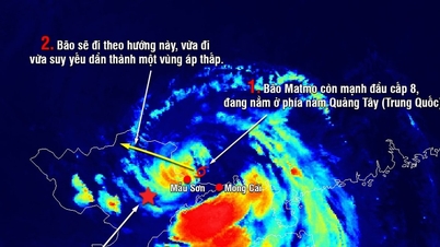
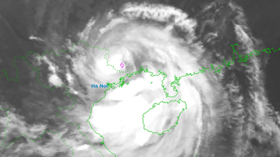
| Storm Ragasa is entering the East Sea. (Photo: nchmf) |
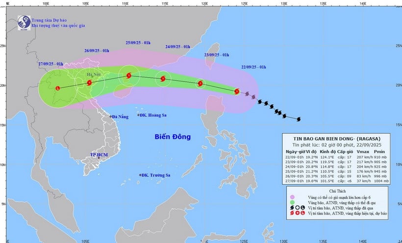
Comments on storm Ragasa, according to the National Center for Hydro-Meteorological Forecasting, at 1:00 a.m. on September 22, the center of super storm Ragasa was at about 19.2 degrees North latitude; 124.1 degrees East longitude, about 230km East Northeast of Luzon Island (Philippines). The strongest wind near the center of the storm is level 16-17 (184-221km/h), gusting above level 17. Moving in the West Northwest direction at a speed of about 20km/h.
Storm risk warning level 4 - very dangerous level
At 0:00 on September 23, the storm was in the northeastern sea, the northern East Sea area with strong winds of level 17, gusting above level 17; moving in the West Northwest direction at a speed of about 20 km/h and likely to strengthen. The affected area is the eastern sea area of the northern East Sea area. Disaster risk level 4.
At 7:00 a.m. on September 24, the storm was in the northern sea, in the North Northeast region, about 490 km east of Leizhou Island (China) with strong winds of level 16-17, gusting above level 17; moving in the West Northwest direction at a speed of about 20 km/h and entering the East Sea. The affected area is the northern sea area of the North East Sea. Disaster risk level 4.
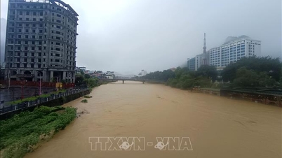
 |
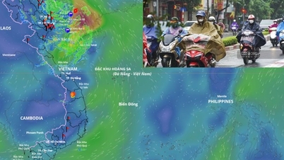
| Illustrative photo. (Source: VNA) |
At 1am on September 25, the storm was in the eastern sea, Leizhou Island (China) with strong winds of level 14-15, gusting over level 17; moving in the West Northwest direction at a speed of about 15-20km/h and gradually weakening. The affected area is the northwest sea of the North East Sea, the eastern sea of the Gulf of Tonkin. Disaster risk level 4.
From the next 72 to 120 hours, the storm will move mainly in the West Southwest direction, about 20km per hour, and its intensity will continue to weaken.
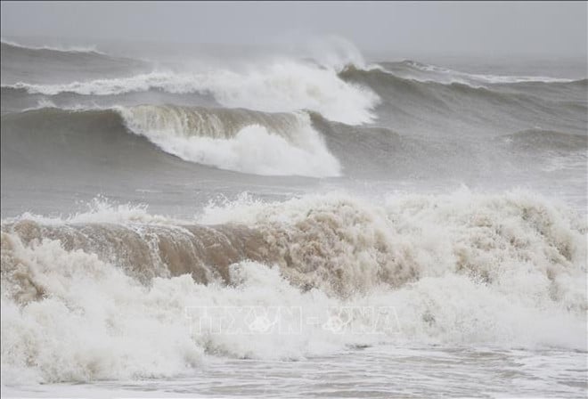
Associate Professor, Doctor, Director of the National Center for Hydro-Meteorological Forecasting Mai Van Khiem noted that due to the influence of the storm, the eastern sea area of the North East Sea has strong winds gradually increasing to level 8-9, then increasing to level 10-14, the area near the storm's center has levels 15-17, gusts above level 17, waves over 10m high; the sea is very rough.
Vessels operating in the above mentioned dangerous areas are susceptible to the impact of storms, whirlwinds, strong winds and large waves.
Beware of flash floods and landslides in 5 northern mountainous provinces
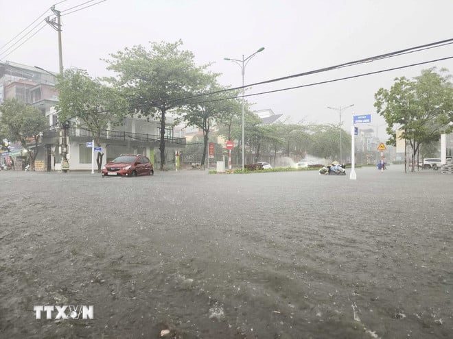
The National Center for Hydro-Meteorological Forecasting forecasts that from 4:40 a.m. to 9:40 a.m. on September 22, the provinces of Lai Chau, Dien Bien , Son La, Lao Cai and Tuyen Quang will continue to have rain with accumulated rainfall ranging from 10-40 mm, with some places over 80 mm.
Warning of the risk of flash floods on small rivers and streams, landslides on steep slopes in many communes/wards: Muong Kim; Khoen On, Muong Than, Nam So, Sin Suoi Ho, Than Uyen; Binh Lu, Dao San, Hong Thu, Khong Lao, Khun Ha, Nam Ma, Nam Tam, Doan Ket Ward, Tan Phong, Ta Leng, Tan Uyen, Tua Sin Chai ( Lai Chau province);
Pu Nhung; Muong Pon, Sin Chai, Tua Chua, Tua Thang; Chieng Sinh, Muong Cha, Muong Mun, Muong Nha, Na Sang, Na Son, Nam Nen, Nua Ngam, Muong Lay, Pa Ham, Sang Nhe, Si Pa Phin, Sinh Phinh, Tuan Giao (Dien Bien province);
Muong Gion; Muong Chien; Chieng Lao, Chieng Mai, Muoi Noi, Muong Chanh, Nam Ty, Phieng Cam, Phu Yen, Suoi To, Ta Xua ( Son La province);
Nghia Do; Coc Lau, Duong Quy; Bao Ha, Bao Thang, Chau Que, Gia Hoi, Khanh Yen, Minh Luong, Nam Chay, Nam Xe, Cau Thia, Trung Tam, Tang Loong, Thuong Ha, Van Ban, Vo Lao, Xuan Quang (Lao Cai province);
Ho Thau, Tien Nguyen; Cao Bo, Khuon Lung, Tung Ba, Yen Thanh; Bac Quang, Binh An, Dong Tam, Lam Binh, Linh Ho, Minh Son, Nam Dich, Ngoc Duong, Ha Giang 1, Ha Giang 2, Phu Linh, Quang Binh, Tan Quang, Tan Tien, Tan Trinh, Thong Nguyen, Thuan Hoa, Thuong Son, Vi Xuyen, Viet Lam (Tuyen Quang province).
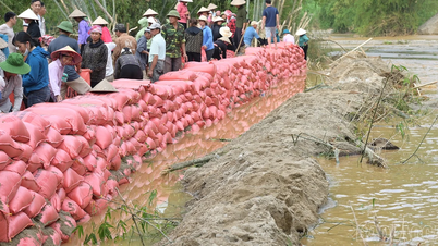
 |
| Warning level of natural disaster risk due to flash floods, landslides, and land subsidence caused by heavy rains and floods. (Photo: VNA) |
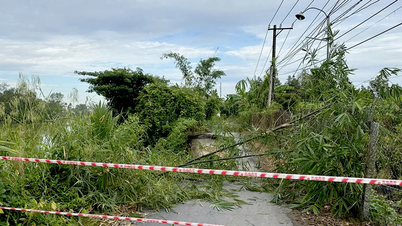
Flash floods and landslides can have very negative impacts on the environment, threaten people's lives; cause local traffic congestion, affect the movement of vehicles; destroy civil and economic works, causing damage to production and socio-economic activities.
The hydrometeorological agency recommends that local authorities pay attention to reviewing bottlenecks and vulnerable locations in the area to have prevention and response measures.
From 0:00 to 3:00 on September 22, the provinces of Lai Chau, Dien Bien, Son La, Lao Cai and Tuyen Quang had moderate to heavy rain such as Nam Xe 1 (Lai Chau) 47.8mm; Muong Pon 2 (Dien Bien) 99mm; Pha Khinh (Son La) 63.2mm; Tan Tien (Lao Cai) 70mm; Tung Ba 1 (Tuyen Quang) 93.4mm...
Soil moisture models show that some areas in the above provinces are close to saturation (over 85%) or have reached saturation.
Many sea areas have strong gusts of wind and high waves.
The National Center for Hydro-Meteorological Forecasting said that at 1:00 a.m. on September 22, the central area of the East Sea, the northern Gulf of Tonkin, and the sea area from Gia Lai to Ca Mau will have scattered showers and thunderstorms.
Forecast, day and night of September 22, the central East Sea area will have wind level 5, sometimes level 6; at night the wind will gradually increase to level 6, gusting to level 7-8, rough sea, waves 2-3m high.
The sea area from Khanh Hoa to Ho Chi Minh City, the sea area north of the South China Sea (including the sea area north of Truong Sa special zone) has wind level 5, sometimes level 6, gusting to level 7-8, rough sea, waves 2-3m high.
In addition, on the day and night of September 22, in the North and Central East Sea (including Hoang Sa special zone), the North Gulf of Tonkin, the sea area from Gia Lai to Ca Mau will have scattered showers and thunderstorms; in particular, the eastern sea area of the North East Sea will have storms from the afternoon, with the possibility of tornadoes, strong gusts of wind of level 6-7 and waves over 2m high.
Warning, day and night of September 23, the sea area south of the North East Sea (including Hoang Sa special zone), the central East Sea area has strong West to Southwest wind level 6, sometimes level 7, gusting to level 8-10; waves 3-5m high, rough seas.
Risk level of natural disasters due to strong winds at sea: level 2; in the northeastern sea area of the North East Sea, level 3.
All vessels operating in the above areas are at high risk of being affected by cyclones, strong winds and large waves.
Weather in regions day and night September 22:
Northwest
- There will be scattered showers and thunderstorms, locally heavy to very heavy rain, with the possibility of tornadoes, lightning and strong gusts of wind.
- Lowest temperature 22-25 degrees Celsius, some places below 22 degrees Celsius. Highest temperature 29-32 degrees Celsius.
Northeast
- There will be scattered showers and thunderstorms, locally heavy to very heavy rain, with the possibility of tornadoes, lightning and strong gusts of wind.
- Lowest temperature 23-26 degrees Celsius, mountainous areas below 22 degrees Celsius. Highest temperature 29-32 degrees Celsius.
Hanoi capital
- There will be scattered showers and thunderstorms, locally heavy rain in some places, with the possibility of tornadoes, lightning, hail and strong gusts of wind.
- Lowest temperature 24-26 degrees Celsius. Highest temperature 30-32 degrees Celsius.
From Thanh Hoa - Hue
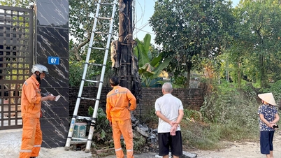
 |
| Illustrative photo. (Photo: Xuan Tu/VNA) |
- There will be scattered showers and thunderstorms in some places; in the late afternoon and evening there will be scattered showers and thunderstorms, with the possibility of tornadoes, lightning, hail and strong gusts of wind.
- Lowest temperature 23-26 degrees Celsius. Highest temperature 30-33 degrees Celsius.
South Central Coast
- There will be scattered showers and thunderstorms in some places; in the afternoon and evening there will be scattered showers and thunderstorms, locally heavy rain in some places, with the possibility of tornadoes, lightning, hail and strong gusts of wind. Southwest wind level 2-3.
- Lowest temperature 23-26 degrees Celsius. Highest temperature 31-34 degrees Celsius.
Central Highlands
- Scattered showers and thunderstorms, locally heavy to very heavy rain, thunderstorms with possibility of tornadoes, lightning, hail and strong gusts of wind. Southwest wind level 2-3.
- Lowest temperature 20-23 degrees Celsius. Highest temperature 27-30 degrees Celsius.
Southern region
- Scattered showers and thunderstorms, locally heavy rain, with the possibility of tornadoes, lightning, hail and strong gusts of wind. Southwest wind level 2-3.
- Lowest temperature 24-27 degrees Celsius. Highest temperature 29-32 degrees Celsius.
Ho Chi Minh City
- Scattered showers and thunderstorms, locally heavy rain, with the possibility of tornadoes, lightning, hail and strong gusts of wind. Southwest wind level 2-3.
- Lowest temperature 24-26 degrees Celsius. Highest temperature 29-31 degrees Celsius.
Source: VNA
Source: https://baodongnai.com.vn/tin-moi/202509/sieu-bao-ragasa-di-chuyen-vao-bien-dong-canh-bao-rui-ro-thien-tai-cap-4-8e100b2/

![[Photo] Prime Minister Pham Minh Chinh launched a peak emulation campaign to achieve achievements in celebration of the 14th National Party Congress](https://vphoto.vietnam.vn/thumb/1200x675/vietnam/resource/IMAGE/2025/10/5/8869ec5cdbc740f58fbf2ae73f065076)


![[Photo] Prime Minister Pham Minh Chinh chairs the Government's online conference with localities](https://vphoto.vietnam.vn/thumb/1200x675/vietnam/resource/IMAGE/2025/10/5/264793cfb4404c63a701d235ff43e1bd)


Comment (0)