
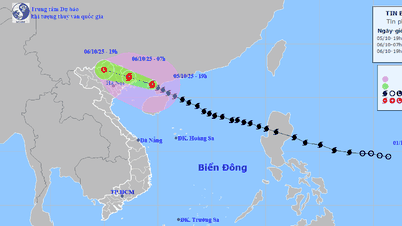
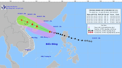
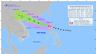
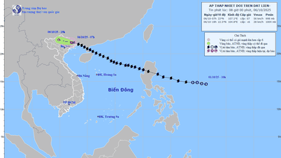
At 1 p.m. on October 6, the storm moved deep into the Vietnam-China border area, its intensity decreased to level 6, gusting to level 8. At 1 a.m. on October 7, the storm weakened into a low pressure area in the mountainous region of the Northwest.
Due to the influence of storm No. 11, at Bach Long Vi there were strong winds of level 8, gusting to level 9. The coastal area of Quang Ninh - Hai Phong had gusts of level 6-7.
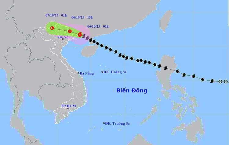
Warning: In the next 12-24 hours, the Northern Gulf of Tonkin (including the islands of Bach Long Vi, Van Don, Co To, Cat Hai, Hon Dau) will have strong winds of level 6-7, near the storm center level 8, gusting to level 10; waves 2-4 m high, rough seas, dangerous for boats. The coastal areas of Quang Ninh - Hai Phong will have storm surges of 0.4-0.6 m, risk of flooding in low-lying areas and river mouths in the early morning of October 6.
In addition, on October 6, the Gulf of Tonkin, the sea area from South Quang Tri to Hue City and the Gulf of Thailand will have showers and thunderstorms. During the thunderstorms, there is a possibility of tornadoes, strong gusts of wind of level 6-7 and waves over 2.0 m high. From the night of October 6, the wind in the sea areas will decrease rapidly.
On land, coastal provinces from Quang Ninh to Hai Phong and Lang Son have strong winds of level 6-7, near the storm center level 8, gusting to level 9; deep inland in the Northeast, winds of level 4-5, in some places level 6, gusting to level 7-8. Communes/wards in the Northeast of Quang Ninh may have winds of level 8, gusting to level 9; coastal areas in Hai Phong have strong winds of level 6-7, gusting to level 8.
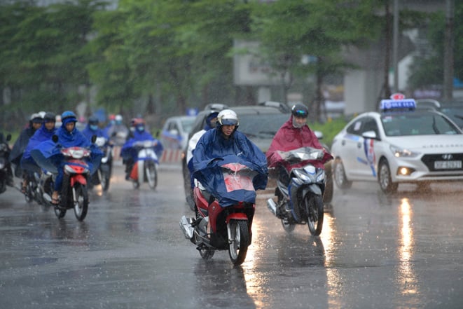
Regarding rain, from October 6 to the night of October 7, the mountainous and midland areas of the North will have heavy rain of 150-250 mm, locally over 350 mm, with the possibility of extreme rain with an amount of >150 mm in 3 hours. The Northern Delta and Thanh Hoa will have moderate to heavy rain of 70-150 mm, in some places over 200 mm. Hanoi alone will be less directly affected by storms, but from the morning of October 6 to October 7, there will be moderate to heavy rain (70-120 mm, in some places over 150 mm) with the risk of thunderstorms, whirlwinds, and strong gusts of wind. From October 8, heavy rain in the North and Thanh Hoa will decrease rapidly.
The wide storm circulation also poses the risk of thunderstorms, tornadoes, and strong gusts of wind at sea and on land, especially before and during the storm's landfall. The disaster risk level is warned at level 3 for the northern Gulf of Tonkin, coastal mainland from Quang Ninh to Hai Phong and Lang Son province.
Weather forecast for regions across the country:
Hanoi capital is cloudy with moderate rain, heavy rain and thunderstorms, locally very heavy rain. Northwest to north wind level 3-4; later changing to southeast wind level 2-3. During thunderstorms there is a possibility of tornadoes, lightning and strong gusts. Lowest temperature 24-26 degrees Celsius. Highest temperature 28-30 degrees Celsius.
The Northwestern provinces are cloudy with scattered showers and thunderstorms, some places have heavy rain; in the afternoon and at night there will be moderate rain, heavy rain, some places have very heavy rain. Light wind. During thunderstorms there is a possibility of tornadoes, lightning and strong gusts of wind. The lowest temperature is 21-24 degrees Celsius, some places below 21 degrees Celsius. The highest temperature is 28-31 degrees Celsius.
The Northeastern region is cloudy with heavy rain, locally very heavy rain and thunderstorms; the Delta and Thanh Hoa regions have moderate rain, heavy rain and thunderstorms, locally very heavy rain. The wind is from the northwest to the north; then changes to the southeast at level 3-4; in Quang Ninh and Lang Son in the morning there will be strong winds at level 6, gusting at level 7-8. There is a possibility of tornadoes, lightning and strong gusts of wind during thunderstorms. The lowest temperature is 22-25 degrees Celsius. The highest temperature is 27-30 degrees Celsius, some places above 30 degrees Celsius.
Provinces from Thanh Hoa to Hue: In the North, it is cloudy with scattered showers and thunderstorms; in the South, it is cloudy with scattered showers and thunderstorms. Southwest wind level 2-3. During thunderstorms, there is a possibility of tornadoes, lightning and strong gusts of wind. Lowest temperature 24-27 degrees Celsius. Highest temperature 30-33 degrees Celsius.
The South Central Coast region is cloudy with scattered showers and thunderstorms. Southwesterly winds at level 2-3. There is a possibility of tornadoes, lightning and strong gusts of wind during thunderstorms. Lowest temperature 24-27 degrees Celsius. Highest temperature 31-34 degrees Celsius.
The Central Highlands is cloudy, sunny during the day, with showers and thunderstorms in some places in the evening and at night. Southwest wind level 2-3. During thunderstorms, there is a possibility of tornadoes, lightning and strong gusts of wind. The lowest temperature is 20-23 degrees Celsius, in some places below 20 degrees Celsius. The highest temperature is 28-31 degrees Celsius.
The South is cloudy, sunny during the day, with showers and thunderstorms in some places in the evening and at night. Southwest wind level 2-3. During thunderstorms, there is a possibility of tornadoes, lightning and strong gusts of wind. Lowest temperature 24-27 degrees Celsius. Highest temperature 31-34 degrees Celsius.
Ho Chi Minh City is cloudy, sunny during the day, with showers and thunderstorms in some places in the evening and at night. Southwest wind level 2-3. During thunderstorms, there is a possibility of tornadoes, lightning and strong gusts of wind. Lowest temperature 24-26 degrees Celsius. Highest temperature 32-34 degrees Celsius.
Source: https://baotintuc.vn/xa-hoi/thoi-tiet-ngay-610-bao-so-11-tien-vao-bien-gioi-viet-trung-bac-bo-mua-lon-20251006034630260.htm


![[Photo] Prime Minister Pham Minh Chinh chairs the Government's online conference with localities](https://vphoto.vietnam.vn/thumb/1200x675/vietnam/resource/IMAGE/2025/10/5/264793cfb4404c63a701d235ff43e1bd)
![[Photo] Opening of the 13th Conference of the 13th Party Central Committee](https://vphoto.vietnam.vn/thumb/1200x675/vietnam/resource/IMAGE/2025/10/6/d4b269e6c4b64696af775925cb608560)


![[Photo] Prime Minister Pham Minh Chinh launched a peak emulation campaign to achieve achievements in celebration of the 14th National Party Congress](https://vphoto.vietnam.vn/thumb/1200x675/vietnam/resource/IMAGE/2025/10/5/8869ec5cdbc740f58fbf2ae73f065076)


Comment (0)