
According to Director Mai Van Khiem, the developments of the storms that occurred in the recent past were quite unusual. Specifically, storm No. 9 (RAGASA) had an intensity in the East Sea reaching super typhoon level (level 17, gusts above level 17) - the strongest storm in the world in 2025, this is also the strongest storm in the history of storm statistics in the East Sea. However, because the storm changed direction to land in China, when moving to the mainland of Quang Ninh province, it weakened into a tropical depression and did not have much impact on our mainland.
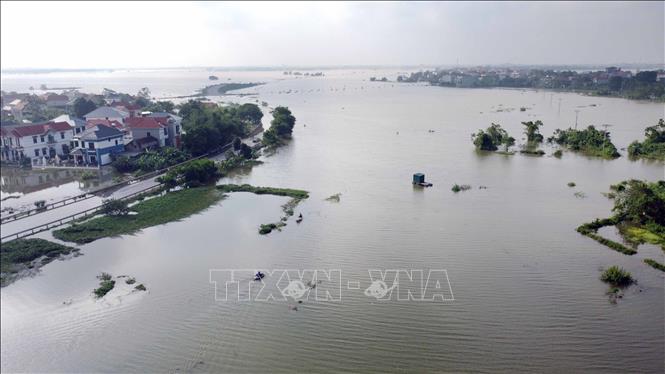
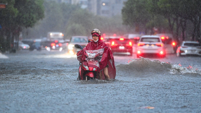
Meanwhile, storm No. 10 (BUALOI) moved rapidly in the East Sea at twice the speed of a normal storm, sometimes reaching 35 - 40 km/h, but when it made landfall, it slowed down, moving along the Central coast before making landfall in the Northern and Central regions with very strong impacts. The time that storm No. 10 stayed on land in the provinces of Nghe An - Northern Quang Tri was rarely seen, lasting up to more than 12 hours. The storm's circulation caused heavy rain throughout the Northern region and Thanh Hoa down to Hue city (in some places, rain was nearly 600 mm).
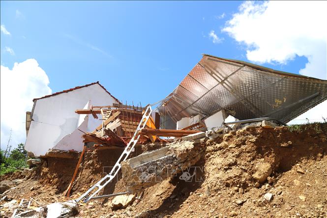
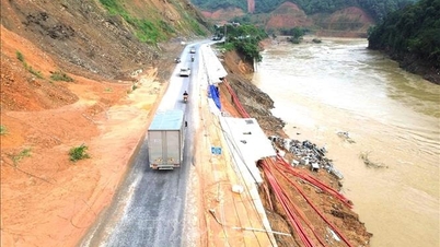
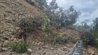
Strong storm wind circulation from level 6 and above stretches across 11/21 coastal provinces, in which the area with strong wind from level 8 stretches from Ninh Binh to Quang Tri, the area of South Ha Tinh - North Quang Tri is the storm center affected and also the area with the strongest wind, commonly level 10-11, gusting to level 13-14; causing thunderstorms; major floods on many rivers; causing landslides, flash floods in many areas...
"This is one of the most serious and fierce natural disasters, with especially dangerous types of natural disasters occurring almost simultaneously (very strong storms, large floods, especially large floods; flash floods, landslides, and widespread flooding); severely impacting and affecting most socio-economic activities and infrastructure institutions from coastal areas to deltas, midlands, and mountainous areas," Director Mai Van Khiem emphasized.
Explaining the unusual cause of the storms as analyzed above, Director Mai Van Khiem said that in recent years, the Northwest Pacific Ocean has been affected by climate change, the temperature has increased, the sea surface has also increased, causing the amount of water vapor in the atmosphere to accumulate more, creating conditions for the formation of very strong storms. Along with that, in the storms mentioned above, storm number 10 moves very fast. It is rare for a storm to move at a speed of 30-35 km/hour. The reason why the storm moves so fast is because of the subtropical high pressure (a large-scale circulation system that exists in many different atmospheric layers). The high pressure is very strong, so it guides the storm to move at a very fast speed...
Regarding the storm situation from now until the end of the year, Mr. Mai Van Khiem said that it is forecasted that there will be about 2-4 storms and tropical depressions in the East Sea and 1-2 storms are likely to affect mainland Vietnam.
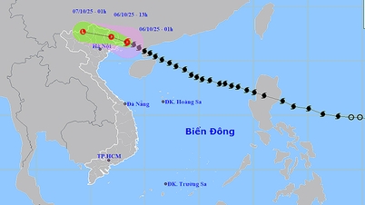
Regarding the unusual nature of many storms since the beginning of the year, which have tended to shift northward (towards the North), Dr. Truong Ba Kien, Deputy Director of the Center for Hydrometeorological Research, Institute of Hydrometeorology and Climate Change, said that the unusual nature of this year's storm season lies in the fact that storms in September and October usually affect the Central region. Specifically, storms often form in the East of the Philippines, move in a West-Northwest direction, cross Luzon Island, enter the East Sea and then head towards the Central coast. However, there have been some storms that have moved northward and affected the Northern region. Up to this point, out of 11 storms in 2025, 6 have moved northward, including WUTIP (storm No. 1), WIPHA (storm No. 3), KAJIKI (storm No. 5), TAPAH (storm No. 7), RAGASA (storm No. 9) and MATMO (storm No. 11).
Regarding the cause of the Northward shift of many storms, Dr. Truong Ba Kien said that for storms moving Northward, it is due to the subtropical high pressure in the East combined with cold air from the North creating a West-Northwest flow. In the past, there were similar storms moving Northward such as storm SARIKA - storm No. 7 (2016) formed in the East of the Philippines, crossed Luzon, landed in Hainan, then affected the North and North Central regions, causing heavy rain due to cold air interaction.
In October 2017, typhoon KHANUN - typhoon No. 6 intensified in the North of the East Sea, in the direction of Hainan - Guangdong, causing strong winds, large waves in the Gulf of Tonkin and rain in the North. Typhoon Nesat (late September - early October 2011), after affecting Luzon, moved up to Hainan - Guangdong, causing strong monsoon conditions and heavy rain in the North of Vietnam.
As for storm No. 11, the National Center for Hydro-Meteorological Forecasting also forecasts that it will shift to the North. The reason is believed to be due to the subtropical high pressure that dominates in the Northwest direction, then the high pressure is forecast to retreat to the East and shift to the South, creating conditions for storm No. 11 to change direction to the North. Along with that, the cold air that is budding in the North, has not yet reached deep enough so it does not have enough strong pressure to push the storm to the South, towards the Central region.
By the morning of October 6, although storm No. 11 had weakened into a tropical depression, at sea (the northern Gulf of Tonkin including Bach Long Vi special zone) there were still strong winds, high waves, and rough seas (dangerous for ships).
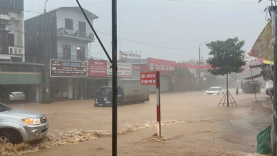
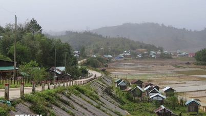
On the morning of October 6, on land in Quang Ninh and Lang Son areas, there will be strong winds of level 5, in some places level 6, gusting to level 7-8. From the morning of October 6 to the end of the night of October 7, mountainous areas and midlands of the North will have heavy rain and thunderstorms, with rainfall ranging from 100-200 mm, locally with very heavy rain over 300 mm. Warning of the risk of heavy rain (>150 mm/3 hours); in the Northern Delta and Thanh Hoa areas, there will be moderate to heavy rain with rainfall ranging from 50-150 mm, locally with very heavy rain over 200 mm.
In Hanoi area, from the morning of October 6 to the end of October 7, there is forecast to be moderate rain, heavy rain and thunderstorms, with common rainfall of 50-100 mm, locally over 150 mm, with the possibility of tornadoes, lightning and strong gusts of wind during thunderstorms.
Hydrometeorological experts recommend that in order to proactively respond to storm No. 11, heavy rains, floods, flash floods, landslides... first of all, people must absolutely comply with the instructions and directions of local authorities.
People need to regularly monitor storm warning information, flood and rain situation, and thunderstorm warnings on the website of the National Center for Hydro-Meteorological Forecasting at nchmf.gov.vn, provincial, municipal and regional Hydro-Meteorological Stations; and the official mass media of the Central and local levels to proactively respond.
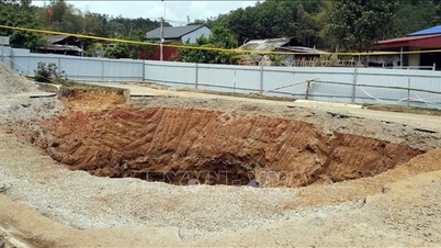
In addition, the impact of storm No. 11 will cause very heavy rain in the Northern region and Thanh Hoa, with a high risk of flash floods and landslides. Therefore, the Hydrometeorological Agency recommends that local authorities pay attention to reviewing the flow bottlenecks and vulnerable locations in the area to have preventive and response measures.
Source: https://baotintuc.vn/xa-hoi/chuyen-gia-ly-giai-ve-mua-bao-bat-thuong-20251006112601757.htm


Comment (0)