
At 8:00 a.m. this morning, October 23, the National Center for Hydro-Meteorological Forecasting issued the final bulletin on storm number 12.

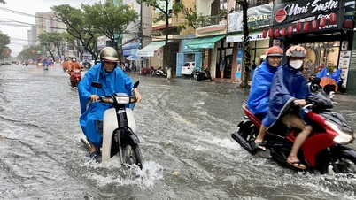
Accordingly, early this morning, after entering the coastal waters of Hue - Da Nang area, the tropical depression (weakened from storm No. 12) has weakened into a low pressure area. It is forecasted that in the next 12 hours, the low pressure area will continue to move mainly in the southwest direction and gradually dissipate.
However, far offshore there is a new tropical depression that is moving towards the North East Sea.
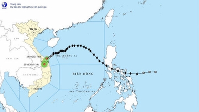
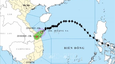
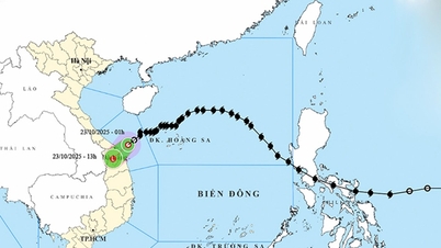
According to the update at 8am this morning of the National Center for Hydro-Meteorological Forecasting, the center of the tropical depression is at coordinates of about 20.4 degrees North latitude - 121.4 degrees East longitude. The strongest wind near the center of the tropical depression is level 7 (50-61km/h), gusting to level 9 and the tropical depression is moving southwest at a speed of about 20km/h.
Vietnam's meteorological agency said that within the next 24 hours (from this morning), the center of the tropical depression will enter the North East Sea area.
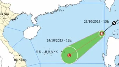
At about 7:00 a.m. tomorrow (October 24), the center of the tropical depression will be at about 17.7 degrees North latitude - 117.9 degrees East longitude, in the eastern sea of the North East Sea area, moving in the Southwest direction at a speed of about 20km/hour.
At 7:00 a.m. on October 25, the tropical depression continued to move southwest at a speed of about 20 km/hour, located at about 15.5 degrees North latitude - 114.1 degrees East longitude, about 250 km east of Hoang Sa special zone, but its intensity gradually weakened to below level 6.
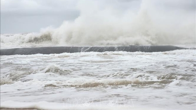
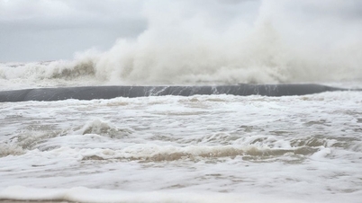
Due to the combined influence of low pressure and strengthening cold air, the eastern sea area of the North East Sea continues to have strong winds of level 6-7, gusts of level 9, and waves 3-5m high.
Although storm No. 12 no longer directly affects the weather at sea, the new tropical depression will continue to cause bad and dangerous weather for the North East Sea area in the next 1-3 days.
Therefore, vessels operating in the above-mentioned dangerous areas are likely to be affected by storms, whirlwinds, strong winds and large waves.
Source: https://www.sggp.org.vn/trong-24-gio-toi-ap-thap-nhiet-doi-vao-bien-dong-post819438.html


![[Photo] Prime Minister Pham Minh Chinh chairs meeting on railway projects](https://vphoto.vietnam.vn/thumb/1200x675/vietnam/resource/IMAGE/2025/10/23/1761206277171_dsc-9703-jpg.webp)


Comment (0)