
The water rose faster than ever before.
After the recent historic flood, the people of Tan Ky, Tan An, Nghia Hanh, Nghia Dong communes (former Tan Ky district) are still in shock. A river that was once gentle, after just one night, the rising water swept away houses, properties and peaceful memories of countless people.
.jpg)
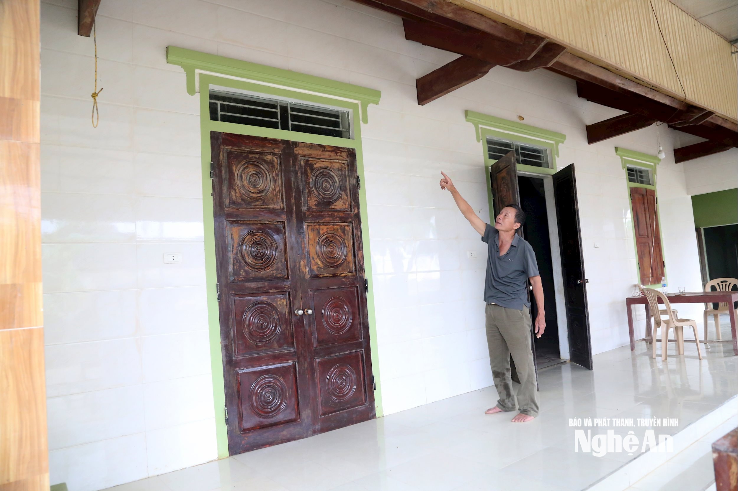
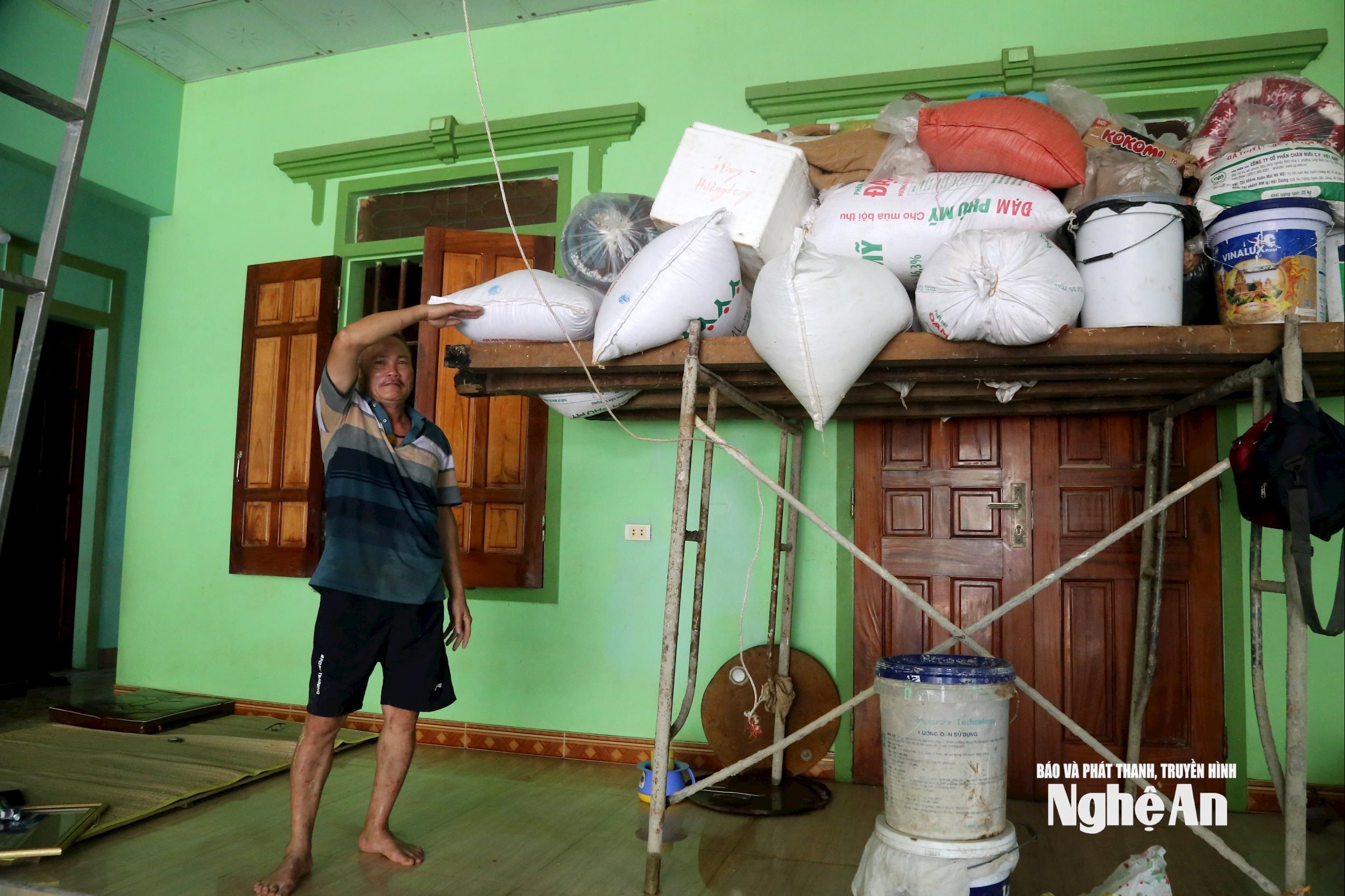
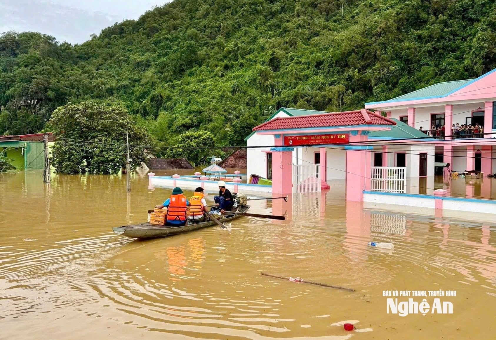
Dien Nam Hamlet, Tan Ky Commune is the most deeply flooded area. Mr. Nguyen Ngoc My - Deputy Secretary of the Party Cell, Head of Dien Nam Hamlet, recounted: "Every year, the flood water of Con River only rises 1-1.5m, people still have time to move their belongings. But in the recent flood, the water rose nearly 4m, in some places touching the roofs. All furniture, rice, and electrical equipment were submerged in water and severely damaged."
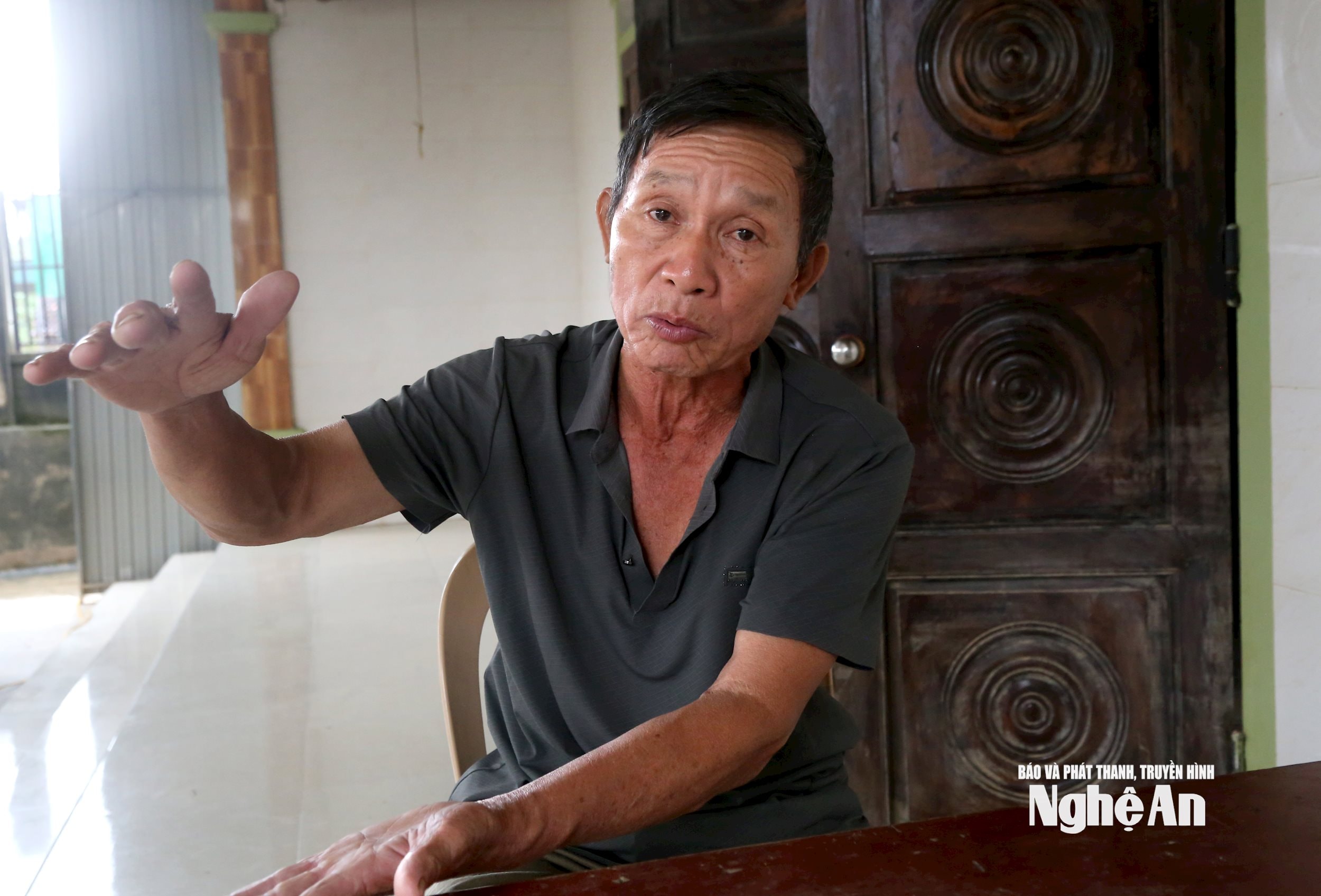
According to Mr. My, the prolonged heavy rains caused by the impact of storm No. 10 caused water from streams and mountain slopes to flow into the Con River at the same time. In particular, the huge amount of water from the upper reaches of the Hieu River overflowed, causing the river to rise abnormally quickly in just one night, from the evening of October 1 to the early morning of October 2.
“The water has never risen so quickly. Many houses were submerged in just a few hours, people had no time to react,” Mr. My said.
Sharing the same situation, Mr. Nguyen Thanh Tuan (born 1965) - a resident of Tan Ky commune said that he had witnessed many floods, including the one in 1978 which was considered the biggest before. "But this flood was more than 1 meter higher than in 1978", Mr. Tuan said.
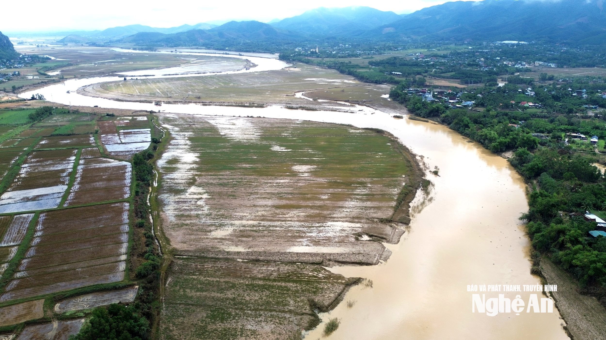
According to meteorological experts, storm No. 10 is one of the strongest storms to hit the North Central region in the past 10 years. The storm brought with it a huge amount of moisture, causing exceptionally heavy rain over a wide area. In many places, the rain lasted for 2-3 days, with total rainfall reaching 300-500mm, even exceeding 500mm in some places - a record level in many years.
Mr. Nguyen Truong Thanh - Head of Nghe An Irrigation Sub-Department, said: “The main and most direct cause is the extremely heavy rainfall caused by storm No. 10 over a large area, commonly from 300 - 500mm, especially in the upstream areas of the Con River, such as the old districts: Que Phong, Quy Chau... rainfall over 500mm, so the water on rivers and streams rises. Water flows into Hieu River and then flows down to Con River. Data measured at Nghia Khanh station at 9am on September 30 shows that the water level is 0.86m higher than alarm level 3 - ie 40.86m, a very rare level”.
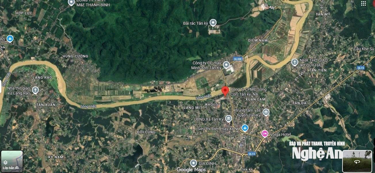
Not only that, the time when the flood on the Con River rises also coincides with the high tide on the Lam River, making it impossible for the water to drain quickly. “The Lam River rises high, and when it goes downstream, it encounters high tide, causing the flow to reverse. Therefore, the water in the old Tan Ky district and surrounding areas rises quickly and recedes slowly,” Mr. Thanh analyzed.
Alarm bells
In addition to extreme weather, many believe that the decline of upstream forests also contributes to the river's ferocity. When forests are destroyed, the soil's natural water retention capacity is greatly reduced, and heavy rainfall quickly becomes overflow, rushing downstream.
Mr. Phan Van Giap - Secretary of the Tan An Commune Party Committee, commented: "The main reason is still the heavy rain, but in the past, there were also long rains but the water level of the Con River did not rise like that. At Khe Sanh Bridge - one of the streams flowing into the Con River, the water level recently reached 9m, the highest in recorded history. Never before have thousands of households, schools, and markets been flooded so deeply."
Mr. Nguyen Viet Hoa - Vice Chairman of Tan Phu Commune People's Committee, said: "The flood water mainly flows from the upstream of Hieu River through Con River, combined with a large amount of water from Lam River, so it rises very quickly, making the downstream area unable to drain in time, causing widespread flooding."
Sharing the same view, Mr. Le Van Ngoc - Secretary of Tan Ky Commune Party Committee, suggested: "The province needs to soon invest in a measuring system and monitoring stations to monitor the development of floods. When there are signs of extreme weather, there needs to be an early warning mechanism to help people and local authorities proactively evacuate, protect lives and property."
These opinions show the urgent need to improve the capacity to forecast and warn of natural disasters early in the context of increasingly complex climate change.
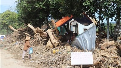
This historic flood is not only a natural disaster, but also a warning bell for planning and managing river basins. Some opinions suggest that specialized agencies should promptly investigate and comprehensively assess the system of dams, drainage channels, upstream forests and downstream areas to have appropriate response strategies. It is necessary to strictly control sand mining and construction in flood escape corridors; in addition, calculate low-lying areas to have resettlement plans.
In particular, it is necessary to implement a program to restore the protective forests of the Con River upstream in association with sustainable livelihoods for people in mountainous areas. When forests are protected, the land is “water-retained”, flash floods and landslides will be significantly reduced.
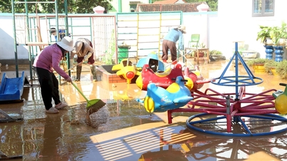
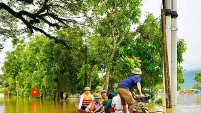
According to preliminary statistics, thousands of houses along the Con River were flooded for many days, dozens of hectares of rice, crops, livestock and poultry were swept away. Many inter-commune and inter-village roads were paralyzed. School infrastructure, medical stations and traditional markets were submerged in water.
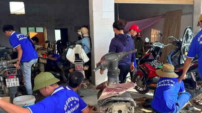
However, amidst the difficulties, the spirit of solidarity of the people in the flooded areas shone brightly. The local government, together with the police and military forces, promptly rescued and evacuated people from the deep flooded areas, and at the same time provided essential supplies to the affected households. Many volunteer groups from inside and outside the province were also present in time, bringing life jackets, clean water and food.
Source: https://baonghean.vn/vi-sao-cac-xa-o-huyen-tan-ky-cu-ngap-dai-dang-sau-bao-so-10-10307866.html
![[Photo] Closing of the 13th Conference of the 13th Party Central Committee](https://vphoto.vietnam.vn/thumb/1200x675/vietnam/resource/IMAGE/2025/10/08/1759893763535_ndo_br_a3-bnd-2504-jpg.webp)


![[Photo] Prime Minister Pham Minh Chinh inspects and directs the work of overcoming the consequences of floods after the storm in Thai Nguyen](https://vphoto.vietnam.vn/thumb/1200x675/vietnam/resource/IMAGE/2025/10/08/1759930075451_dsc-9441-jpg.webp)


Comment (0)