
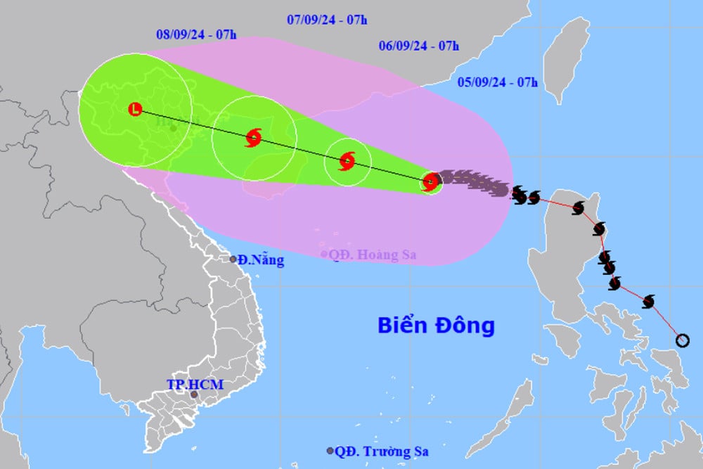
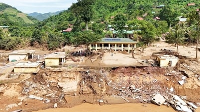
According to the National Center for Hydro-Meteorological Forecasting, as of 7:00 a.m. this morning (September 5), the center of storm No. 3 Yagi was located in the northern sea area of the North East Sea, about 520 km east of Hainan Island (China). The strongest wind near the center of the storm was level 15 (167-183 km/h), gusting over level 17. In the past hours, the storm has been moving slowly westward at a speed of about 10 km/h.
Ensuring traffic and works
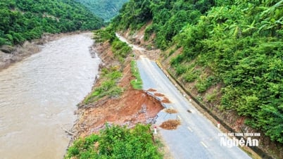
The Vietnam Road Administration ( Ministry of Transport ) has just sent a telegram to Road Management Zones I, II, III and many provinces about responding to storm No. 3 (storm Yagi).
To promptly respond and limit damage caused by storm No. 3, the Vietnam Road Administration recommends that units and localities closely monitor the developments of storm No. 3; proactively deploy plans to ensure traffic and take measures to protect road works, bridges, culverts, warehouses, etc.
Units must also prepare bridge girders, buoys, machinery, equipment, vehicles, and human resources ready to ensure traffic when an incident occurs; maintain forces and vehicles ready to participate in rescue operations to ensure traffic safety in order to minimize the level of damage.
The Vietnam Road Administration also requires units to immediately carry out traffic diversion when there is a traffic jam, and directs road traffic inspectors to proactively coordinate with traffic police and local authorities when diverting traffic.
At the same time, coordinate with the local Steering Committee for Disaster Prevention and Control to organize rescue forces to ensure 24/24h traffic; closely monitor the developments of storm No. 3; request units to organize 24/24h duty...
Instructions for ships to avoid storm number 3
The Vietnam Maritime Administration (Ministry of Transport) has also just issued a dispatch requesting the Vietnam Maritime Electronic Information Company Limited to direct coastal information stations to broadcast storm warning No. 3 in the East Sea to inform vessels operating at sea of the location, direction of movement and developments of the storm so that they can proactively take shelter safely.
Maritime port authorities are required to monitor and update the developments of storm No. 3 and guide ships to avoid entering dangerous areas.
In case of ships leaving port, it is recommended that ships do not enter the disaster danger zone, especially for ships with restriction level 3 and inland waterway vehicles with VR-SB level.
Particularly, the maritime port authorities of Quang Ninh, Hai Phong, Thai Binh, Thanh Hoa, Nghe An, Ha Tinh, Quang Binh, Quang Tri, Thua Thien Hue, Da Nang, and Quang Nam need to organize a vessel count before 6:00 and 15:00 every day, report to the Vietnam Maritime Administration the number of vessels anchored in the management area and other unexpected cases.
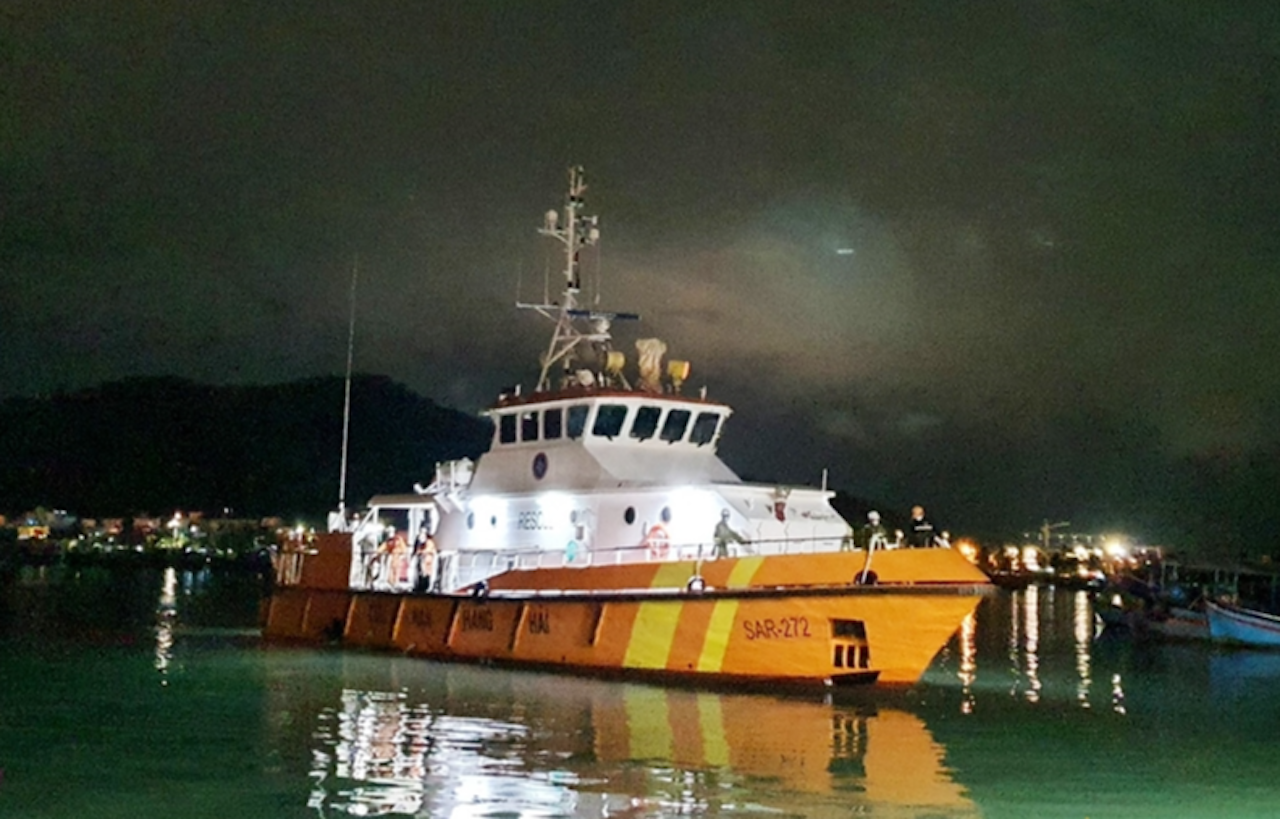
The Vietnam Maritime Search and Rescue Coordination Center needs to maintain its forces and means, ready to participate in disaster prevention and search and rescue when requested.
According to the assessment of the Aviation Meteorological Center - Vietnam Air Traffic Management Corporation, after passing through Leizhou Island and Hainan - China, storm No. 3 will decrease in intensity and continue moving in a West-Northwest direction.
Due to the impact of storm No. 3, Van Don and Cat Bi airports from the evening and night of September 6 to the morning of September 7 were affected by the storm, visibility could be reduced to 1km in stormy rain accompanied by strong gusts of wind.
Noi Bai Airport and Tho Xuan Airport were affected by storms from noon, afternoon to night on September 7, visibility sometimes reduced to 1.5km in storms with strong gusts of wind.
Source: https://vietnamnet.vn/chu-dong-ung-pho-voi-bao-so-3-tren-duong-bo-va-bien-dong-2318554.html


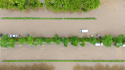
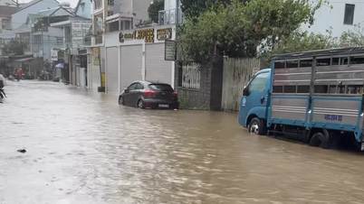
![[Photo] Hanoi morning of October 1: Prolonged flooding, people wade to work](https://vphoto.vietnam.vn/thumb/1200x675/vietnam/resource/IMAGE/2025/10/1/189be28938e3493fa26b2938efa2059e)


![[Photo] Panorama of the cable-stayed bridge, the final bottleneck of the Ben Luc-Long Thanh expressway](https://vphoto.vietnam.vn/thumb/1200x675/vietnam/resource/IMAGE/2025/9/30/391fdf21025541d6b2f092e49a17243f)


Comment (0)