
On the same morning, Hanoi City Police coordinated with city departments and branches to deploy traffic congestion prevention work.
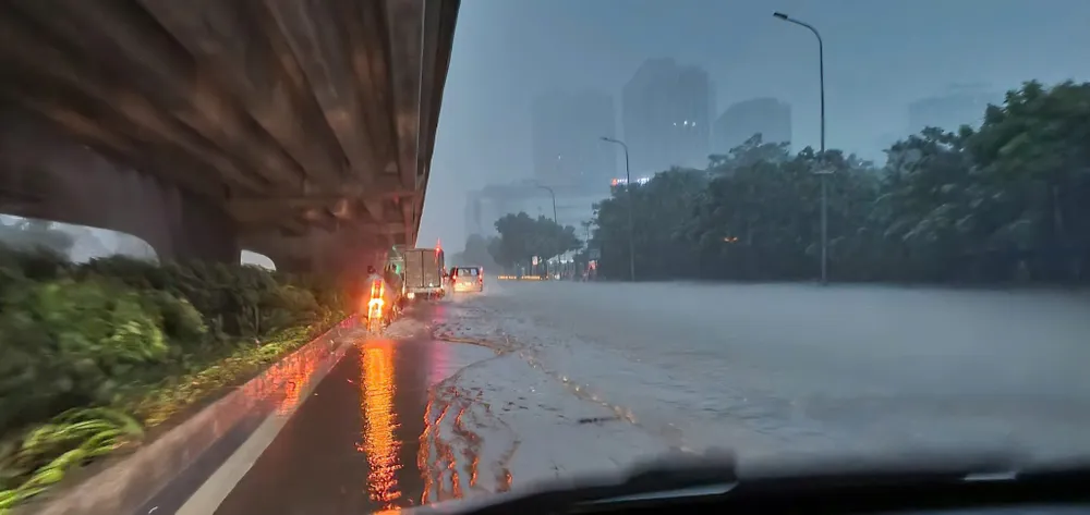
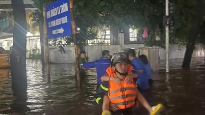
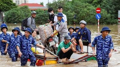
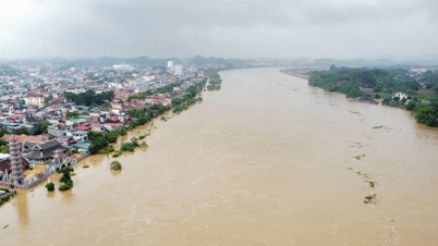
According to the local authorities, there have been many flooded areas in Hanoi. Hanoi Police have announced a list of flooded areas:
Accordingly, flooded areas include the following routes: Thuy Khue (Chu Van An - Doc La Pho section), Mac Thi Buoi, Minh Khai Street (Vinh Tuy bridge foot), Bui Xuong Trach (from number 49 to number 93 Bui Xuong Trach), Huynh Thuc Khang (Nguyen Hong intersection - lane 14 Huynh Thuc Khang), Thanh Cong.

My Dinh - Thien Hien, Le Duc Tho (My Dinh Stadium Square), Phu Xa (Phu Xa - Phuc Hoa intersection), Duong Dinh Nghe - Nam Trung Yen (behind Keangnam building), Vo Chi Cong (UDIC building), Hoang Quoc Viet (Electricity University section), Phan Van Truong (market gate - military barracks), Hoa Bang (at alley 99), Tran Cung (A38 gas station section), Tran Binh (Mai Dich Ward People's Committee to 19-8 Hospital), Do Duc Duc (road to Mieu Dam), Nguyen Trai (University of Social Sciences and Humanities, section on the even bus lane), Quan Nhan, Quang Trung (in front of Nguyen Hue High School), Quang Trung (opposite La Khe station), Yen Nghia (from Yen Nghia bus station to Ba La intersection), Pho Xom (section opposite Hai Phat building), Le Loi - Tran Hung Dao (area around Ha Dong market), Quyet Thang street, To Hieu (in front of tax office and HUD3 building), National Highway 6 (section of residential groups 1+4, Yen Nghia ward), TT18 area, Phu La...
 go to school early in the morning of October 7.")
Ngoc Lam routes (Long Bien intersection), Duc Giang (from Duc Hoa market to lane 97), Dam Quang Trung street (in front and opposite Aeon Mall supermarket), Co Linh (in front and opposite Long Bien Secondary School), and Thien Duc street train underpass.
Source: https://www.sggp.org.vn/cong-an-ha-noi-khuyen-cao-khong-di-chuyen-vao-nhung-diem-ngap-ung-post816711.html


![[Photo] Prime Minister Pham Minh Chinh chairs the 16th meeting of the National Steering Committee on combating illegal fishing.](https://vphoto.vietnam.vn/thumb/1200x675/vietnam/resource/IMAGE/2025/10/07/1759848378556_dsc-9253-jpg.webp)


![[Photo] Super harvest moon shines brightly on Mid-Autumn Festival night around the world](https://vphoto.vietnam.vn/thumb/1200x675/vietnam/resource/IMAGE/2025/10/07/1759816565798_1759814567021-jpg.webp)


Comment (0)