
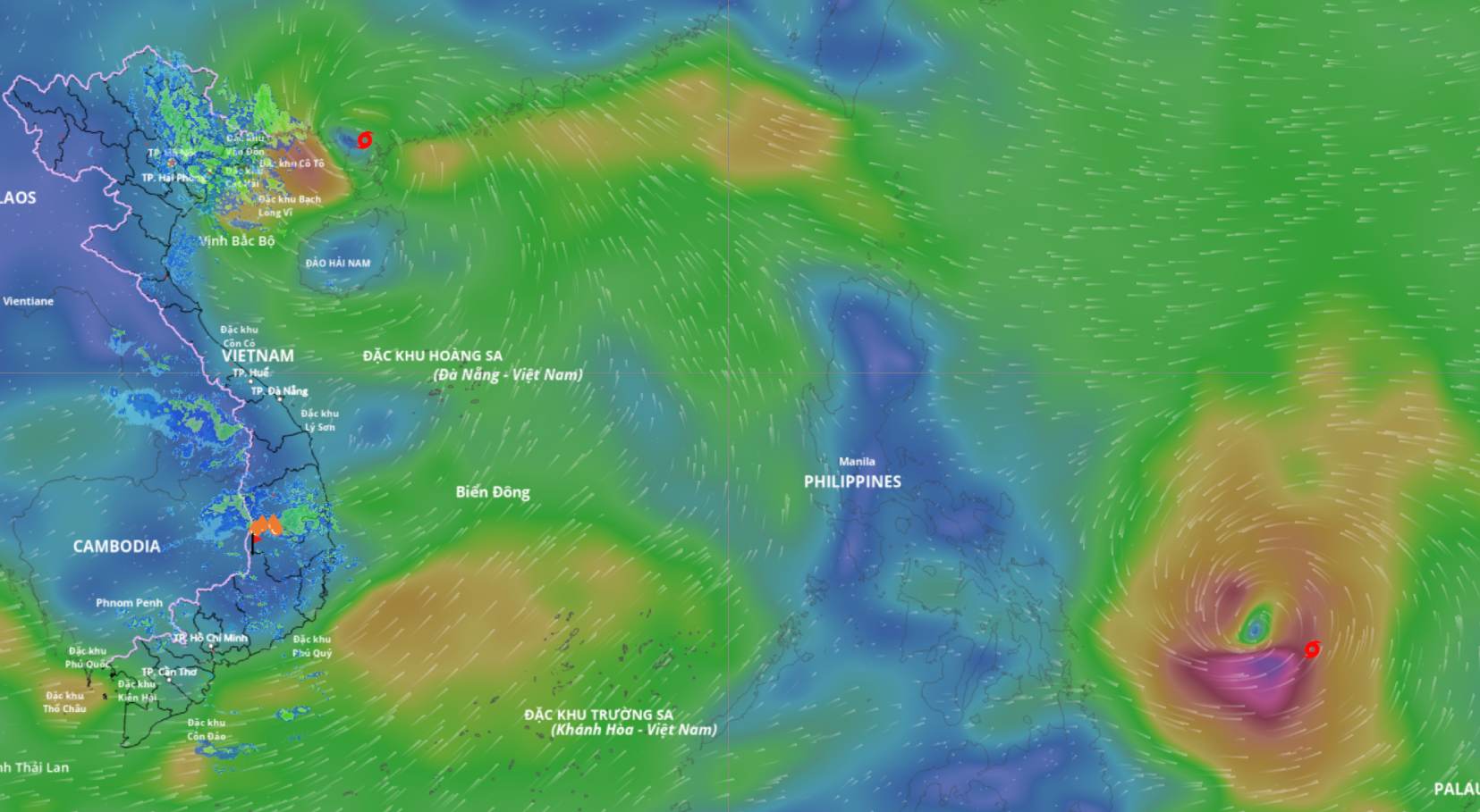
Storm No. 9 Ragasa is getting closer to Quang Ninh . Source: Vietnam Disaster Monitoring System
Latest update from the National Center for Hydro-Meteorological Forecasting, due to the influence of storm No. 9, in Bach Long Vi special zone there are strong winds of level 7, gusting to level 8.
According to Mr. Mai Van Khiem - Director of the National Center for Hydro-Meteorological Forecasting, at 4:00 a.m. on September 25, the center of the storm was located at about 21.5 degrees north latitude; 109.5 degrees east longitude, about 170 km east of Mong Cai (Quang Ninh). The strongest wind near the center of the storm was level 9 (75-88 km/h), gusting to level 11. The storm moved westward at a speed of about 20 km/h.

Mr. Mai Van Khiem said the time of storm No. 9 Ragasa making landfall is near. Photo: An An
"It is forecasted that at noon today, September 25, storm No. 9 will make landfall in Quang Ninh province" - Mr. Khiem said.
Forecast in the next 12 hours, the storm will move west at a speed of about 20 km/h, gradually weakening into a tropical depression.
At 4:00 p.m. on September 25, the center of the tropical depression was at about 21.5 degrees north latitude; 106.9 degrees east longitude, on the mainland in the northeastern region of the North. The intensity was level 6, gusting to level 8.
Danger zone north of 20 degrees north latitude, west of 111.5 degrees east longitude. Disaster risk level 3 for the northwest sea area of the North East Sea, the northern Gulf of Tonkin and the northeastern coast.
Mr. Khiem said that in the next 24 hours, the tropical depression is forecast to continue moving west at a speed of about 20 km/hour, gradually weakening into a low pressure area.
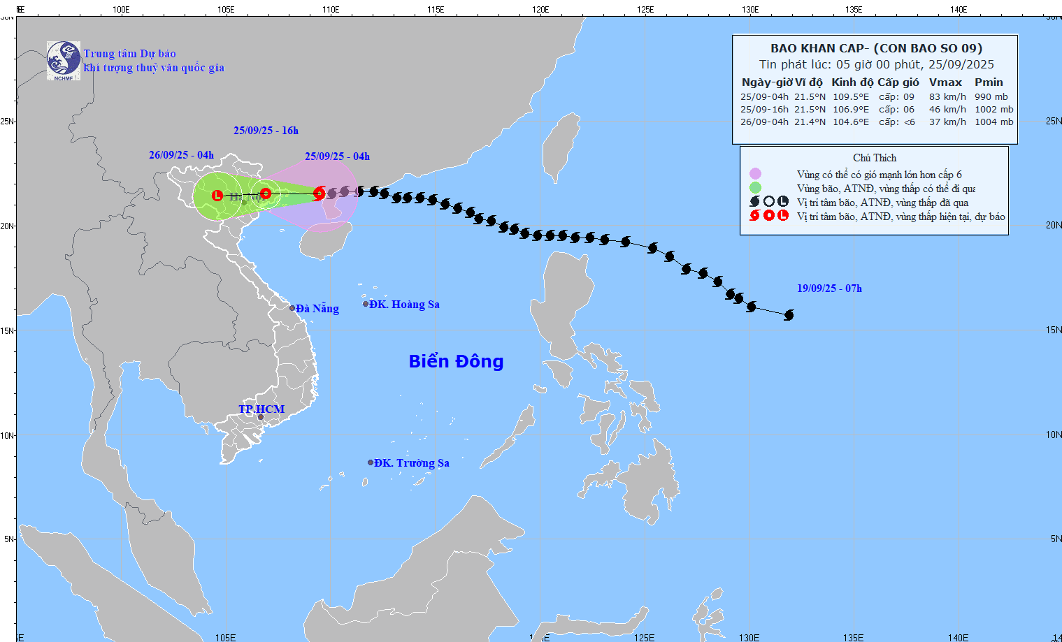
Updated position and path of storm No. 9 Ragasa at 5:00 a.m. on September 25. Source: National Center for Hydro-Meteorological Forecasting
At 4:00 a.m. on September 26, the center of the low pressure area was at about 21.4 degrees north latitude; 104.6 degrees east longitude, on the mainland in the northwest region of the North. Intensity below level 6.
According to Mr. Hoang Phuc Lam - Deputy Director of the National Center for Hydro-Meteorological Forecasting, regarding the impact of the storm at sea, the northwest sea area of the North East Sea has strong winds of level 6-8, gusts of level 10, waves 3-5 m high, and rough seas.
The northern area of Bac Bo Gulf, including Bach Long Vi, Van Don, Co To, Cat Hai and Hon Dau Island, has strong winds of level 6-7, waves 2-3 m high, near the storm center level 8-9, gusts of level 11, waves 3-4 m high, very rough seas. Boats and aquaculture areas in the danger zone are strongly affected by strong winds, high waves and storm surges.
On land, along the coast from Quang Ninh to Hai Phong, winds will gradually increase to level 6-7, near the storm center level 8, gusting to level 9-10. Inland areas in the Northeast, winds will increase to level 5, in some places level 6, gusting to level 7-8.
According to Mr. Lam, From early morning of September 25 to the end of the night of September 26, in the Northern region, Thanh Hoa and Nghe An, there will be heavy to very heavy rain with common rainfall of 150-300 mm, locally over 450 mm in some places, with the risk of urban flooding.
"Special attention should be paid to the eastern slopes of the Hoang Lien Son range, where the two old provinces of Lao Cai and Yen Bai will experience heavy to very heavy rain during this period. The rain will last until the night of September 26, with peak rain during the day and night of September 25," Mr. Lam emphasized.
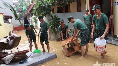
Regarding the hydrological situation, from September 25 to September 27, floods are likely to occur on rivers in the Northern region, Thanh Hoa and Nghe An. The flood peak on the Thao River and small rivers is likely to reach alert levels 2-3; on the Lo River, the upper reaches of the Thai Binh River, the Hoang Long River, the Buoi River, and the upper reaches of the Ma River are at alert levels 1-2, with some rivers above alert level 2. Heavy rains can cause flooding in low-lying areas, flash floods in small rivers and streams, and landslides in mountainous areas.
Due to the influence of the wide storm circulation, it is necessary to guard against the risk of thunderstorms, tornadoes and strong gusts of wind both before and during the storm's landfall.
According to Lao Dong Newspaper
Source: https://baotuyenquang.com.vn/xa-hoi/202509/trua-nay-bao-so-9-ragasa-do-bo-gay-mua-to-gio-manh-cao-diem-trong-ngay-259-3b06642/

![[Photo] Prime Minister Pham Minh Chinh chairs a meeting of the Government Standing Committee on overcoming the consequences of natural disasters after storm No. 11](https://vphoto.vietnam.vn/thumb/1200x675/vietnam/resource/IMAGE/2025/10/09/1759997894015_dsc-0591-jpg.webp)


![[Photo] Prime Minister Pham Minh Chinh chairs the Conference to deploy the National Target Program on Drug Prevention and Control until 2030](https://vphoto.vietnam.vn/thumb/1200x675/vietnam/resource/IMAGE/2025/10/09/1759990393779_dsc-0495-jpg.webp)


Comment (0)