
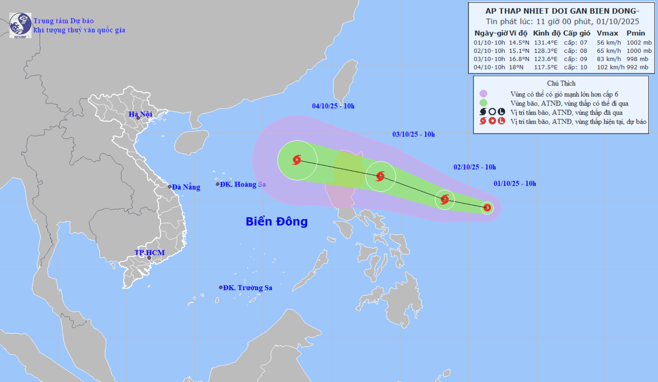
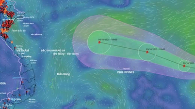
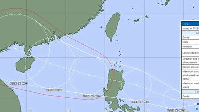
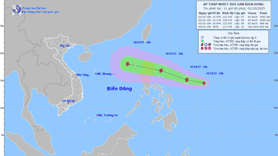
Forecast of the path of the tropical depression that could become storm No. 11 - Photo: National Center for Hydro-Meteorological Forecasting
The National Center for Hydro-Meteorological Forecasting said this morning, a tropical depression is in the sea east of Luzon Island. The strongest wind near the center of the tropical depression is level 6-7 (39-61km/h), gusting to level 9.
The tropical depression is moving west-northwest at a speed of about 15km/h.
In the next 24 hours, this pattern will keep the west-northwest direction at a speed of about 15km/h, and is likely to strengthen into a storm before making landfall in the Philippines.
After that, the storm moved mainly in the west-northwest direction, traveling 25-30km per hour and entered the East Sea as storm number 11 and continued to strengthen.
The speed of movement of tropical depressions when they become storms is also quite fast. Normally, the average speed of storms is about 15-20km. However, the difference is that storm Bualoi has a speed twice as fast as normal, now it is forecasted that the storm that is about to form will also have a fast speed.
From October 3, the sea area east of the northern East Sea will have winds gradually increasing to level 6-7, near the storm center will be level 8, gusting to level 10. Waves will be 2.5-4.5m high, with rough seas.
Between October 4 and 6, the northern East Sea area (including Hoang Sa special zone) is likely to be affected by strong winds of level 10-11, gusting to level 14.
Vessels operating in the above mentioned dangerous areas are susceptible to the impact of storms, whirlwinds, strong winds and large waves.
Regarding the possibility of landfall in our country, the meteorological agency is closely monitoring, people need to pay attention to the latest forecasts.
Tuoitre.vn
Source: https://tuoitre.vn/ap-thap-nhiet-doi-nguy-co-thanh-bao-so-11-cuoi-tuan-nay-2025100112320442.htm
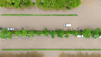
![[Photo] Hanoi morning of October 1: Prolonged flooding, people wade to work](https://vphoto.vietnam.vn/thumb/1200x675/vietnam/resource/IMAGE/2025/10/1/189be28938e3493fa26b2938efa2059e)


![[Photo] Panorama of the cable-stayed bridge, the final bottleneck of the Ben Luc-Long Thanh expressway](https://vphoto.vietnam.vn/thumb/1200x675/vietnam/resource/IMAGE/2025/9/30/391fdf21025541d6b2f092e49a17243f)


Comment (0)