
 |
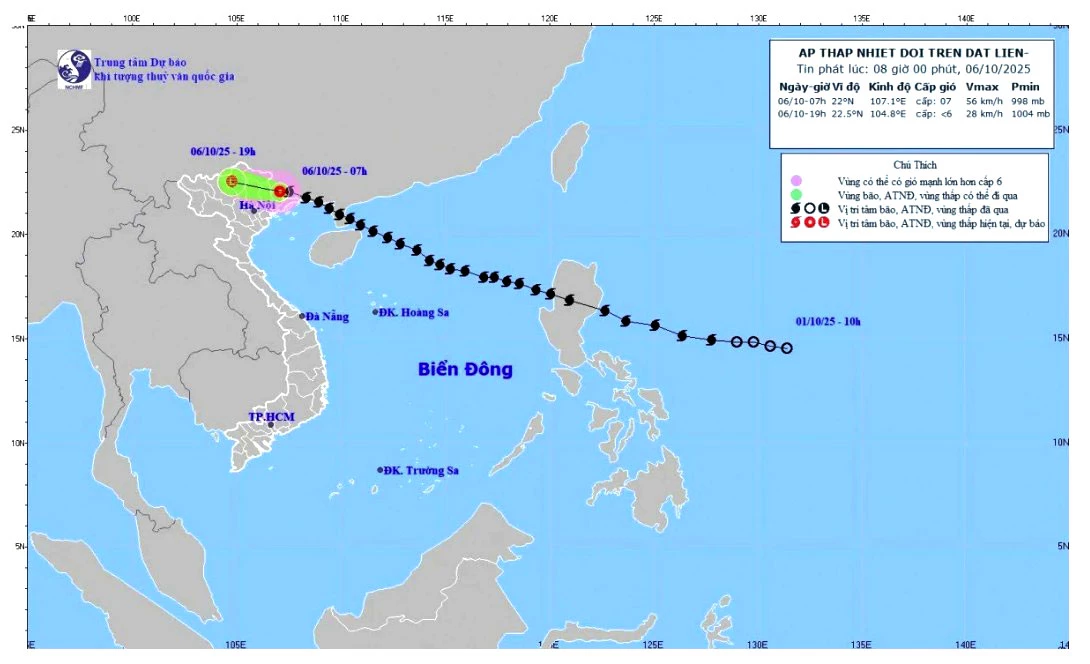
| The path of storm No. 11, later turning into a tropical depression |
Forecast for the next 12 hours
At 7:00 p.m. on October 6, the tropical depression moved in the West-Northwest direction at a speed of 20-25 km/hour, expected to enter the mountainous region of the North and weaken into a low pressure area with an intensity below level 6.
The danger zone is identified as the area north of latitude 20.0 degrees North and west of longitude 109.0 degrees East. The natural disaster risk level is warned at level 3 for the area north of the Gulf of Tonkin, the mainland of Quang Ninh and Lang Son provinces.
Forecasted impact of tropical depression
At sea:
This morning (October 6), the Northern Gulf of Tonkin area (including Bach Long Vi special zone) has strong winds of level 6, gusts of level 8, waves 2.0-3.0m high, rough seas (dangerous for ships).
On land:
This morning (October 6), on land in Quang Ninh and Lang Son areas, there are strong winds of level 5, in some places level 6, gusting to level 7-8.
Forecast of storm impact on Tuyen Quang province:
Heavy rain: From the morning of October 6 to the morning of October 8, Tuyen Quang province will have heavy to very heavy rain and scattered thunderstorms. Rainfall is generally from 100-200mm/period, in some places over 300mm/period. Warning of heavy rain intensity >100mm/3 hours.
Thunderstorms, tornadoes: Due to the influence of wide storm circulation, it is necessary to take precautions against the risk of thunderstorms, tornadoes, lightning and strong gusts of wind both before and during the storm's landfall.
Source: https://baotuyenquang.com.vn/xa-hoi/202510/ap-thap-nhiet-doi-suy-yeu-tu-bao-so-11-gay-mua-lon-tren-dia-ban-tinh-6d1285b/


Comment (0)