

Strong winds, rain up to 400mm
According to Mr. Mai Van Khiem, Director of the National Center for Hydro-Meteorological Forecasting, on the evening of October 5, storm No. 11 entered the northeastern sea area of the Northern Gulf of Tonkin with level 12, gusting to level 15. Updated to 10:00 p.m. on October 5, the center of the storm was at coordinates of about 21.5 degrees North latitude - 109.1 degrees East longitude, located in the area of Beihai City (Bac Hai) of Guangxi Province (China).
At this time, the storm is still at level 11-12, moving at a speed of about 20-25km/hour. The main direction of the storm is West - Northwest, deep into the interior of Guangxi province (China) and then approaching the northern border of Vietnam (Lang Son - Cao Bang area).
The National Center for Hydro-Meteorological Forecasting predicts that from the night of October 5 to noon on October 6, coastal areas from Quang Ninh to Hung Yen and Lang Son province will have winds gradually increasing to level 6-7, areas near the storm's eye will have winds of level 8-9, gusting to level 11-12. Inland areas in the Northeast region, there will be strong winds of level 4-5, in some places level 6, gusting to level 7-8.
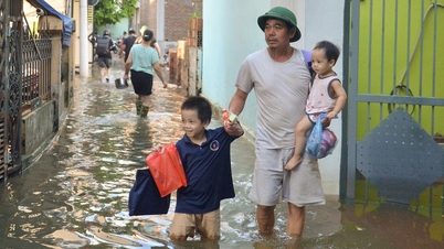
The Department of Dyke Management and Natural Disaster Prevention (Ministry of Agriculture and Environment) said that from the night of October 5 to the end of October 7, the mountainous and midland areas of the North will have widespread rain of 150-250mm, in some places over 400mm; the Northern Delta and Thanh Hoa will have rain of 70-150mm, in some places over 200mm.
To cope with the storm, the local border guards have notified and instructed nearly 68,000 vehicles with more than 292,000 workers to proactively take shelter from the storm. Quang Ninh, Hai Phong, Hung Yen and Ninh Binh have issued a sea ban.
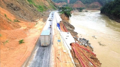
Several large hydroelectric reservoirs in the North, such as Hoa Binh, Thac Ba, and Tuyen Quang, are operating to release water to accommodate floods. Sea dykes from Quang Ninh to Ha Tinh are being inspected and reinforced by local authorities to ensure safety when storms make landfall.
Typhoon Matmo made landfall in southern China on October 5, bringing strong winds and heavy rains to large areas in Guangdong Province and Hainan Island. Hundreds of flights and many outdoor events in Hainan, a popular tourist destination during China's National Day holiday, were canceled to ensure safety.
According to CNA, the China National Meteorological Center forecast that when approaching the coast, Typhoon Matmo will reach winds of 151 km/h, gusts of over 170 km/h, and make landfall in Xuwen County, Guangdong Province at 2:50 p.m. Local authorities said about 300,000 people in Guangdong and Hainan have been evacuated from coastal areas.

Encourage online working
On October 5, the National Civil Defense Steering Committee issued a dispatch requesting northern provinces and relevant ministries and branches to strictly implement measures to respond to storm No. 11.
The telegram requires localities: Quang Ninh, Hai Phong, Hung Yen, Ninh Binh, Bac Ninh, Lang Son, Cao Bang, Lao Cai, Lai Chau, Dien Bien, Thai Nguyen, Tuyen Quang, Phu Tho and Hanoi to closely monitor the storm's developments, proactively evacuate people in dangerous areas, prohibit ships from going to sea, and ensure safety for coastal tourist areas and essential infrastructure. The Chairman of the People's Committee of the provinces and cities has the right to decide to let students stay home from school or temporarily suspend production in areas at high risk of being severely affected by the storm.
On the same day, Chairman of Hanoi People's Committee Tran Sy Thanh issued an official dispatch directing departments, branches, sectors, units and localities of the city to have plans and solutions to respond decisively, proactively, promptly and effectively to storm No. 11.
In the dispatch, Hanoi leaders encouraged agencies and organizations in the area to arrange for officials, civil servants, public employees and workers to work online on Monday (October 6) to avoid storms.
At the same time, the Chairman of the Hanoi People's Committee requested the Director of the Hanoi Department of Education and Training to direct inspections and be ready to deploy plans to ensure safety for teachers and students, school facilities and classrooms in the city when natural disasters occur; based on the developments of rain, storms and floods in the area, proactively direct students at all levels to stay home from school to ensure safety for students and teachers.
In Quang Ninh province, the Department of Education and Training has instructed schools to suspend in-person teaching or switch to online learning during the storm. In Hai Phong, the Department of Education and Training has also requested educational institutions to decide for themselves whether to let students stay home from school and to specifically notify parents. In Ninh Binh province, the Department of Education and Training has issued an official dispatch instructing schools to proactively let children and students stay home when there are strong winds, heavy rains, floods or landslides...
It is estimated that more than 3.4 million students in the above localities will be off school on October 6 to avoid storm No. 11.
5 Northern airports may be affected
On October 5, the Civil Aviation Authority of Vietnam said that according to the assessment of the path of storm No. 11, Cat Bi and Van Don international airports will be directly affected.
At the same time, Noi Bai and Vinh international airports and Tho Xuan airport are forecast to be affected and need to be ready to respond when the storm moves abnormally. Airlines are required to closely monitor weather developments in the storm-affected areas and adjust or change flight schedules accordingly.
Source: https://www.sggp.org.vn/bao-so-11-do-bo-mien-bac-hon-34-trieu-hoc-sinh-nghi-hoc-ngay-6-10-post816506.html


Comment (0)