
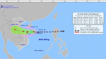
According to the National Center for Hydro-Meteorological Forecasting, at 7:00 a.m. on October 7, the center of the storm was located at about 21.1 degrees North latitude; 115.4 degrees East longitude, about 180km southeast of Hong Kong (China). The strongest wind near the center of the storm was level 13 (134-149km/h), gusting to level 16, moving slowly westward at a speed of about 5km/h.
Forecast at 7am on October 8, storm No. 4 is about 140km south of Hong Kong (China), the strongest wind near the storm center is level 12, gusting to level 15, moving west, speed about 5km/h.
At 7:00 a.m. on October 9, the storm was about 230km southwest of Hong Kong (China), with the strongest wind near the storm's center at level 9-10, gusting to level 13, moving west-southwest at about 5km per hour and gradually weakening.
At 7:00 a.m. on October 10, the storm on the eastern coastal area of Leizhou Peninsula (China), the strongest wind near the storm center was level 8, gusting to level 10, continuing to move in the West Southwest direction, speed of about 10km/h and continuing to weaken.
From the next 72 to 96 hours, the storm will move mainly in the West Southwest direction, about 10km per hour, weakening into a tropical depression and then into a low pressure area.
The National Center for Hydro-Meteorological Forecasting said that in the next 24 to 48 hours, the northern sea area of the North East Sea will have strong winds of level 7-10, the area near the eye of the storm will have strong winds of level 11-13, gusting to level 16; the sea will be rough. All vessels operating in this area will be affected by strong storm winds. The North East Sea area will have waves of 2-4m high, the northern sea area will have waves of 4-6m high, the area near the eye of the storm will have waves of 7-9m high.
Source


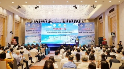
![[Photo] Opening of the 13th Conference of the 13th Party Central Committee](https://vphoto.vietnam.vn/thumb/1200x675/vietnam/resource/IMAGE/2025/10/6/d4b269e6c4b64696af775925cb608560)


Comment (0)