
This afternoon (September 6), Mr. Mai Van Khiem, Director of the National Center for Hydro-Meteorological Forecasting, informed about the developments of storm No. 7 that has just formed in the East Sea.
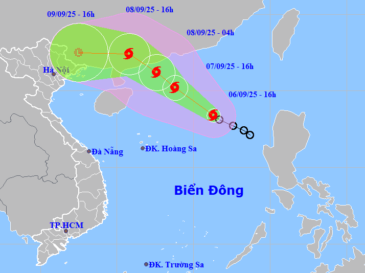
Accordingly, at 4:00 p.m., the center of storm No. 7 (Tapah) was located in the northeastern sea of the East Sea with the strongest wind at level 8 (62-74 km/h), gusting to level 10; moving northwest at a speed of 15 km/h.
Forecast in the next 24 hours, the storm will continue to move northwest, speed 10-15km/h and continue to strengthen. By 4pm tomorrow (September 7), the center of the storm will be about 420km northeast of Hoang Sa archipelago with strong winds of level 9-10, gusting to level 12. Disaster risk level: level 3, northern waters of the East Sea.
In the next 12 hours, the storm maintained its direction, speed of movement and intensified. At 4:00 a.m. on September 8, the center of the storm was about 110km south-southeast of Hong Kong (China) with strong winds of level 10, gusts of level 13. Disaster risk level: level 3, northwest sea area of the East Sea.
At 4:00 p.m. the same day, the storm continued to move northwest at a speed of about 15 km/h and gradually weakened; located on the mainland of Guangdong province (China); strong winds level 9, gusts level 12. Disaster risk level: level 3, northwest sea area of the East Sea.
In the next 24 hours, the storm will move mainly westward at a speed of about 15km/h, weakening into a tropical depression, then a low pressure area over the mainland of Guangxi province (China); intensity below level 6.
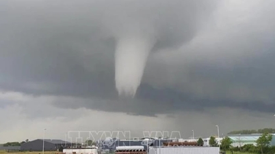
The National Center for Hydro-Meteorological Forecasting said that after making landfall in China, storm No. 7 will quickly weaken into a low pressure area, but then drift westward towards our country.
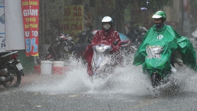
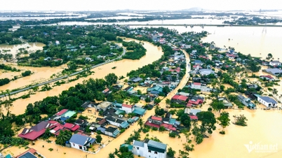
Therefore, the post-storm circulation No. 7 will cause a widespread heavy rain in the North from the afternoon and night of September 9-11, focusing on the midland and mountainous areas of the Northeast.
Due to the storm's influence, the northeastern sea area of the East Sea has strong winds of level 6-7, later increasing to level 7-8; the area near the storm's center has strong winds of level 9-10, gusting to level 13. Waves are 3-5m high, and the sea is very rough. Ships operating in the danger zone are likely to be affected by storms, whirlwinds, strong winds, and large waves.
PVSource: https://baohaiphong.vn/bao-so-7-da-hinh-thanh-tren-bien-dong-kha-nang-tiep-tuc-manh-them-520104.html


![[Photo] Solemn opening of the 12th Military Party Congress for the 2025-2030 term](https://vphoto.vietnam.vn/thumb/1200x675/vietnam/resource/IMAGE/2025/9/30/2cd383b3130d41a1a4b5ace0d5eb989d)
![[Photo] President Luong Cuong receives President of the Cuban National Assembly Esteban Lazo Hernandez](https://vphoto.vietnam.vn/thumb/1200x675/vietnam/resource/IMAGE/2025/9/30/4d38932911c24f6ea1936252bd5427fa)
![[Photo] The 1st Congress of Phu Tho Provincial Party Committee, term 2025-2030](https://vphoto.vietnam.vn/thumb/1200x675/vietnam/resource/IMAGE/2025/9/30/1507da06216649bba8a1ce6251816820)
![[Photo] Panorama of the cable-stayed bridge, the final bottleneck of the Ben Luc-Long Thanh expressway](https://vphoto.vietnam.vn/thumb/1200x675/vietnam/resource/IMAGE/2025/9/30/391fdf21025541d6b2f092e49a17243f)


Comment (0)