
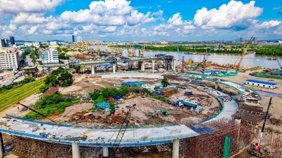
On August 12 , at the special session of the People's Council of Da Nang City, delegates voted unanimously to approve the proposal of the City People's Committee on reviewing and deciding on the zoning plan for the construction of the tourist area along National Highway 14G , in the western ecological zone, at a scale of 1/2,000.
According to the report, the People's Committee of Da Nang City assigned the Management Board of Investment Projects for Construction of Traffic and Agricultural Works to organize the planning; the Institute of Rural Development Planning - Central Sub-Institute of Urban and Rural Planning is the consulting unit for the project.
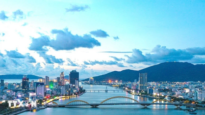
The tourist area construction area is located along National Highway 14G in Hoa Vang Commune, Da Nang City . The North and South border the mountainous area in Hoa Vang Commune; the East and West border National Highway 14G. The project scale is about 339 hectares .
Da Nang orients this as a limited-development ecological subdivision , based on biodiversity and natural landscape, to ensure sustainable development.

Along National Highway 14G, a number of tourist areas have been formed that attract visitors thanks to their natural landscapes.
This area will form adventure and eco-tourism attractions to serve the people and tourists; develop resorts, explore, and take advantage of available natural conditions.
In addition, develop eco-tourism - picnicking along National Highway 14G, connecting with existing tourist areas such as Nui Than Tai Hot Spring Park, Lai Thieu Tourist Area, Hoa Phu Thanh Tourist Area, Suoi Hoa Tourist Area .
The basic population target of the subdivision is about 1,000 people . Regarding traffic, National Highway 14G is a regional route passing through the project, with a proposed cross-section of 42.5 m . However, National Highway 14G is not within the planning boundary.
Functional zones in the land use structure are formed based on the foundation of existing tourist areas.
In addition, the project also has a common public service area with the function of displaying, exhibiting, shopping and enjoying OCOP products; at the same time, it is a place to exchange and trade agricultural products to serve the community and tourists.
National Highway 14G is a vital traffic route connecting the center of Da Nang City with the areas of Tay Giang and Dong Giang districts of Quang Nam Province in the past. The route starts from Hoa Bac commune (now Hoa Vang commune) and ends at Prao town, Dong Giang district (now Dong Giang commune, also in Da Nang City).
Along the route are sites with rich eco-tourism potential, with primeval forests, streams and waterfalls. National Highway 14G not only meets travel needs but also creates momentum to promote trade between the mountains and the plains.
Source: https://nld.com.vn/da-nang-phe-duyet-quy-hoach-khu-du-lich-sinh-thai-hon-300-ha-doc-quoc-lo-14g-196250812122125272.htm


![[Photo] Discover unique experiences at the first World Cultural Festival](https://vphoto.vietnam.vn/thumb/1200x675/vietnam/resource/IMAGE/2025/10/11/1760198064937_le-hoi-van-hoa-4199-3623-jpg.webp)


![[Photo] General Secretary attends the parade to celebrate the 80th anniversary of the founding of the Korean Workers' Party](https://vphoto.vietnam.vn/thumb/1200x675/vietnam/resource/IMAGE/2025/10/11/1760150039564_vna-potal-tong-bi-thu-du-le-duyet-binh-ky-niem-80-nam-thanh-lap-dang-lao-dong-trieu-tien-8331994-jpg.webp)


Comment (0)