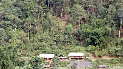
Implementing the plan of the Provincial People's Committee, the District Steering Committee regularly directs and urges members, the Land and Forest Allocation Council, and the People's Committees of communes and towns to strengthen the implementation of land and forest allocation. In August 2023, for forested forestry land, the district organized inspections and reviews of records and procedures related to the issuance of 718 land use right certificates to 116 communities and 569 households and individuals in 14 communes and towns. After that, the members of the working group appraised and submitted them to the District People's Committee for signing and promulgation to ensure compliance with regulations. For the forested land area expected to be assigned to the People's Committees of communes and towns for management and protection, the Department of Natural Resources and Environment sent documents with maps to 12/14 communes. For communes with small areas such as Muong Luan (3.65ha), Chieng So (8.59ha), no plan was made to assign the commune to manage. For non-forested forestry land, from July 20 to July 31, Dien Bien Dong district conducted field measurements and determined 123.48 hectares. From July 31 to August 18, due to the impact of prolonged heavy rain, working groups presented maps and signed the boundaries of Chieng So, Luan Gioi, Hang Lia communes, and Dien Bien Dong town.
Up to now, Dien Bien Dong district has measured and determined the forestry land area to reach 42,817.74 hectares. For forestry land with forest, the total area assigned and measured is 4,176.16 hectares (of which, 466.34 hectares have been allocated and granted land use right certificates; 2,809.82 hectares are being completed; the area for developing plans to be assigned to the People's Committees of communes and towns for management is 900 hectares). Currently, Dien Bien Dong district is proposing the Provincial People's Committee, the Department of Natural Resources and Environment, and the Department of Agriculture and Rural Development to adjust Plan No. 2783/KH-UBND dated September 20, 2019 of the Provincial People's Committee, in which the forested forestry area is adjusted from 7,777.3 hectares to 4,176.16 hectares. The area that has not been measured or allocated is 3,601.14 hectares. The reason is that most of the area has been granted land use right certificates for growing other annual crops under the 2013 forest land planning in Dien Bien Dong town and Na Son commune. Some areas do not have enough reserves to allocate land and forest. The area is fragmented and small, under 3,000 square meters, not contiguous plots or plots.
For non-forested forestry land, the field survey and determination is 38,641.58 ha/45,712.31 ha, reaching 84.53% of the assigned plan. Specifically, in Muong Luan commune, the Department of Natural Resources and Environment has completed the map appraisal; the Department of Natural Resources and Environment, the consulting unit is carrying out internal work. At the same time, map editing and internal work are being carried out for the communes: Hang Lia, Chieng So, Luan Gioi, Noong U, Dien Bien Dong town, Na Son, Phi Nhu, Xa Dung, Pu Hong, Pu Nhi to transfer to the Department of Natural Resources and Environment for appraisal and approval.
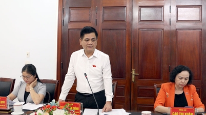
Mr. Nguyen Thanh Lam, Head of the Department of Natural Resources and Environment of Dien Bien Dong district, said: In the coming time, the district will continue to direct the consulting unit to speed up the progress of surveying for communes with large areas that have not been surveyed such as Tia Dinh, Keo Lom, Phinh Giang. At the same time, focus on human resources to edit maps and carry out internal work for communes that have completed surveying. In addition, check and compare with the area inside and outside the planning of 3 types of forests, the measured macadamia area, the area of cadastral survey in the planning of 3 types of forests, compare with the implemented works and projects, individual measurement plots of people... to avoid overlap. Strive to complete the issuance of forest land use right certificates without forests by the end of 2023.
Source


![[Photo] Prime Minister Pham Minh Chinh chairs the 16th meeting of the National Steering Committee on combating illegal fishing.](https://vphoto.vietnam.vn/thumb/1200x675/vietnam/resource/IMAGE/2025/10/07/1759848378556_dsc-9253-jpg.webp)


![[Photo] Super harvest moon shines brightly on Mid-Autumn Festival night around the world](https://vphoto.vietnam.vn/thumb/1200x675/vietnam/resource/IMAGE/2025/10/07/1759816565798_1759814567021-jpg.webp)


Comment (0)