
El Nino is likely to recede soon, signaling a rapid transition to the opposite climate and ocean pattern, La Nina.
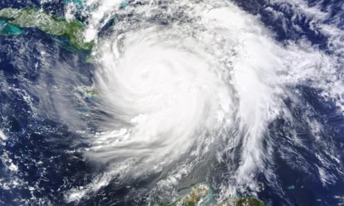
La Nina can lead to powerful Atlantic hurricanes like Hurricane Matthew, which hit Haiti in 2016. Photo: NASA
The shift from El Nino to La Nina brings the risk of major hurricanes in the Atlantic and drier-than-normal weather in the southern United States. Globally, La Nina typically brings cooler temperatures, but before its impact, 2024 will be among the top five hottest years on record, according to Tom Di Liberto, a scientist at the National Oceanic and Atmospheric Administration (NOAA). "All signs point to 2024 being a hot year," Di Liberto told Live Science on April 20.
El Niño and La Niña describe opposing patterns in the trade winds that move around the equator, blowing westward from South America to Asia. In neutral years, when neither pattern is in play, the trade winds push warm water westward, replacing it with colder ocean water from deep water. During El Niño, the trade winds weaken, so the eastern Pacific Ocean, along with the western coasts of North America and South America, gets warmer. As a result, the jet stream moves southward, leaving Canada and the northern United States dry but bringing more moisture to southern parts of the United States, according to NOAA.
During a La Niña year, trade winds strengthen, pushing warm water toward Asia and increasing the upwelling of cold water off the Pacific coast of the Americas. The jet stream moves northward, causing drought in the southwest and southeast of the United States and bringing wetter weather to the northwest and Great Lakes.
El Niño officially begins in June 2023, but NOAA's Climate Prediction Center reports that the climate pattern is weakening, with an 85% chance of transitioning to a neutral phase before June. After that, La Niña will return, with a 60% chance of occurring between June and August, according to the National Centers for Environmental Prediction. "For an El Niño this strong, it's not uncommon for an event like this to end and transition to La Niña so quickly," Di Liberto said.
Current ocean measurements show warm surface temperatures in the Pacific, but colder-than-average water below. As the cold water rises to the surface, the transition will happen quickly. The transition from El Niño to La Niña raises the risk of a strong hurricane season ahead, says Alex DesRosiers, a PhD student in atmospheric sciences at the University of Colorado. During El Niño, heat rises from the eastern Pacific into the upper atmosphere, leading to stronger winds at high altitudes. This creates vertical wind shear, a difference in the speed and direction of winds at the surface versus in the atmosphere. Vertical wind shear can split storms as they form.
During La Nina, winds in the upper atmosphere are calmer, reducing wind shear and allowing larger storms to form through the convection of warm, moist air from the ocean surface. "As we transition to La Nina, the atmosphere becomes more favorable for storms to form and intensify," DesRosiers said.
Influenced by the upcoming La Niña event and the current extremely warm Atlantic surface temperatures, the CSU Tropical Weather and Climate Research Group is predicting a very active Atlantic hurricane season, estimating 23 named storms (above the average of 14.4) and five Category 3 or higher hurricanes. This year could resemble 2010 and 2020, both of which had active hurricane seasons, although it is uncertain whether the strong storms will affect land.
An Khang (According to Live Science )
Source link

![[Photo] Binh Trieu 1 Bridge has been completed, raised by 1.1m, and will open to traffic at the end of November.](https://vphoto.vietnam.vn/thumb/1200x675/vietnam/resource/IMAGE/2025/10/2/a6549e2a3b5848a1ba76a1ded6141fae)


![[Infographics] Biography of Central Party Committee Member, An Giang Provincial Party Secretary Nguyen Tien Hai](https://vphoto.vietnam.vn/thumb/402x226/vietnam/resource/IMAGE/2025/10/3/92491af6e2714aeb80cb1cdf831eb18a)


Comment (0)