
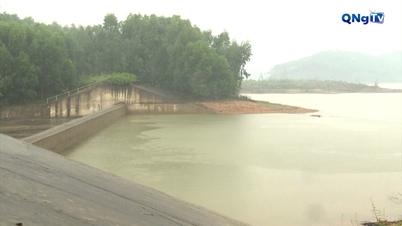
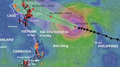
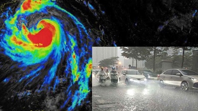
QNgTV- Storm No. 11 Matmo is likely to enter the area between Quang Ninh and Guangxi province (China). It is forecasted that from the morning of October 6-7, the Hanoi area will have moderate to heavy rain, and in some places very heavy rain, with common rainfall of 70-120mm, and in some places over 150mm.
According to the National Center for Hydro-Meteorological Forecasting, as of 1 p.m. this afternoon (October 4), the center of storm No. 11 Matmo was about 350 km east-northeast of Hoang Sa special zone. The strongest wind near the center of the storm was level 12 (118-133 km/h), gusting to level 15, up 1 level compared to this morning.
It is forecasted that in the next 24 hours, the storm will continue to move in a West Northwest direction and its intensity may increase to level 13.
From 7:00 p.m. on October 6 to 7:00 p.m. on October 7, the rain center narrowed and quickly moved to the West.
Specifically, from the night of October 5 to the end of the night of October 7, in the mountainous and midland areas of the North, there will be heavy rain, with common rainfall of 150-250mm, locally over 400mm, warning of the risk of rain with intensity greater than 150mm within 3 hours.
As the storm center moves north, there will be moderate to heavy rain in the Northern Delta and Thanh Hoa , with average rainfall of 70-150mm and locally over 200mm.
Hanoi weather is unlikely to be directly affected by storms. However, from early morning on October 6 to the end of October 7, there will be moderate to heavy rain, with average rainfall of 70-120mm, and in some places over 150mm.
The meteorological agency warned that heavy rain in a short period of time would overload the drainage system, causing flooding in residential areas, urban areas and low-lying areas, traffic jams due to flooded roads and reduced visibility when driving, causing slippery roads and traffic accidents...
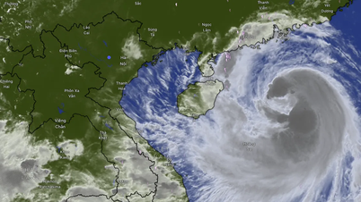
Storm No. 11 heads towards the Northeast region
Regarding the development of storm No. 11 Matmo, the meteorological agency said that in the next 24 hours, the storm will continue to move in the West-Northwest direction, at a speed of about 20-25 km/h and is likely to strengthen. By 10:00 tomorrow morning, the center of the storm will be in the sea east of Leizhou Peninsula (China); intensity level 13, gust level 16.
According to forecasts, after entering the Leizhou Peninsula (China), storm No. 11 will continue to maintain its direction of movement and may weaken in intensity. When entering the Quang Ninh - Hai Phong sea area around dawn on October 6, the storm will decrease to about level 9-10, gusting to level 12-13.
As of 10:00 a.m. on October 6, the storm's eye was located on the Vietnam-China border area; intensity level 8, gust level 10. Disaster risk level 3 in the Northwest region of the North East Sea, the North Gulf of Tonkin and coastal mainland areas from Quang Ninh to Hung Yen.
By 10 p.m. the same day, the storm in the northern mountainous region of the North had reduced its intensity to below level 6.
Due to the impact of storm No. 11, from the night of October 5, coastal areas from Quang Ninh to Hung Yen will have winds gradually increasing to level 6-7, and areas near the storm's eye will have winds of level 8-9 (winds can break tree branches, blow off roofs, cause damage to houses and hinder movement). Inland areas in the Northeast will have strong winds of level 4-5, in some places level 6, gusting to level 7-8.
At the same time, coastal areas and islands in Quang Ninh - Hai Phong provinces will have storm surges of 0.4-0.6m. Beware of flooding in low-lying coastal areas and river mouths due to surges and big waves from the afternoon and evening of October 5.
At sea, in the North East Sea area, there are strong winds of level 8-10, near the storm center level 11-13, gusts of level 16, waves 4-6m high, near the storm center 6-8m, very rough seas (extremely destructive, extremely strong waves, can sink large tonnage ships).
From the afternoon of October 5, the sea area east of the Northern Gulf of Tonkin (including Bach Long Vi special zone) has winds gradually increasing to level 6-7, then increasing to level 8-9.
From the evening of the same day, the Northern Gulf of Tonkin area (including Bach Long Vi, Van Don, Co To, Cat Hai and Hon Dau islands) will have stronger winds of level 8-9, waves of 2-4m high, areas near the storm's eye will have winds of level 10-11, gusts of level 14, waves of 3-5m high, and rough seas (very dangerous for ships).
The meteorological agency especially warned that due to the influence of the wide storm circulation, it is necessary to guard against the risk of thunderstorms, tornadoes and strong gusts of wind both before and during the storm's landfall.
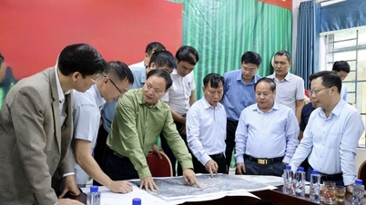
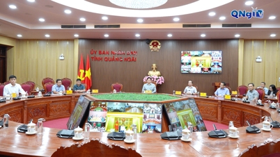
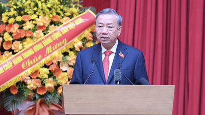
After listening to the reports and discussions from the units, Director Nguyen Thuong Hien requested clarification of issues such as the expected location of the storm, the scope of impact of the storm and tornado; requested central and local forecasting units to mobilize 200% of their forces to be ready for monitoring; coordinate with press and media agencies to strengthen the propaganda work of forecasting and warning about storm No. 11.
Source: https://quangngaitv.vn/bao-so-11-matmo-kha-nang-di-vao-quang-ninh-ha-noi-lieu-co-xay-ra-mua-lut-6508206.html

![[Photo] Solemn opening of the 8th Congress of the Central Public Security Party Committee, term 2025-2030](https://vphoto.vietnam.vn/thumb/1200x675/vietnam/resource/IMAGE/2025/10/4/f3b00fb779f44979809441a4dac5c7df)
![[Photo] Bustling Mid-Autumn Festival at the Museum of Ethnology](https://vphoto.vietnam.vn/thumb/1200x675/vietnam/resource/IMAGE/2025/10/4/da8d5927734d4ca58e3eced14bc435a3)

![[Photo] General Secretary To Lam attends the 8th Congress of the Central Public Security Party Committee](https://vphoto.vietnam.vn/thumb/1200x675/vietnam/resource/IMAGE/2025/10/4/79fadf490f674dc483794f2d955f6045)


![[VIDEO] Summary of Petrovietnam's 50th Anniversary Ceremony](https://vphoto.vietnam.vn/thumb/402x226/vietnam/resource/IMAGE/2025/10/4/abe133bdb8114793a16d4fe3e5bd0f12)
![[VIDEO] GENERAL SECRETARY TO LAM AWARDS PETROVIETNAM 8 GOLDEN WORDS: "PIONEER - EXCELLENT - SUSTAINABLE - GLOBAL"](https://vphoto.vietnam.vn/thumb/402x226/vietnam/resource/IMAGE/2025/7/23/c2fdb48863e846cfa9fb8e6ea9cf44e7)


Comment (0)