
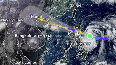
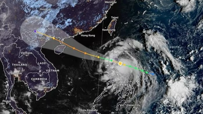
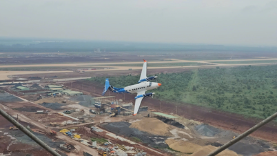
Regarding the current status of storm No. 2, according to the National Center for Hydro-Meteorological Forecasting, this morning (July 21), the tropical depression in the Hoang Sa archipelago has strengthened into a storm, storm No. 2 in 2024.
At 7:00 a.m., the eye of the storm was located at approximately 16.4 degrees North latitude; 111.4 degrees East longitude, in the waters of the Hoang Sa archipelago. The strongest wind near the eye of the storm was level 8 (62-74 km/h), gusting to level 10, moving in the West Northwest direction at a speed of 10-15 km/h.

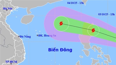
Direction of movement of storm No. 2. Source: nchmf.
Forecast, by 7am on July 22, storm No. 2 will move to the Northwest, speed 10-15 km/h, intensity level 8, gust level 10.
At 7:00 a.m. on July 23, storm No. 2 moved northwest at a speed of about 10 km/h, entered the Gulf of Tonkin and gradually weakened, at level 6-7, gusting to level 9.
At 7:00 a.m. on July 24, storm No. 2 moved northwest, gradually weakening into a low pressure area.
Forecast of storm impact number 2
At sea : The sea area west of the North and Central East Sea (including Hoang Sa archipelago), the sea area east of Quang Tri to Quang Ngai has strong winds of level 6-7, the area near the storm's eye has strong winds of level 8, gusts of level 10, rough seas.
The western sea area of the North and Central East Sea (including Hoang Sa archipelago), the eastern sea area from Quang Tri to Quang Ngai has waves 2.0-4.0m high, the area near the storm center has waves 3.0-5.0m high.
Source: https://danviet.vn/nong-bien-dong-co-con-bao-so-2-tac-dong-den-thoi-tiet-mien-bac-nhung-ngay-toi-ra-sao-20240721082713488.htm

![[Photo] Prime Minister Pham Minh Chinh launched a peak emulation campaign to achieve achievements in celebration of the 14th National Party Congress](https://vphoto.vietnam.vn/thumb/1200x675/vietnam/resource/IMAGE/2025/10/5/8869ec5cdbc740f58fbf2ae73f065076)


![[Photo] Bustling Mid-Autumn Festival at the Museum of Ethnology](https://vphoto.vietnam.vn/thumb/1200x675/vietnam/resource/IMAGE/2025/10/4/da8d5927734d4ca58e3eced14bc435a3)


![[VIDEO] Summary of Petrovietnam's 50th Anniversary Ceremony](https://vphoto.vietnam.vn/thumb/402x226/vietnam/resource/IMAGE/2025/10/4/abe133bdb8114793a16d4fe3e5bd0f12)

![[VIDEO] GENERAL SECRETARY TO LAM AWARDS PETROVIETNAM 8 GOLDEN WORDS: "PIONEER - EXCELLENT - SUSTAINABLE - GLOBAL"](https://vphoto.vietnam.vn/thumb/402x226/vietnam/resource/IMAGE/2025/7/23/c2fdb48863e846cfa9fb8e6ea9cf44e7)


Comment (0)