
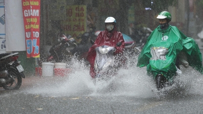
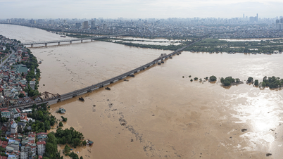
After many days of prolonged rain and thunderstorms, this morning, October 2, the atmosphere in Hanoi , Ho Chi Minh City and many places across the country has become much brighter. According to the National Center for Hydro-Meteorological Forecasting (NCHMF) and climate experts, today there will be little rain and a lot of sunshine across the country.
Only Ha Giang and the southern coast have localized showers in the morning, while in the afternoon, rain in the South and Central Highlands appears sporadically, with less intensity than on October 1.

According to forecasts from international applications such as Weather.com and AccuWeather, Hanoi will be dry, with only short-term thunderstorms at noon; Ho Chi Minh City will have some unseasonal rains but most of the time it will be sunny and cloudy. Global climate forecast models such as GFS (USA) and ECMWF (Europe) also give results: The North and Central regions will have a lot of sunshine until about October 5, while the South will have more rain from tomorrow afternoon, October 3.
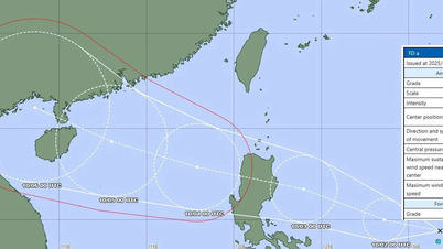
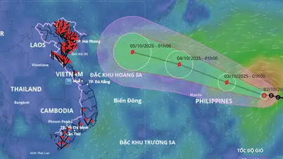
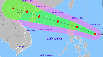
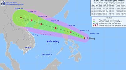
Forecasting the tropical depression currently active in the East of the Philippines, today, the Japan Meteorological Agency (JMA) and the US Joint Typhoon Warning Center (JTWC) both said that this tropical cyclone has a very high possibility of strengthening into a storm today, October 2.

According to the JMA forecast map, the storm's trajectory tends to tilt northward, heading straight towards the East Sea on the evening of October 3. JTWC believes that the storm will head towards the Leizhou Peninsula (China) and affect the Gulf of Tonkin with a high probability. NCHMF also forecasts according to this scenario and warns that the waters of the Gulf of Tonkin will have very dangerous weather in the coming days.

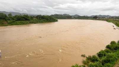
Thus, the weather in Hanoi, Ho Chi Minh City and many other places across the country will only improve temporarily before worsening again with the risk of rain, wind and floods reappearing. People in urban areas need to proactively prepare flood prevention plans early to avoid damage like the past few days. Fishermen in coastal areas of the North and Central regions need to closely monitor storm information entering the East Sea, not going out to sea and entering dangerous areas in the middle and North of the East Sea in the next few days.
According to the National Center for Hydro-Meteorological Forecasting, early in the morning of October 2, the center of the tropical depression was located at about 14.8 degrees North latitude - 129 degrees East longitude, off the eastern coast of the Philippines, with strong winds of level 7, gusts of level 9, moving West Northwest at about 15km/hour. The center forecasts that in the next 24 hours, the depression is likely to strengthen into a storm, by 1:00 a.m. on October 3 near Luzon Island (Philippines) with winds of level 8-9, gusts of level 10. After that, the storm will move faster, about 25km/hour, pass Luzon Island, enter the East Sea, strengthen to level 10, gusts above level 11.
Source: https://www.sggp.org.vn/ap-thap-nhiet-doi-dang-manh-len-thanh-bao-so-11-tien-vao-bien-dong-post815869.html


Comment (0)