
Latest news on storm No. 6 (storm Tra Mi): Mr. Nguyen Van Huong, Head of Weather Forecast Department, National Center for Hydro-Meteorological Forecasting, said that after passing north of Hoang Sa archipelago, storm No. 6 will weaken due to the impact of cold air.
Latest news on storm number 6 (storm Tra Mi)
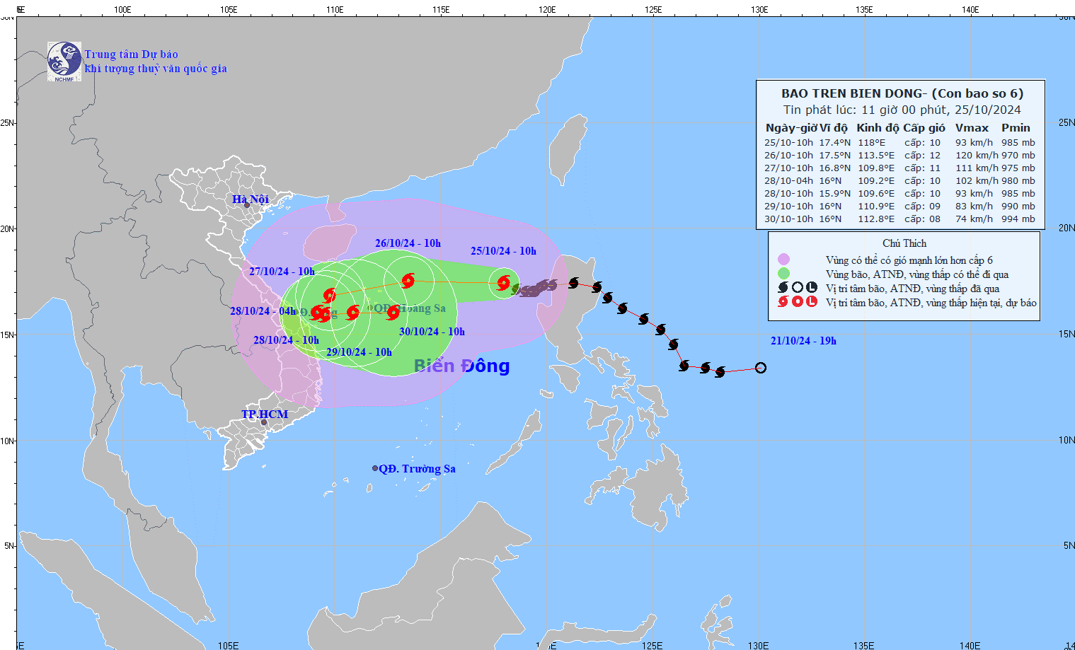
At 10:00 on October 25, the center of the storm was at about 17.4 degrees North latitude; 118.0 degrees East longitude, in the eastern sea of the North East Sea. The strongest wind near the center of the storm was level 10 (89-102 km/h), gusting to level 12. Moving in the West Northwest direction, speed about 15 km/h.
Forecast of storm No. 6 (storm Tra Mi) in the next 24 to 72 hours:
Forecast time | Direction, speed | Location | Intensity | Danger zone | Disaster Risk Level (Affected Area) |
10:00 a.m. October 26 | West, about 20km/h | 17.5N-113.5E; in the North East Sea area; about 160km northeast of Hoang Sa archipelago | Level 11-12, level 15 jerk | Latitude 15.0N-20.0N; East of longitude 111.5E | Level 3: North East Sea area (including Hoang Sa archipelago area) |
10:00 a.m. October 27 | West Southwest, about 15km/h | 16.8N-109.8E; in the western area of Hoang Sa archipelago, about 200km northeast of Quang Tri -Quang Ngai | Level 11, level 14 | Latitude 15.0N-20.0N; west of longitude 116.0E | Level 3: North East Sea area (including Hoang Sa archipelago area), offshore waters of Central Central Vietnam |
10:00 a.m. October 28 | Southwest, then Southeast 5-10km/h | 15.9N-109.6E; in the waters off the Central Central Coast | Level 10, level 12 | Latitude 14.5N-19.0N; West of longitude 112.5E | Level 3: West of the North East Sea area (including the area west of the Hoang Sa archipelago), the sea off the Central Central Coast |
Storm No. 6 warning from the next 72 to 120 hours: From the next 72 to 120 hours, the storm will move mainly to the East at 5-10km per hour, and its intensity will continue to weaken.
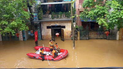
Impact of storm No. 6 (storm Tra Mi): In the North East Sea, strong winds level 8-9, near the storm's eye level 10-12 (89-133km/h), gusts level 15, waves 5.0-7.0m high, near the storm's eye 7.0-9.0m; rough seas.
Ships operating in the above-mentioned dangerous areas (especially in the Hoang Sa island district) are likely to be affected by storms, whirlwinds, strong winds, and big waves.
Storm No. 6 (Tra Mi storm) causes heavy rain
Regarding information about storm No. 6 at the morning meeting on October 25, Mr. Nguyen Van Huong, Head of Weather Forecast Department, National Center for Hydro-Meteorological Forecasting, said that after passing north of Hoang Sa archipelago, storm No. 6 will weaken due to the impact of cold air.
In addition, the path of storm No. 6 also changed direction. After passing the 110th parallel (near the mainland of Central Vietnam), storm No. 6 will turn out to sea, because a tropical depression will appear in the east of the Philippines and will strengthen into a storm and move north of Luzon Island (Philippines). Interaction from this new storm will cause storm No. 6 to weaken and move out.
"The storm's circulation is quite strong and wide, the convective cloud area is heading west, so the north and middle of the East Sea are affected by strong winds. From the afternoon of October 26, the Central Sea will start to have strong winds of level 6 - level 7, when the storm approaches, it will increase to level 8 - level 9," Mr. Huong informed.
Mr. Huong warned that from October 26 to 29, the storm circulation will cause heavy rain in the Central region, with a large area of rain from Ha Tinh to Phu Yen. In particular, the rain will be concentrated in Quang Tri - Quang Nam with rainfall of 200 - 300 mm.
Source: https://danviet.vn/khan-tin-bao-so-6-moi-nhat-bien-dong-rat-manh-ung-pho-hoan-luu-bao-rong-va-manh-gay-mua-lon-20241025113530015.htm
![[Photo] Students of Binh Minh Primary School enjoy the full moon festival, receiving the joys of childhood](https://vphoto.vietnam.vn/thumb/1200x675/vietnam/resource/IMAGE/2025/10/3/8cf8abef22fe4471be400a818912cb85)


![[Photo] Prime Minister Pham Minh Chinh chairs meeting to deploy overcoming consequences of storm No. 10](https://vphoto.vietnam.vn/thumb/1200x675/vietnam/resource/IMAGE/2025/10/3/544f420dcc844463898fcbef46247d16)


Comment (0)