
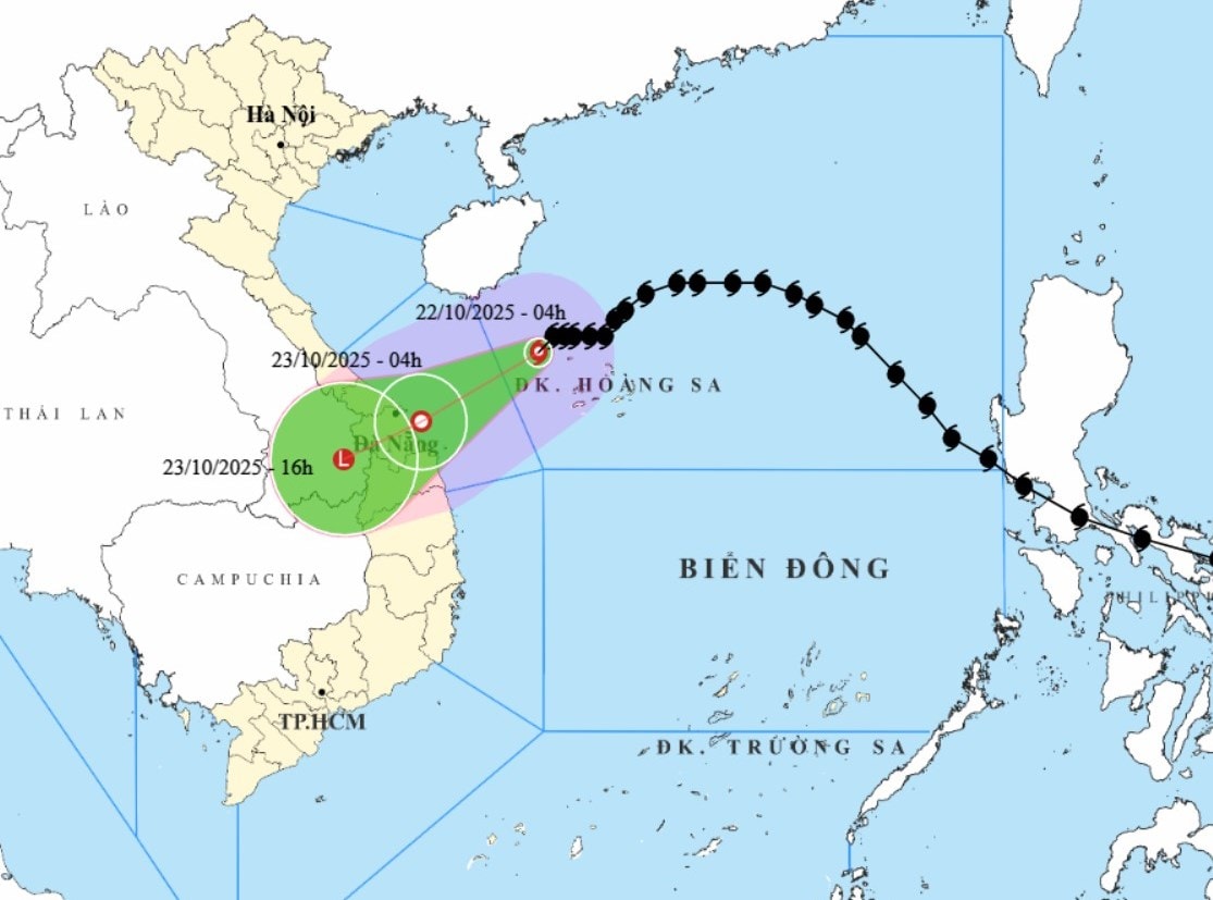
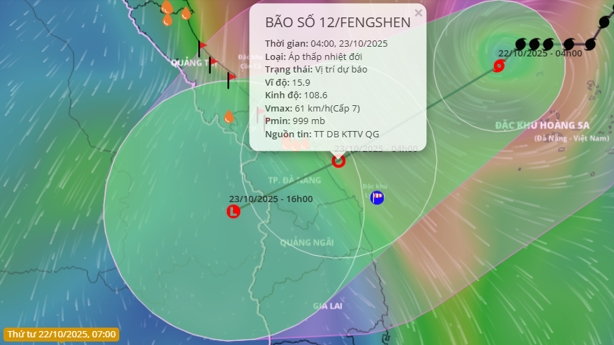
It is forecasted that in the next 3 hours, the storm will move west at a speed of about 10km/hour. After that, the storm will change direction to move mainly west-southwest at a speed of 10-15km/hour and gradually weaken into a tropical depression.
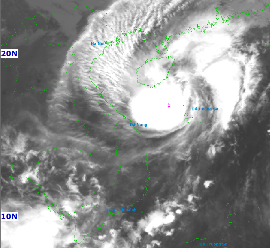
At 4:00 a.m. on October 23, the center of the tropical depression was at about 15.9 degrees north latitude, 108.6 degrees east longitude, on the coastal area from Hue to Quang Ngai with the strongest wind at level 7, gusting to level 9.
The storm continued to move west-southwest towards the mainland and continued to weaken into a low pressure area. At 4 p.m. on October 23, the center of the low pressure area was over southern Laos.
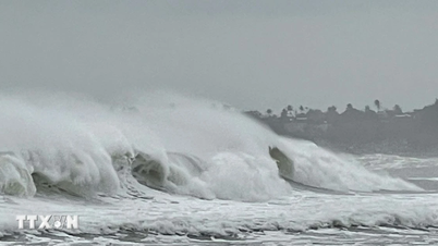
Due to the storm's influence, the western area of the North East Sea (including Hoang Sa special zone) has strong winds of level 7-8; the area near the storm's eye has strong winds of level 9-10, gusting to level 12; waves 3-5m high, the area near the storm's eye has waves of 5-7m high, and very rough seas.
The sea area from Quang Tri to Quang Ngai (including Con Co special zone, Cu Lao Cham island and Ly Son special zone) has strong winds of level 6-7, the area near the storm's eye has winds of level 8, gusts of level 10, waves 3-5m high, rough seas.
Coastal areas from Quang Tri to Da Nang have storm surges ranging from 0.4-0.8m high.
All ships and boats operating in dangerous areas at sea are susceptible to the effects of storms, whirlwinds, strong winds and large waves.
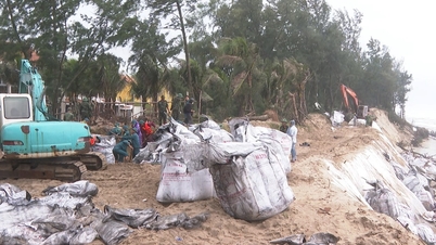
Coastal areas and river mouths from Quang Tri to Da Nang need to be on guard against big waves combined with high tides and wind-driven water surges causing flooding in low-lying areas, coastal roads, and coastal landslides.
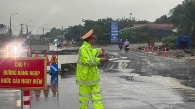
From the afternoon of October 22, on the mainland coastal provinces from Quang Tri to Da Nang, the wind will gradually increase to level 6, sometimes level 7, gusting to level 8-9.
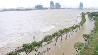
In addition, due to the influence of storm circulation and cold air combined with easterly wind disturbances and topographic effects, from noon on October 22 to October 27, the area from Ha Tinh to Quang Ngai will have widespread heavy rain (heavy rain concentrated from the afternoon of October 22 to the end of October 23).
Total rainfall in Ha Tinh to northern Quang Tri and Quang Ngai provinces is about 200-400mm, locally over 500mm; in the area from southern Quang Tri to Da Nang, it is generally 500-700mm, locally over 900mm.
Warning of rain intensity greater than 200mm in 3 hours. Beware of the risk of thunderstorms, tornadoes with strong gusts of wind in the storm circulation area, both before and during the storm's landfall.
Heavy rain in the Central region is likely to last until the end of October 2025.
High risk of flash floods and landslides in mountainous areas, flooding in low-lying and urban areas.
Localities need to pay attention to safely operating hydroelectric and irrigation reservoirs before, during and after the storm, and prepare response plans for flood scenarios on rivers from Quang Tri to Quang Ngai that could reach and exceed alert level 3.
Source: https://baodanang.vn/bao-co-kha-nang-suy-yeu-thanh-ap-thap-nhet-doi-truoc-khi-vao-ven-bien-3307959.html


![[Photo] Award Ceremony of the Political Contest on Protecting the Party's Ideological Foundation](https://vphoto.vietnam.vn/thumb/1200x675/vietnam/resource/IMAGE/2025/10/22/1761151665557_giaia-jpg.webp)
![[Photo] Da Nang: Shock forces protect people's lives and property from natural disasters](https://vphoto.vietnam.vn/thumb/1200x675/vietnam/resource/IMAGE/2025/10/22/1761145662726_ndo_tr_z7144555003331-7912dd3d47479764c3df11043a705f22-3095-jpg.webp)

![[Photo] Prime Minister Pham Minh Chinh chairs meeting on nuclear power plant construction](https://vphoto.vietnam.vn/thumb/1200x675/vietnam/resource/IMAGE/2025/10/22/1761137852450_dsc-9299-jpg.webp)


Comment (0)