
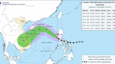
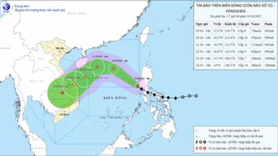
According to the National Center for Hydro-Meteorological Forecasting, on the afternoon of October 19, storm Fengshen entered the eastern sea area of the North East Sea, becoming storm number 12 in 2025. At 4:00 p.m., the center of the storm was at about 15.2°N - 119.7°E, with the strongest wind at level 9 (75-88 km/h), gusting to level 11, moving northwest at 20-25 km/h.
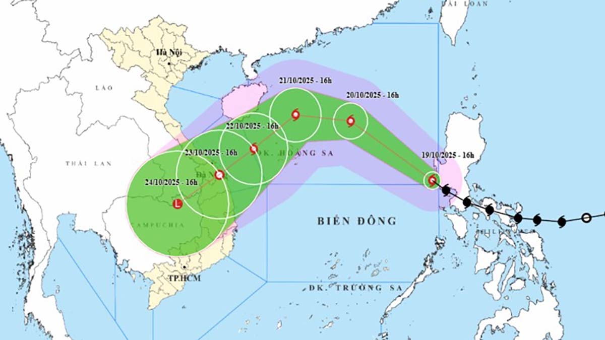
Forecast until 4pm on October 20, the storm will move Northwest at 20-25 km/h, in the North East Sea, about 380 km East Northeast of Hoang Sa; level 10 strength, gust level 12.
By 4:00 p.m. on October 21, the storm moved west at 10-15 km/h, about 200 km north of Hoang Sa; level 11, gusts of level 13. By 4:00 p.m. on October 22, the storm moved southwest at 10-15 km/h, about 220 km northeast of Da Nang ; weakened to level 9, gusts of level 11. Disaster risk level: Level 3, North East Sea area (including Hoang Sa) and sea area from Thua Thien Hue to Quang Ngai.
It is forecasted that in the next 72 - 120 hours, the storm will continue to move southwest at a speed of about 10 km/h and gradually weaken.
Due to the influence of the storm, strong winds of level 6 - 7, near the storm center of level 8 - 10, gusting to level 12; waves 3.0 - 5.0 m high, very rough seas.
From October 20 to 22, in the North East Sea area (including Hoang Sa), there will be strong winds of level 10 - 11, gusts of level 13, waves 5.0 - 7.0 m high, and rough seas.
All ships and boats in the danger zone are at risk of being affected by storms, whirlwinds, strong winds and large waves.
Source: https://baolaocai.vn/bao-fengshen-vao-bien-dong-tro-thanh-bao-so-12-trong-nam-2025-post884847.html


Comment (0)