
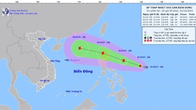
It is forecasted that around October 4, the East Sea will welcome a new storm, storm number 11. The storm is forecast to move towards Hainan Island (China) and then into the Gulf of Tonkin.
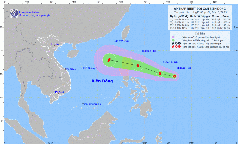
This morning (October 1), a low pressure area in the eastern Philippines has strengthened into a tropical depression. According to the Japan Meteorological Agency (JMA), tomorrow, October 2, this tropical depression is forecast to strengthen into a storm with a strong intensity of level 8 - 9, equivalent to wind speeds of 62 - 74 km/h; it is forecast to enter the East Sea as storm No. 11 in the next few days.
The storm is moving west-northwest at a speed of about 15 km/h, towards the northern area of Luzon Island (Philippines). After that, the storm will move mainly west-northwest, at a speed of 25-30 km/h, and on October 4, it will enter the East Sea, becoming storm number 11 and will continue to strengthen.
The National Center for Hydro-Meteorological Forecasting said: Due to the influence of the storm, from October 3, the sea area east of the northern East Sea will have winds gradually increasing to level 6 - 7; near the center of the storm will have strong winds of level 8, gusting to level 10; waves 2.5 - 4.5m high, rough seas.
During October 4-6, the northern East Sea area (including Hoang Sa special zone) is likely to be affected by strong winds of level 10-11, gusting to level 14. Ships operating in the above-mentioned dangerous areas are likely to be affected by storms, whirlwinds, strong winds, and large waves.
Source: https://cand.com.vn/Xa-hoi/bao-so-10-vua-tan-bien-dong-chuan-bi-don-bao-moi-i783197/

![[Photo] Keep your warehouse safe in all situations](https://vphoto.vietnam.vn/thumb/1200x675/vietnam/resource/IMAGE/2025/10/1/3eb4eceafe68497989865e7faa4e4d0e)
![[Photo] President of the Cuban National Assembly visits President Ho Chi Minh's Mausoleum](https://vphoto.vietnam.vn/thumb/1200x675/vietnam/resource/IMAGE/2025/10/1/39f1142310fc4dae9e3de4fcc9ac2ed0)


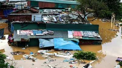
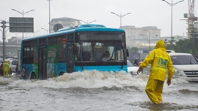
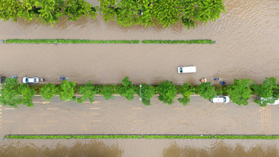
![[Photo] Hanoi morning of October 1: Prolonged flooding, people wade to work](https://vphoto.vietnam.vn/thumb/1200x675/vietnam/resource/IMAGE/2025/10/1/189be28938e3493fa26b2938efa2059e)


Comment (0)